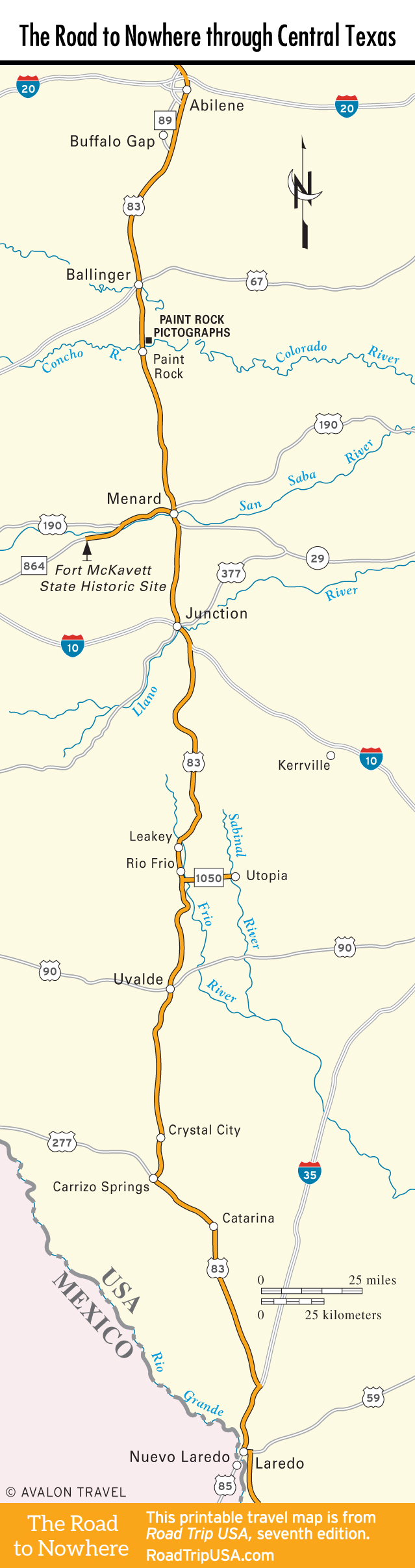
Buffalo Gap to the Paint Rock Pictographs
Buffalo Gap
If you’re passing through Abilene, don’t miss the restored frontier town of Buffalo Gap (325/572-3365, daily, $7 adults), 14 mi (22.5 km) southwest of town via Hwy-89. It’s not completely a tourist trap; cowpokes still reside here, and a courthouse and jail are just 2 of 20-odd buildings dating from the late 1800s, when Buffalo Gap, then the county seat, had over 1,200 residents and Abilene was barely a blip on the map. Other buildings are done up as Wild West souvenir stands, and there’s at least one good restaurant: Perini Ranch (3002 Hwy-89, 325/572-3339), for steak and chicken.
Ballinger
Heading south from Abilene, the first real place you come to among the rolling sheepherding hills of the Edwards Plateau is Ballinger (pop. 3,631), a lively little town with many of its brick and sandstone buildings dating from its inception in 1886, when the railroad came through. Standing along the banks of the Colorado River, the town now supports itself with agriculture. On the courthouse square are the photogenic Pompeo Coppini’s Charles H. Noyes Statue and the courthouse itself: a Texas classic, completed in 1889 in opulent, mansard-roofed Second Empire style. Within a block you can get a taste of Ballinger’s best enchiladas, either cheese, chicken, or beef at the Gonzalez Restaurant (700 Hutchings Ave., 325/365-3781).
Paint Rock Pictographs
Just west of US-83, 15 mi (24.1 km) or so south of Ballinger, the Paint Rock Pictographs are the largest concentration of prehistoric drawings in Texas, with well over 1,500 brightly colored images covering a limestone bluff along the north bank of the Concho River. These images, which range in size from a few inches to over five feet tall, are on privately owned ranchland. Many of the paintings were made in the frontier days of the 19th century, when Comanche people lived in the region, but some are believed to date back over 1,000 years, to the time when Kiowa and Apache forebears settled here.
The town of Paint Rock is a relic of sorts itself, with photogenic abandoned buildings and a couple of picturesque churches.
Travel Map of the Road to Nowhere through Central Texas
![[object Object]](https://content.roadtripusa.com/wp-content/uploads/2018/10/MoonAustin6e.jpg)
![[object Object]](https://content.roadtripusa.com/wp-content/uploads/2021/06/9781640499812.webp)