South Dakota
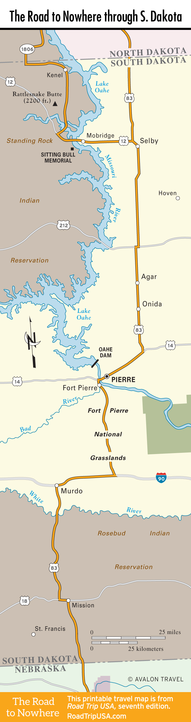
US-83 cuts through South Dakota’s broad expanse for 255 mi (410 km), crossing mostly level but never slate-flat topography, and passing through what’s known as the Great Lakes region of the state, most evident in and around Pierre.
Instead of a multilane transcontinental highway, US-83 across South Dakota resembles a country road, giving an up-close-and-personal look at farming and grazing lands, with an occasional jutting hill, ravine, or serpentine creek bed to break up the monotony. Classic South Dakota—no pretensions.
To either side of the North Dakota border, US-83 is little more than a beeline across the plains. Sadly, the Missouri River is well out of sight, so we strongly recommend following a scenic detour across the river through the huge Standing Rock Indian Reservation, linking up with US-83 again approximately 20 mi (32 km) east of Mobridge via US-12. After that you’ll pass through small farm towns before reaching the state capital, Pierre, at the center of South Dakota.
Travel Map of the Road to Nowhere through South Dakota
![[object Object]](https://content.roadtripusa.com/wp-content/uploads/2020/04/51i-AsrAKmL.jpg)
![[object Object]](https://content.roadtripusa.com/wp-content/uploads/2018/09/South-Dakotas-Black-Hills-Jacket-scaled.jpeg)