


Texas
The old WPA Guide to Texas says that “no other route across Texas offers such differences in topography, produce, climate, and people” as does US-83, which is still true today.
Starting at the Oklahoma border on the southern edge of the Great Plains, your route winds along the foot of the Caprock Escarpment, then opens out onto the cattle country of Edwards Plateau, where numerous river canyons provide respite from the mesquite scrubland, and finally ends up some 900 mi (1,450 km) later at the Gulf of Mexico.
Besides diverse landscapes, US-83 also passes through a virtual survey of Texas history: the prehistoric pictographs of Paint Rock; Mexican-American battlegrounds along the Rio Grande; and 100-year-old frontier towns built of red brick around their central courthouses.
As you’ll soon learn if you’re perusing other Texas travel literature, this section of the state is, for the most part, ignored. Thus, you’re definitely among an elite company, traveling along truly unbeaten paths.
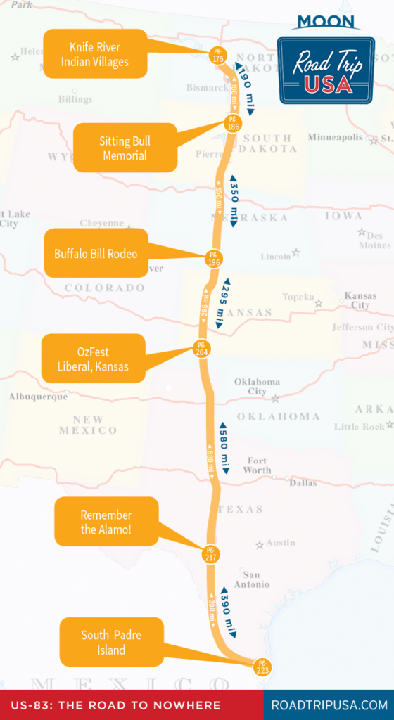
Travel Map of the Road to Nowhere through Texas
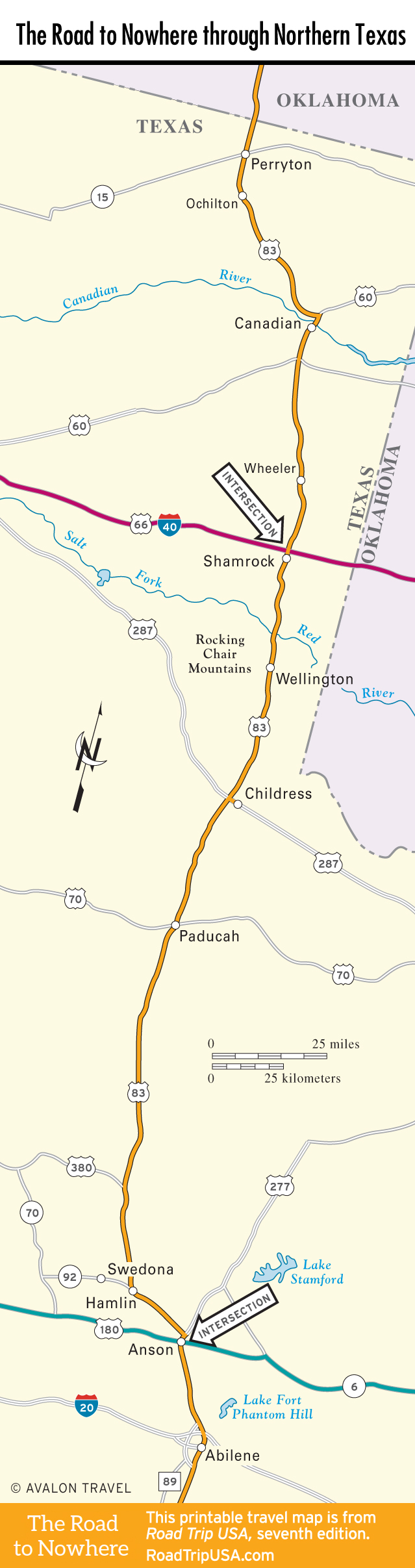
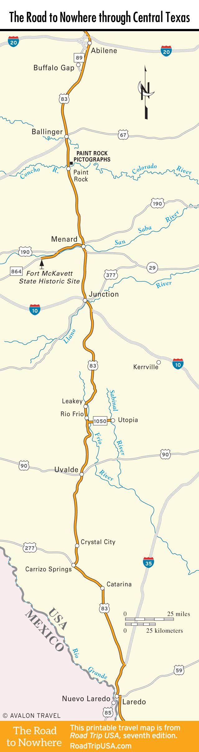
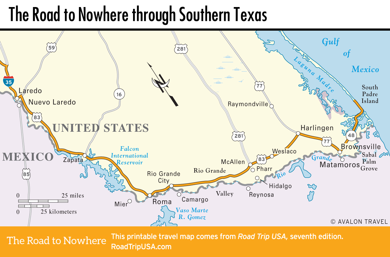
Travel Map of the Road to Nowhere
 Related Travel Guides for the Road to Nowhere

