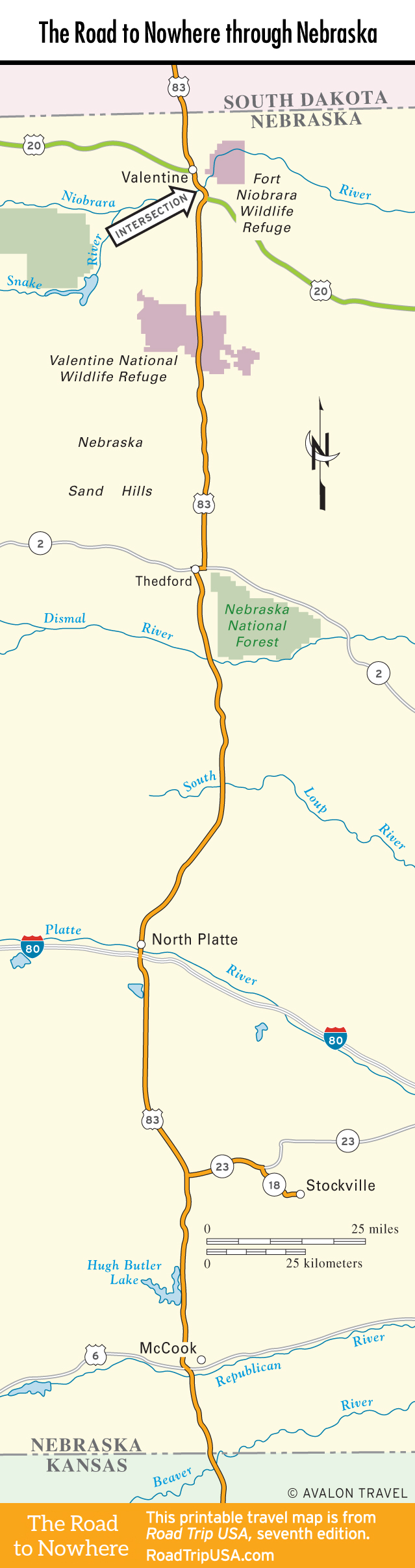
McCook
Patches of corn grow in the fertile loam of the undulating Republican River Valley around McCook (pop. 7,551), the market center for much of southwest Nebraska, 15 mi (24 km) north of the Kansas border. With the arrival of the railroad, the town (which is still served by Amtrak’s California Zephyr and numerous freight trains) grew into a farm trade center, and now it is a sedate, content-enough place, with at least two good excuses for a brief stop, both of them on the hill above downtown. The Museum of the High Plains (421 Norris Ave., 308/345-3661, Tues.-Sat., free), in a large modern building, includes excellent fossil collections, some World War II prisoner-of-war artwork, information on Senator George Norris (1861-1944), and an old drugstore replicated in the very building where Kool-Aid was developed. Up the street, the George W. Norris Home (706 Norris Ave., 308/345-8484, Wed.-Fri.1-4:30pm, Sat. 1-3:30pm, $3) is a museum devoted to McCook’s favorite son, the progressive Nebraska senator who sponsored legislation forming the Tennessee Valley Authority and promoted rural electrification during the New Deal in the 1930s. Norris, who was first elected to Congress as a Republican in 1902, spoke out strongly against U.S. involvement in World War I and was elected to his final term in 1936 as an independent. In between the two museums, at 602 Norris Avenue, stands Nebraska’s only Frank Lloyd Wright-designed house. Finished in 1908, it is a private residence, not open for tours.
South of McCook, US-83 turns grandly scenic; it’s even marked as such on some maps. Just north of the Nebraska-Kansas state line, the highway crosses Beaver Creek, passing over an old trestle bridge.
Travel Map of the Road to Nowhere through Nebraska
Related Travel Guides for the Road to Nowhere