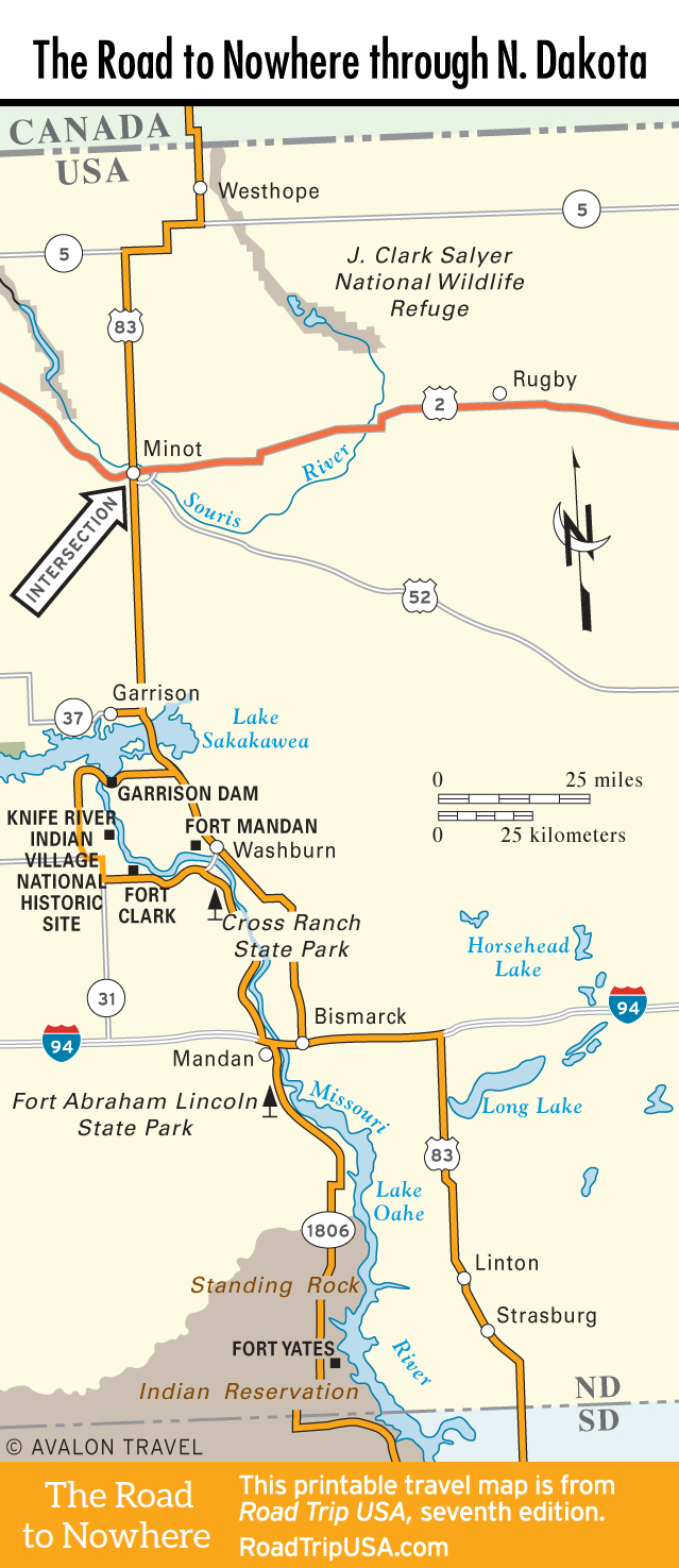
Westhope
US-83 begins winding its way from the Canadian border at the small United States Port of Entry (8am-9pm daily ) 7 mi (11.3 km) north of Westhope (pop. 408). Westhope, named by an optimistic Great Northern Railway official, is a good example of North Dakota’s small agrarian towns. There are cafés, gas stations, a sparse two-block-long downtown, and that’s about it.
South of Westhope about 6 mi (9.6 km), US-83 zigzags west along Hwy-5 for about 15 mi (24 km) before sharply banking south. The next 37 mi (60 km) to Minot are a straight shot south, passing nothing but a sweeping wildlife refuge and a lonely Domino’s Pizza, all by itself beneath the occasional B-52s thundering overhead to and from Minot Air Force Base. One of the primary bases for the U.S. military’s tactical and strategic nuclear forces, Minot AFB controls hundreds of nuclear-tipped Minuteman III ICBM missiles, which are housed in high-security underground silos that look like high-security parking lots amid the wheat fields all over the northern Great Plains.
Travel Map of the Road to Nowhere through North Dakota
![[object Object]](https://content.roadtripusa.com/wp-content/uploads/2021/09/Moon-USA-State-by-State-2026.jpg)
![[object Object]](https://content.roadtripusa.com/wp-content/uploads/2018/09/South-Dakotas-Black-Hills-Jacket-scaled.jpeg)
![[object Object]](https://content.roadtripusa.com/wp-content/uploads/2020/04/51i-AsrAKmL.jpg)