Border to Border
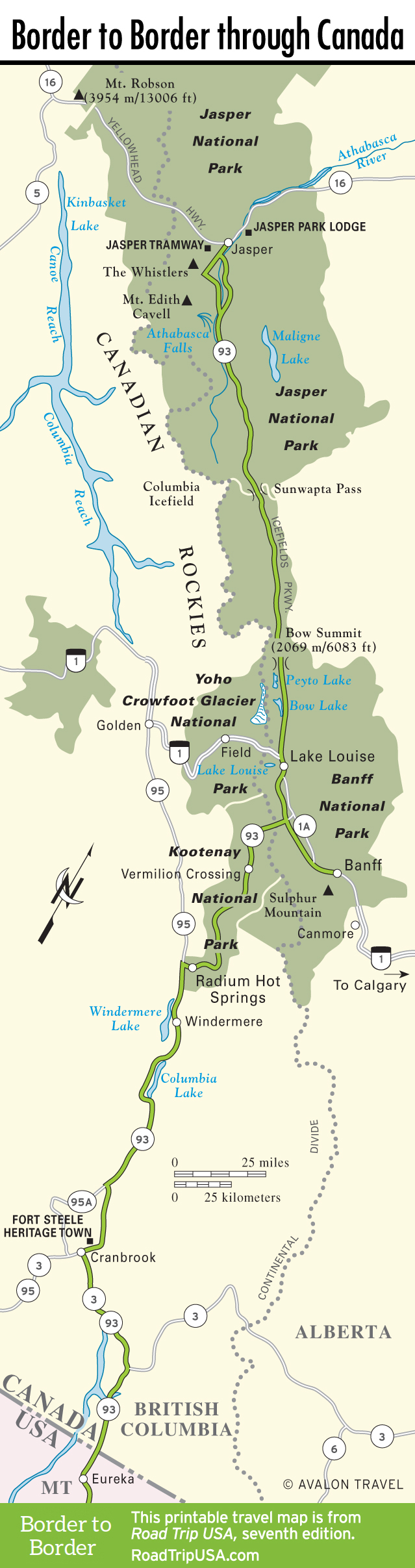
The western half of North America is often described as a land of contrasts, and no route across it gives a sharper sense of the region’s extremes than US-93. Starting in the north, across the Canadian border at Jasper National Park in the heart of the Rocky Mountains, and winding up south of the border in the Sonora Desert twin towns of Nogales (one in Arizona, one in Mexico), this route, which retains the number 93 despite the different international jurisdictions, traverses some of the wildest and most rugged lands imaginable: mighty mountains, glaciated valleys, raging rivers, and two very different deserts. Besides offering up-close looks at mile after mile of magnificent and almost completely untouched wilderness, US-93 also takes you right through the neon heart of what is surely the most extreme (and most extremely visual) example of our contemporary “civilization”: Las Vegas.
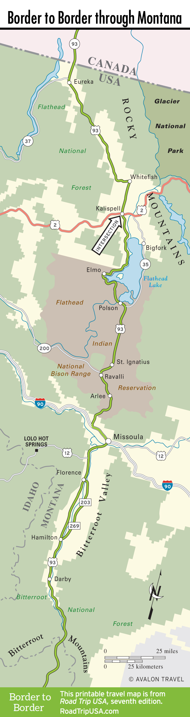
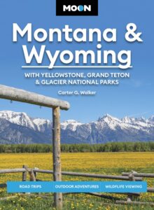
The route divides into two almost unrecognizably different halves. The northern section, from the Canadian Rockies wonderland of Banff and Jasper south as far as Sun Valley, Idaho, is pure alpine majesty. Passing the western flanks of Glacier National Park, US-93 runs along river valleys through diverse communities where skiing, hiking, and sightseeing have replaced mining and lumbering as the economic engines. South of Kalispell, the highway winds across the Flathead Reservation along the western shores of Flathead Lake to Missoula, located at the heart of the bountiful country captured in the film A River Runs Through It. Western Montana’s natural beauty reaches a peak in the Bitterroot Valley, which stretches south from Missoula all the way to the Idaho border. Besides scenery, the valley also abounds in history, holding many key sites pertaining to the explorers Lewis and Clark, the first nonnatives to set foot in the region, and other sites related to the epic struggle of the Nez Perce Tribe and their leader Chief Joseph (known to his own people as Hinmatoowyalahtqit).
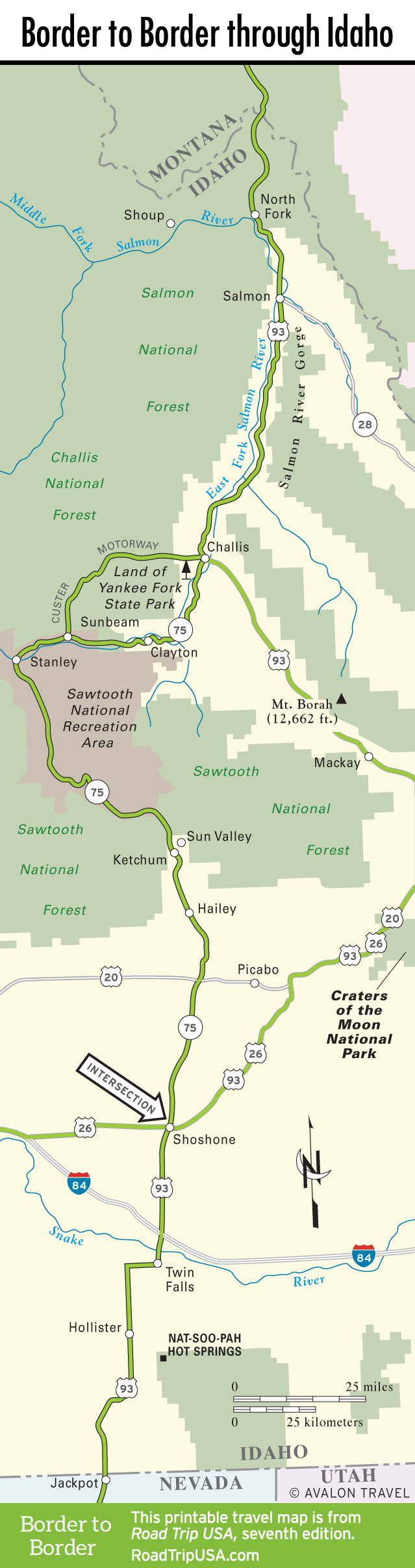
As you pass over the Bitterroots into Idaho across the Continental Divide, the scenery remains impressive as US-93 winds along the banks of the Salmon River, all the way to its source in the serrated Sawtooth Mountains, then drops down swiftly into Sun Valley, the oldest and most upscale ski resort in the country.
South of Sun Valley, however, everything changes suddenly. Roaring rivers and mountain forests give way to lava flows and empty deserts as US-93 races across the inhospitable landscape of the Snake River Plain. This was the most difficult portion of the historic Oregon Trail, though the biggest difficulty facing today’s travelers is the struggle to stay alert—there’s little to look for, apart from acres of potato farms reclaimed from the arid desert. The one real sight is the Snake River itself, which has carved itself into a deep gorge near Twin Falls.
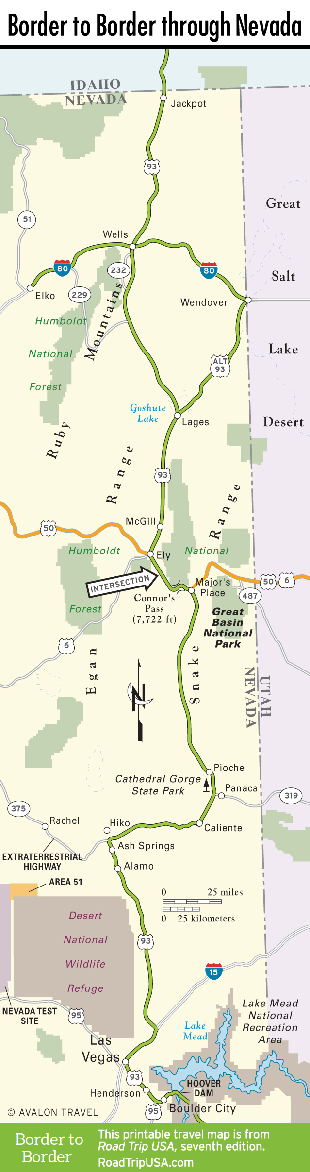
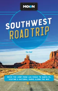
Continuing south into Nevada, US-93 embarks on what is truly, if not officially, the “Loneliest Road in America,” traveling across nearly 500 mi (805 km) of Great Basin Desert. Though not for the faint-hearted or those with unreliable cars, it’s an unforgettably beautiful journey; after hours or days of existential solitude, you drop down into the frenetic boomtown of Las Vegas.
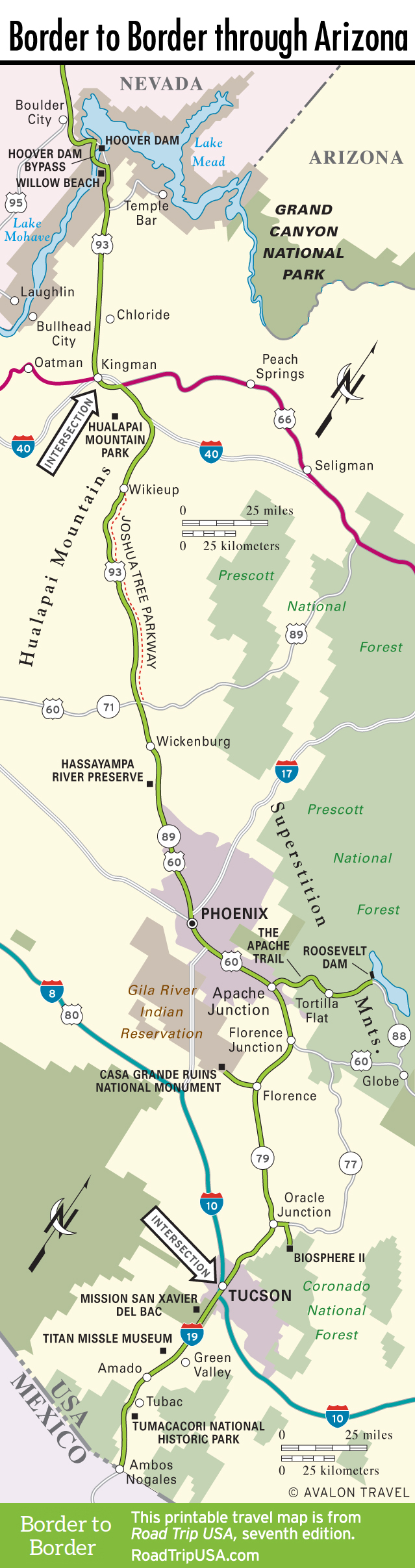
Crossing Hoover Dam into Arizona, the route crosses old Route 66 west of the Grand Canyon, then races southeast across the lush Sonoran Desert—known as the “world’s greenest desert” because of its abundant flora and fauna—through Phoenix and Tucson to the Mexican border. This last stretch of nearly 200 miles of highway is among the most fascinating in the country, taking you past such intriguingly diverse and unique sights as the controversial Biosphere 2 scientific research center, the country’s only intact Cold War-era missile silo, and a pair of centuries-old churches, two of the most captivating pieces of architecture in the western United States.
Border to Border Road Trip Maps
Related Travel Guides
Pin it for Later