Hueco Tanks and Guadalupe Mountains Parks
Hueco Tanks State Historic Park
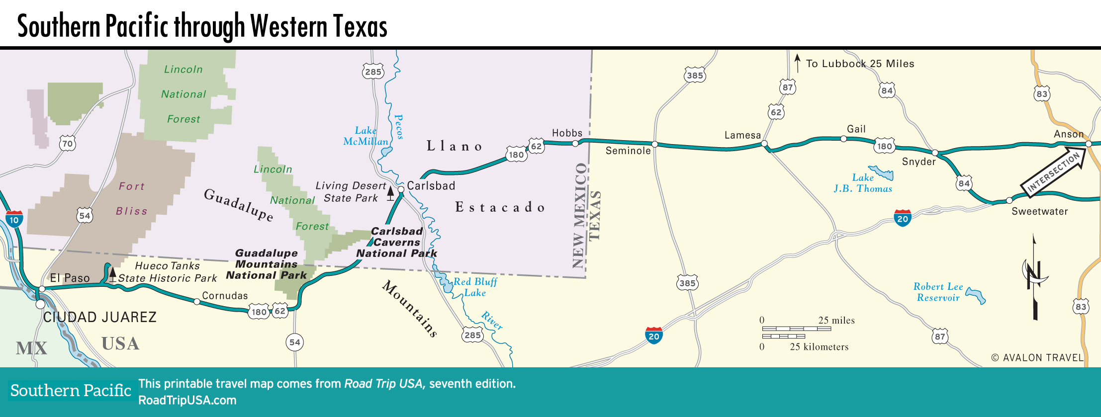
In the 100 mi (161 km) of arid West Texas desert between El Paso and the Guadalupe Mountains, don’t miss tiny Hueco Tanks State Historic Park (915/857-1135, 8am-6pm daily Oct.-Apr., 7am-7pm daily May-Sept., $7). Located on the eastern fringes of sprawling Fort Bliss, some 25 mi (40 km) east of El Paso, then 8 mi (12.8 km) north on Hwy-2775, the 860-ac (348-ha) park was established to preserve the approximately 3,000 pictographs painted on the syenite basalt boulders. The “hueco tanks” of the title are naturally formed rock basins that collect rainwater, making the site a natural stop for passing travelers, from prehistoric Native Americans to the Butterfield stagecoach in the 1850s. Unfortunately, sometimes the historic pictograph graffiti is overwhelmed by more contemporary spray-paint versions. But the site is pleasant enough, with a popular campground and excellent opportunities for bird-watching and rock climbing.
Some 36 mi (58 km) east of the Hueco Tanks turnoff the tiny highway town of Cornudas has the welcome middle-of-nowhere May’s Café (915/964-2508), “Home of the World Famous Cornudas Burger.” At mile marker 82.5, there’s a row of false-fronted Wild West buildings.
Guadalupe Mountains National Park
One of the few unhyped wonders of Texas, Guadalupe Mountains National Park covers the rugged peaks that rise along the New Mexico border, about 110 mi (177 km) east of El Paso. Formed as part of the same Capitan Reef of 250 million-year-old limestone as the great caverns of Carlsbad, the Guadalupe Mountains, a cool contrast to the surrounding desert, rise in sheer faces more than 2,000 ft (610 m) above the desert floor and offer the chance to experience many different and contrasting ecosystems side by side, within easy reach of the highway.
Even if you’re not prepared to do any serious hiking—which is the best way to experience the grandeur of the park or to see signs of the abundant wildlife (including mountain lions)—the quickest way to get a feel for the Guadalupes is to walk the half-mile (0.8 km) nature trail that runs between the main visitor center (915/828-3251, daily, $10 park entry fee) and the remains of a Butterfield stagecoach station, passing well-signed specimens of all the major desert flora. If you have more time, head to McKittrick Canyon, off US-62/180 in the northeast corner of the park. From the ranger station at the end of the road, a well-marked, well-maintained, and generally flat trail winds along a stream, through a green landscape that changes gradually from the cacti of the Chihuahuan Desert to the oaks, madrones, and maples of the inner canyon. Rated by many as the most beautiful spot in Texas, it is best in spring, when the desert wildflowers bloom, or in autumn, when the big-leaf maple hardwoods turn color.
If you’re feeling fit, climb Guadalupe Peak, at 8,750 ft (2,667 m) the highest point in Texas, via a steep 8.4-mi (13.7 km) round-trip trail from the main visitors center. Be aware that the change in elevation makes the mountains subject to serious weather, with great booming thunderstorms in late summer.
Camping is available on a first-come, first-served basis at Pine Springs Campground, near the main visitors center, and at numerous sites in the backcountry.
Map of the Southern Pacific Route through Texas
![[object Object]](https://content.roadtripusa.com/wp-content/uploads/2024/02/9798886471281.jpeg)
![[object Object]](https://content.roadtripusa.com/wp-content/uploads/2020/04/9798886471083_RetailCover_RetailAndCatalog.jpg)