The Bitterroot Valley
Missoula sits at the north end of the Bitterroot Valley, where Lewis and Clark set up camp at what they called Travelers’ Rest in September 1805 and again on their return in July 1806. A roadside marker off US-93, just south of the US-12 junction, tells more of the story.
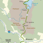
If you’re a fan of Lewis and Clark, or hot springs, or want to unwind after a day of cross-country skiing, you won’t want to miss the idyllic Lolo Hot Springs Resort (406/273-2290), in the mountains 36 mi (58 km) southwest of Missoula via scenic US-12, which runs along the route Lewis and Clark followed on their way west. Moose wander through the wooded grounds, and the natural hot springs (where Lewis and Clark themselves soaked on their way home from the Pacific Ocean) have been extensively and attractively developed.
Continuing south toward the Idaho border, US-93 runs along the banks of the beautiful Bitterroot River through a broad valley lined by groves of cottonwood trees and bordered by parallel ridges of 8,000-ft (2,438-m) peaks. In the hamlet of Florence, Glen’s Café (406/273-2534), tucked away just west of the highway, is renowned throughout Montana for its carb-loaded pastries, pancakes, and incredibly good, double-crusted, fresh berry pies.
South of Florence, the Eastside Highway (Hwy-203 and Hwy-269), a well-marked alternative route, runs parallel to US-93 a half-mile (0.8 km) to the east, passing rolling ranch lands, pioneer homesteads—some of which are among the oldest in the state—and occasional prefab trailers. This eastern side of the Bitterroot Valley is mostly open countryside, with a few small hamlets like Stevensville, Montana’s oldest town. It was founded by Jesuits in 1841 around the still intact St. Mary’s Mission at the end of 4th Street, two blocks west of Main Street.
Related Travel Guides
Travel Map of the Border to Border Route through Montana


