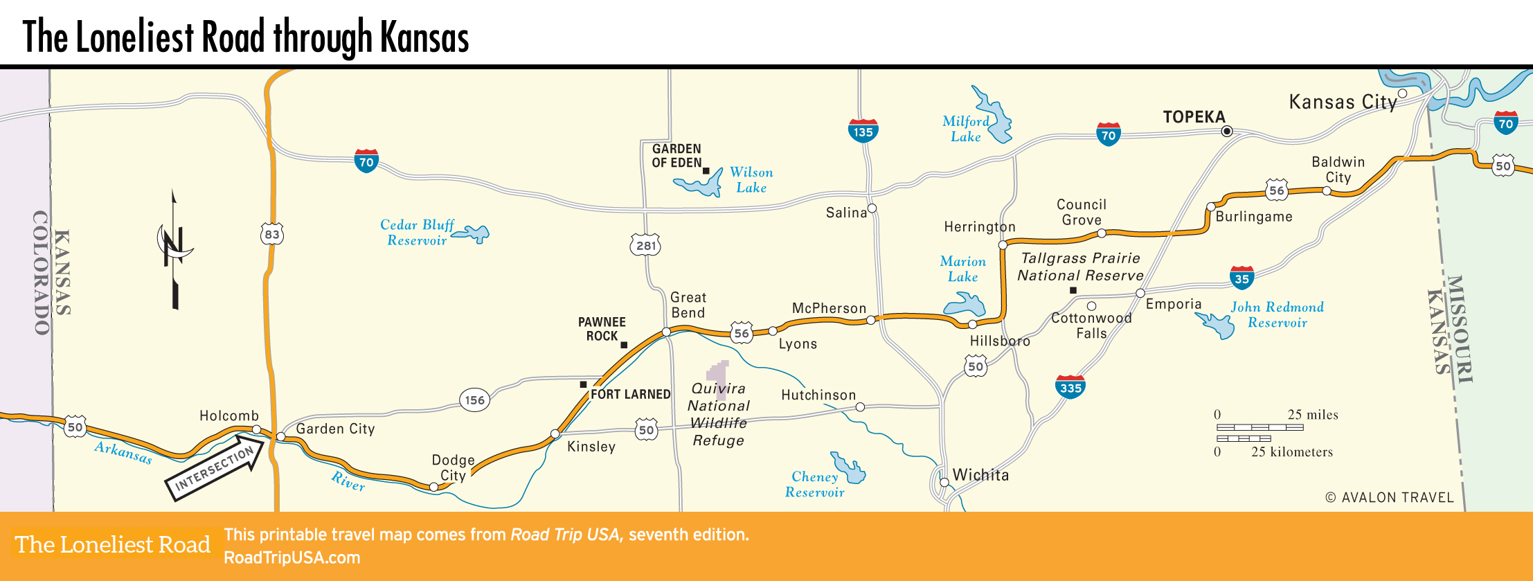
Kansas
All the way across Kansas, we follow almost exactly in the footsteps of the trappers and traders who braved the Santa Fe Trail along the western frontier, stopping at preserved old outposts like Fort Larned and Council Grove while tracking the few more evocative remnants of this pioneer Wild West corridor.
In its 450 mi (725 km) across Kansas, US-50 and its selected variants pass across the agricultural heartland of America, winding through dozens of small farming towns that dot the generally level landscape. (Locals definitely seem to prefer the word “level” to the equally accurate “flat,” if only because it sounds less boring.)
This is the heart of the “Wheat Belt,” where most of the country’s grain is grown—as much as half the bread baked in America is made from Kansas wheat—and it’s also prime cattle country, with towns like Dodge City maintaining their historic dependence on cows and cowboys, producing and packing much of the nation’s beef supply.
Related Travel Guides