Midway USA & Fort Larned
Kinsley: Midway USA
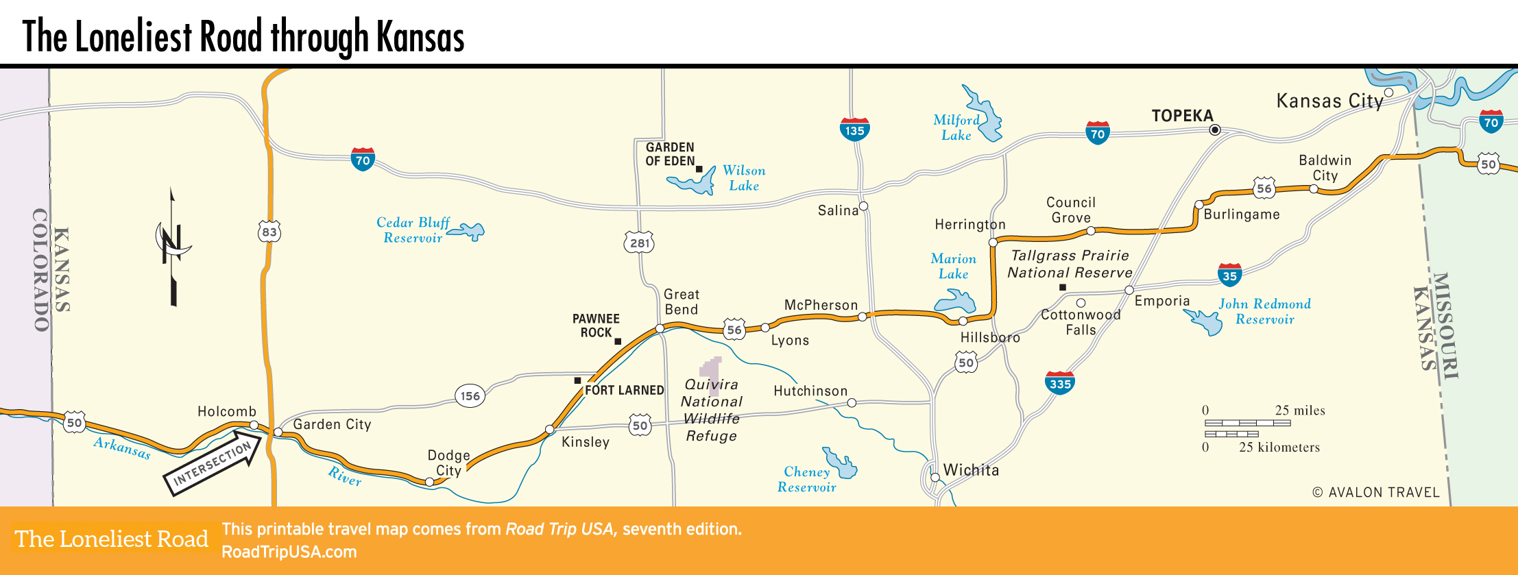
Paralleling the main line of the Santa Fe Railroad across the flattest, emptiest 50 mi (81 km) of Kansas cornfields, east of Dodge City we follow US-50 as far as Kinsley, where we switch onto US-56 (which used to be known as “US-50 North”) to follow the Santa Fe Trail. Kinsley, which calls itself “Midway USA,” lies equidistant between New York and San Francisco: 1,561 miles from either city. This geographical fact is pointed out by a large sign outside the entertaining (and free!) Edwards County Historical Society Museum, at the US-50/56 junction on the west side of town, surrounded by an old locomotive and a variety of old farming and ranching equipment.
Fort Larned
One of the best-preserved vestiges of the Santa Fe Trail, and the whole “Wild West” for that matter, Fort Larned National Historic Site (620/285-6911, daily, free), 6 mi (9.6 km) west of US-56 via Hwy-156, was established in 1859, and for the next 20 years the troops stationed here protected travelers on the Santa Fe Trail from the threat of attack by local Arapahoe and Cheyenne people. The fort also served a vital role in the many Indian Wars of the 1860s, but by 1878, when the trail was no longer in active use, the fort was deactivated. It was sold and used as a ranch until 1960, but has survived the intervening years in excellent condition. Careful restoration by the National Park Service has made Fort Larned an excellent place to understand what the frontier was really like, albeit from the U.S. military perspective.
Sandstone buildings, which replaced the original adobe after the end of the Civil War, surround a 400-sq-ft parade ground (37-sq-m), and interior rooms have been filled with accurate reproductions of original fixtures and fittings, ranging from barracks to blacksmith shops to a large storehouse. A nearby farm preserves a set of ruts surviving from the Santa Fe Trail days, though you need to have an active imagination to get much from them.
In between Fort Larned and US-56, the Santa Fe Trail Center (620/285-2054, Tues.-Sat., $6) is a private nonprofit museum focusing on the overall history of the Santa Fe Trail region. Diorama-like exhibits feature full-scale mock-ups of wagons and frontier trading posts, and behind the main building are a sod house and a one-room schoolhouse.
Pawnee Rock
Just 9 mi (14.5 km) northeast of Larned, a half-mile north of US-56 and the Arkansas River, Pawnee Rock was once one of the most important landmarks on the Santa Fe Trail. However, so much of the original 60-ft-high (18-m) tower of Dakota sandstone has been quarried—to build houses as well as the rail bed of the Santa Fe railroad—that it’s little more than a stubby hump. But you can still get a grand view of the surrounding countryside from the easy trail that leads to the rock’s much-diminished summit.
Related Travel Guides