Council Grove to Baldwin City
Council Grove
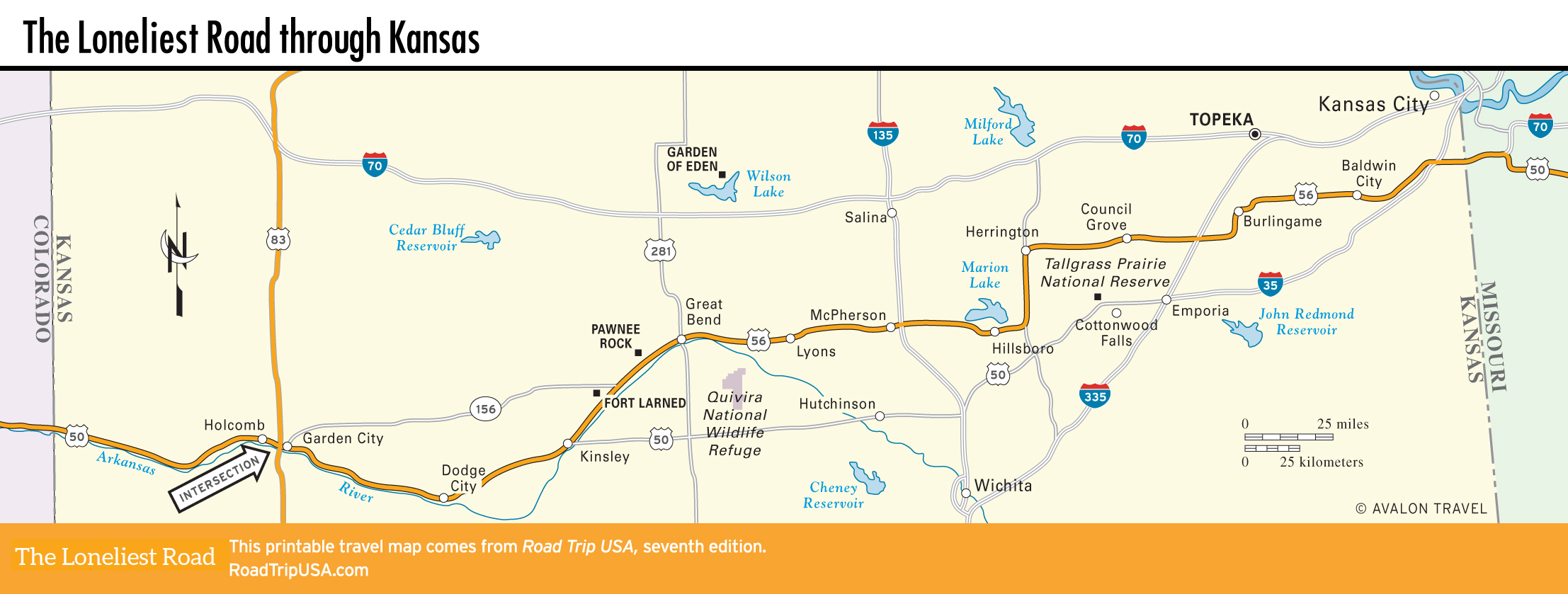
Just 75 mi (121 km) southwest of the suburban sprawl of Kansas City and 25 mi (40 km) west of the I-335 Kansas Turnpike, Council Grove (pop. 2,079) still looks much as it did over a century ago, when, from the 1830s to the 1860s, it was the most important of all way stations on the Santa Fe Trail. Council Grove’s lush maples and oaks were the last hardwoods available on the long route west across the treeless plain, which meant traders and travelers could make final repairs and stock up on spare axles and other essentials. It was also the western extent of “safe territory”; beyond here travelers were subject to frequent attacks by Native Americans.
Nowadays the town proudly preserves its many historic sites, and in many ways serves as the most not-to-be-missed stop for modern travelers heading along the Santa Fe Trail. Though by now the trees themselves are little more than desiccated stumps, the sites of two of the most important trail icons are marked along Main Street (US-56), east of the bridge over the small Neosho River: the Council Oak, under which, in 1825, the indigenous Kansa and Osage people agreed to allow pioneers to cross their territory, and the Post Office Oak, which served as a natural message center for early travelers. Four blocks west, the 1857 Last Chance Store at Main and Chautauqua Streets which served as a bank and a post office, is now a state historic site.
The banks, cafés, and stores along Main Street, which the Santa Fe Trail followed through town, make little obvious effort to cater to tourists. The town basically goes about its day-to-day business without forgetting its extraordinary past. The Hays House (112 W. Main St., 620/767-5911), in the center of town, lays claim to being the oldest restaurant west of the Mississippi; originally built as a frontier home, and later serving as a saloon, supply post, courthouse, and hotel, it has stood on this site since 1847. Now modernized, it is still the focus of the town’s social and political life and is open all day—with excellent fried chicken.
Across Main, the soda fountain inside the Aldrich Apothecary (123 W. Main St., 620/767-6731) serves famous “Santa Fe Trail” root beer floats, and ice cream. The best place to stay is the comfortable Cottage House Hotel (25 N. Neosho St., 620/767-6828, $65 and up).
Burlingame and Baldwin City
Between Council Grove and Kansas City, US-56 passes through the lovely cattle-ranching grasslands of the northern Flint Hills, zigzagging at 90-degree angles through onetime coal-mining towns like Scranton, Overbrook, and Worden. Burlingame (pop. 890), the largest of this bunch, is noteworthy for its broad, brick-paved, 20-mph (32 km/h) Main Street (US-56), lined by diverse 100-year-old buildings painted with a barrage of signs advertising the usual liquor, food, and auto parts.
At the northeast edge of the Flint Hills, 13 mi (20.9 km) west of the I-35 freeway from Kansas City, US-56 skirts the leafy brick-paved streets of Baldwin City (pop. 4,691), a small town that was once a main rest-and-repair stop on the Santa Fe Trail—four days’ travel west of Independence, Missouri. In 1858, the first college on the western frontier was founded here in a three-story sandstone building now preserved as “The Old Castle,” alongside a combination general store and post office on the east side of the pleasant campus of Methodist-run Baker University. The library (785/594-8393, by appointment, free), three blocks west, displays the Quayle Collection of rare religious texts, including clay tablets dating from Old Testament times and a range of hand-bound bibles, arranged to trace the development of printing techniques and typography styles.
For the rest of the way east to Kansas City, US-56 parallels I-35 across lush rolling grassland pastures and farms, marked in places by signs reading “Old US-50.” Along this route, 2 mi (3.2 km) west of Gardner, a historical marker stands on the site where the Santa Fe and Oregon Trails once divided. For many years, a crude wooden sign pointed westbound travelers in the proper direction: left to Santa Fe, right to Oregon.
Related Travel Guides