Colorado
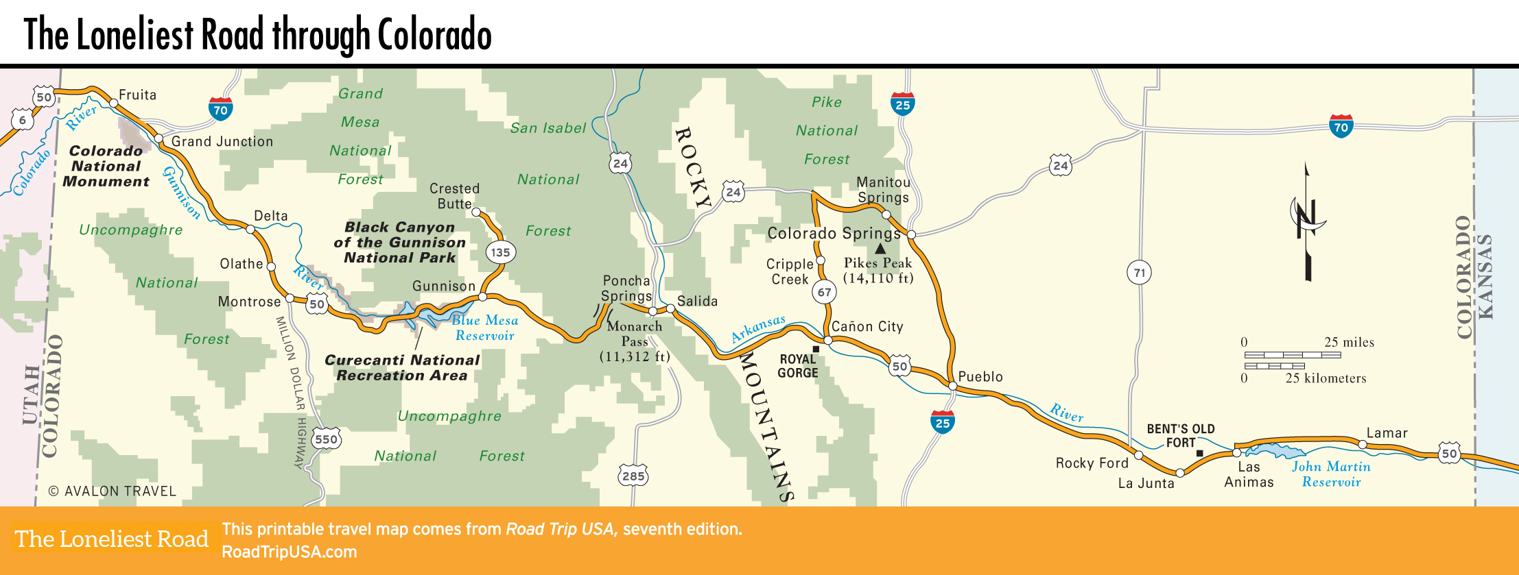
Driving across southern Colorado on US-50 takes you through almost every landscape landlocked North America has to offer. From the geological wonderland of the Colorado River plateau, which stretches west into Utah, the route climbs up and over the 14,000-ft (4,267-m) Rocky Mountains, which form a formidable wall down the center of the state.
Continuing east, the alpine meadows, deeply etched river canyons, and snow-covered peaks of the southern Rockies fade away into the flat agricultural prairies that stretch east across the middle of the country. While there is considerable ranching and farming, outdoor recreation—fishing, hiking, skiing, and mountain biking—is the basis for the economy, and the region is well provided with tourist facilities, especially in the mountainous middle.
Related Travel Guides