Gila Bend
Yuma to Gila Bend: I-8
Spanning 110 mi (177 km) of barren desert east of Yuma, between the U.S. Air Force’s 1.9-million-ac (769,000 ha) Barry M. Goldwater Bombing Range and a U.S. Army Proving Ground, the I-8 freeway follows the route of early Spanish explorers and settlers on the flat but forbidding El Camino del Diablo, along the banks of the usually dry Gila River.
East of 1,092-ft-high (333 m) Telegraph Pass, 16 mi (26 km) outside Yuma, the old US-80 highway reappears along the north side of the freeway, running through old-time desert outposts. If you’re hungry, the flyspeck ranching community of Tacna has a great place to eat burgers, lamb chops, and a full menu of other Spanish and American dishes: Basque Etchea (928/785-4027, Tues.-Sun.). Take I-8 exit 42, then head north across the railroad tracks.
Another great middle-of-nowhere desert oasis, along I-8 at milepost 67, is Dateland, 67 mi (108 km) east of Yuma and 49 mi (79 km) west of Gila Bend. Dateland has a 24-hour gas station, a café (928/454-2772), an RV park, and a gift shop selling dates in all possible forms, including refreshing date milk shakes. The top-quality, hand-pollinated Medjool dates are grown in the adjacent 9-ac (3.6 ha) grove.
Gila Bend
The only place approaching a town between Yuma and Phoenix or Tucson, Gila Bend (pop. 2,094) is regularly the “Hottest Spot in the Country”—a title of which it is so proud that, more than once, it’s been caught inflating the numbers. First settled as a main stop on the Butterfield Stage route, Gila Bend doesn’t offer much relief for the senses, though it does have some photogenic old motels and all the gas stations, restrooms, and restaurants you could reasonably expect to find in the middle of the Arizona desert.
One place to eat is the Space Age Restaurant (401 E. Pima Ave., 928/683-2761), downtown off exit 115. Marked by a flying-saucer-shaped sign, it’s part of the Best Western Space Age Lodge motel (928/683-2273, $80 and up). Both are essential stops for any Jetsons-age traveler, though the refurbishment after a fire has diminished the 1960s Space Age charm.
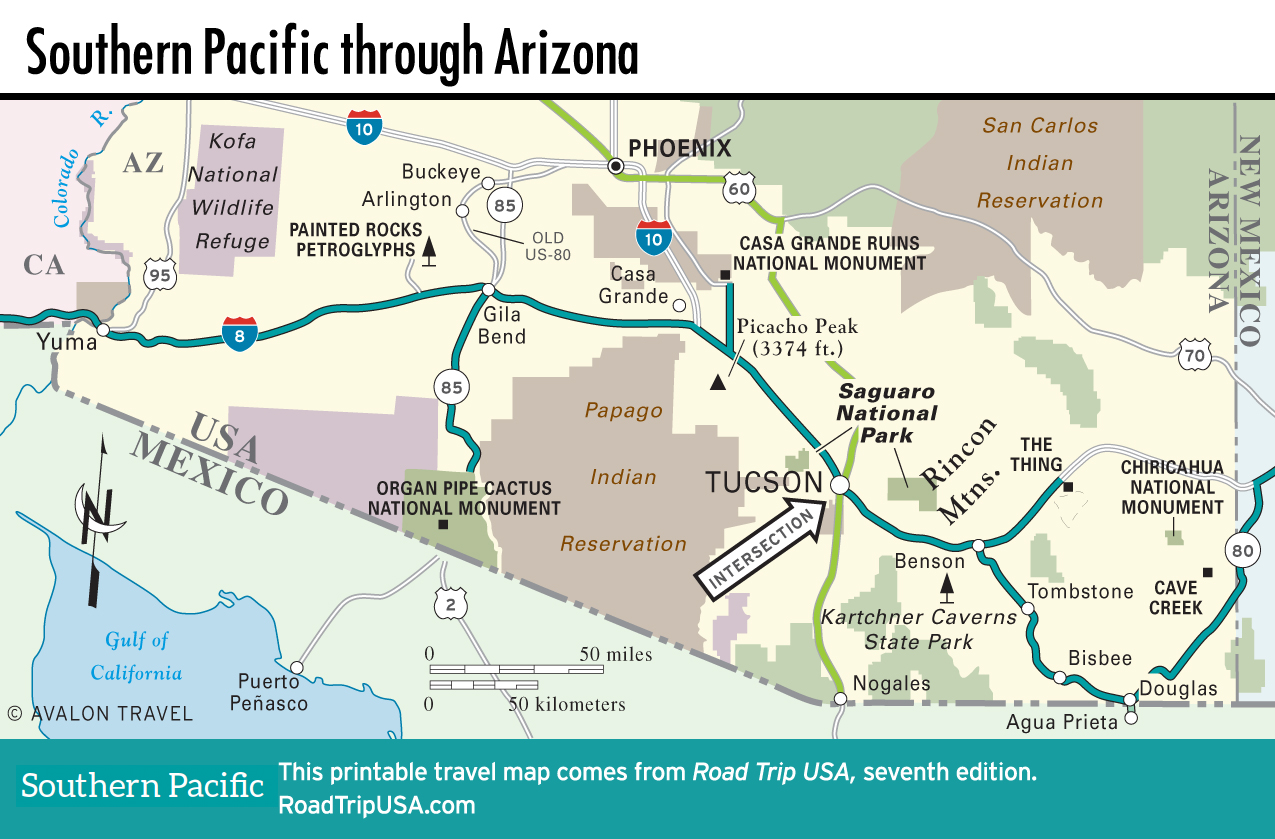
Map of the Southern Pacific Route through Arizona
Related Travel Guides