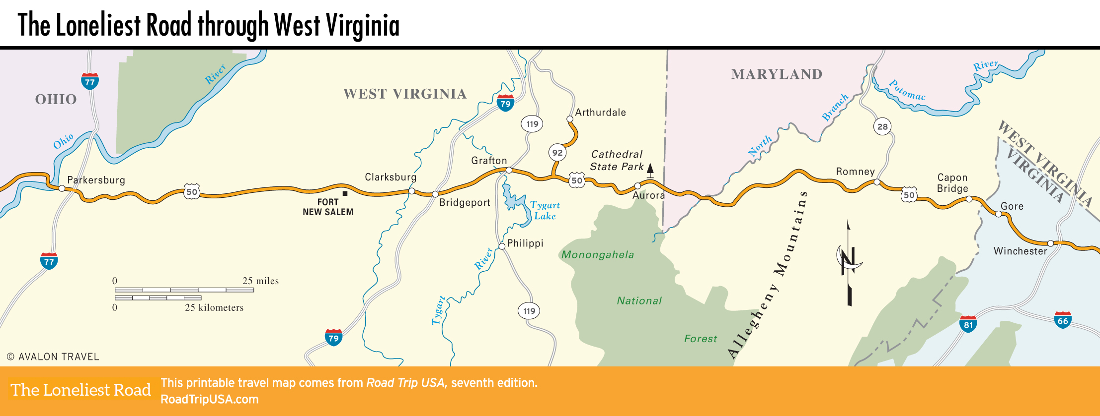
West Virginia
The slowest part of US-50’s transcontinental crossing is the 200-mi (320-km) section across West Virginia, which twists and turns its way over the rugged Allegheny Mountains. Starting along the Ohio River in the western, more-developed half of the state, US-50 runs briefly as a fairly fast freeway before beginning its climb into the rugged hill country. Across West Virginia, US-50 follows the approximate route of the colonial-era Northwest Turnpike, which was surveyed in 1748 by a 16-year-old George Washington.
Though there are many fine hardwood forests and white-water rivers, including some of the most extensive semi-wilderness areas left in the eastern states, this part of West Virginia is mostly rural, with more than a few corners where things seem straight out of a Depression-era Walker Evans photograph. Rusting appliances and broken-down cars fill more than a few front yards, but around the next bend you may come across a lovely old covered bridge, or a waterfall that takes your breath away. The few towns along the route, formerly bustling thanks to the railroads or coal mines, are still dominated by the empty remnants of industries that have vanished, never to return. Most places are populated by people who seem to have lived there forever.
The self-reliant “mountaineer” ethos still runs strong in West Virginia, but the lingering impression of a visit is of taking a step back in time to a world where men work hard in mines and mills, women raise the kids, and everybody goes to church on Sunday.
Related Travel Guides