Arthurdale and Cathedral State Park
Arthurdale
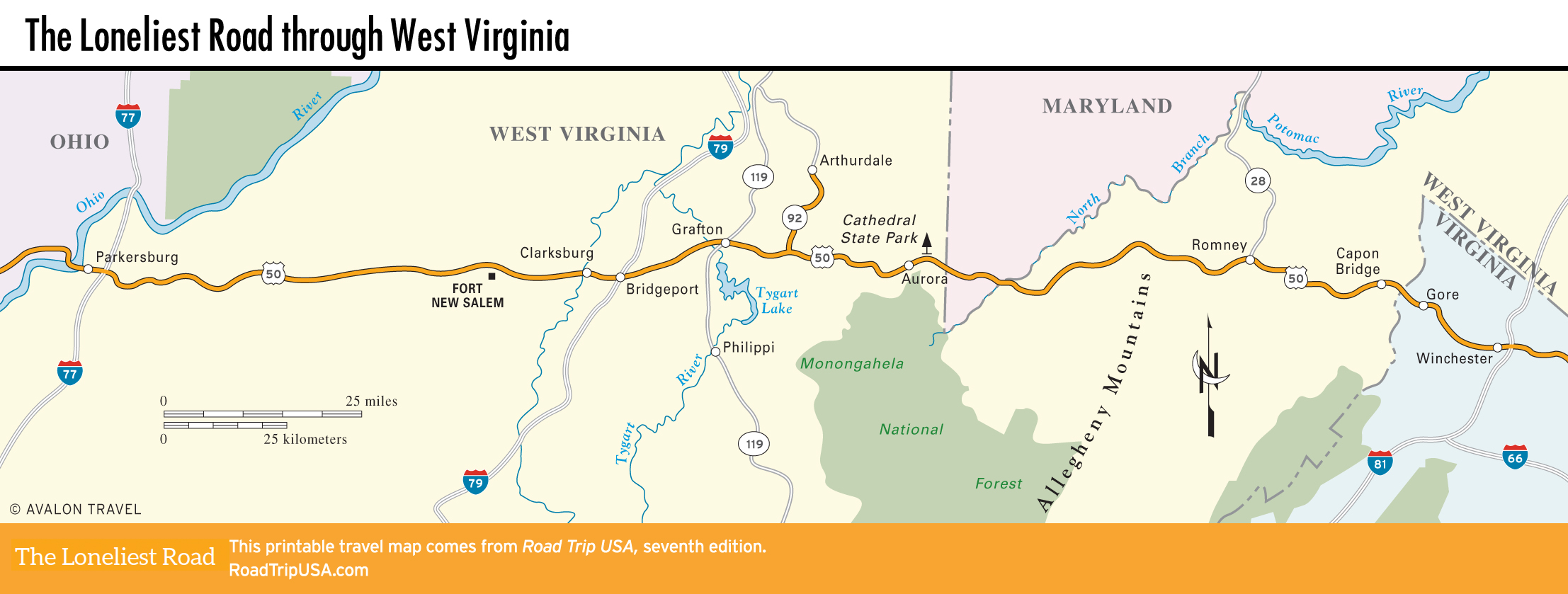
Northeast of Grafton, a half-hour north of US-50 via Hwy-92, the homestead community of Arthurdale was the first and perhaps the most important of the many antipoverty rural resettlement projects initiated during the Depression-era New Deal. Though not the largest, Arthurdale was prominent because of the personal involvement of First Lady Eleanor Roosevelt, who not only helped plan the project but also visited many times, handing out diplomas at school graduations.
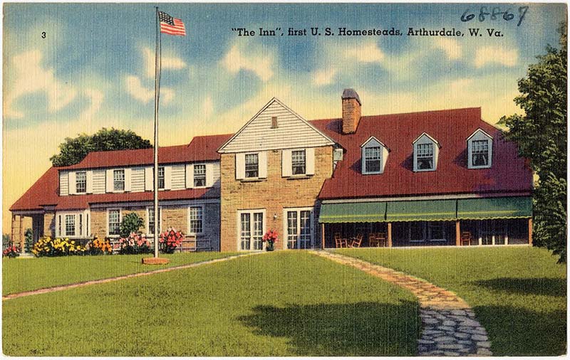
Beginning in 1934 with the construction of some 165 homes, plus schools and factories, a cooperative farm, a health center, and a small hotel, Arthurdale was an ideal community set up to relieve the dire living conditions of unemployed Morgantown coal miners. Most of the houses are still intact and still inhabited by the original homesteaders or their descendants. The old community center is being restored and now holds a small museum (18 Q Rd., 304/864-3959, $11) that chronicles the whole story.
Cathedral State Park
Four mi (6.4 km) west of the Maryland border, US-50 runs right through Cathedral State Park, where more than 133 ac (54 ha) of stately maples and hemlocks constitute one of the few first-growth stands left in this lumber-hungry state. Beyond here, US-50 makes a quick 7-mi (11.3-km) jaunt across a corner of Maryland before crossing the north branch of the Potomac River back into West Virginia.
From the bridge, US-50 climbs steeply up the densely wooded Alleghenies, twisting over 3,000-ft-high (914-m) ridges with turns so tight the posted speed limit is 15 mph (24 km/h)—the going is slow, and not much fun if you’re prone to car sickness.
Related Travel Guides