Ohio
The backbone of America runs from sea to shining sea, passing through 11 states and some of the country’s most magnificent landscapes.
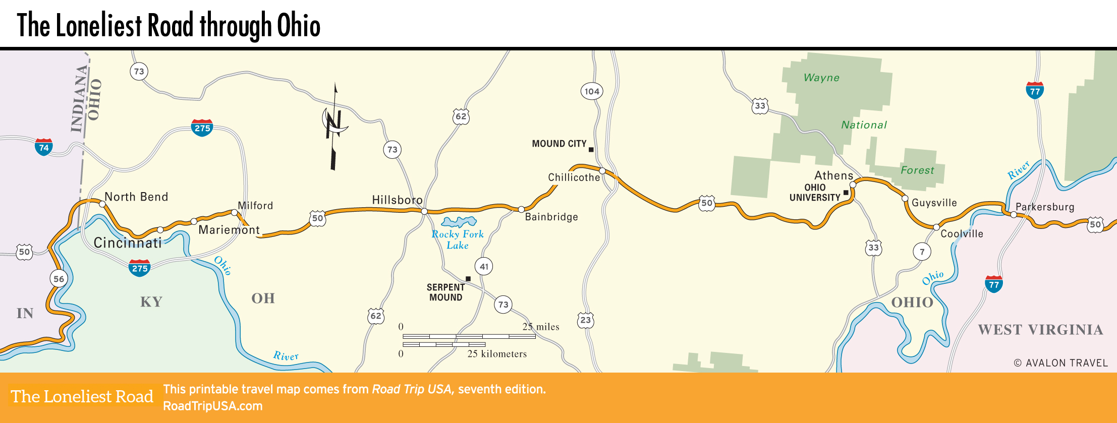
Winding along the Ohio River from Indiana, US-50 cuts east from Cincinnati across the hill-and-valley country of southern Ohio before finally crossing the Ohio River into West Virginia.
The 210 mi (340 km) US-50 takes to cross the state are a fairly constant mix of upland forest and bottomland farms, with a single industrial district in the middle around Chillicothe, and a refreshing small college town, Athens, farther east.
Related Travel Guides