Montrose: The Million Dollar Highway
With the San Juan Mountains standing out to the south, and Black Canyon just up the road, Montrose, a fast-growing farming community of more than 19,000 that spreads from the heart of the fertile Uncompahgre Valley, makes a good base for exploring the region. The town itself has an appealing, still-in-business business district and a historical museum housed in the old railroad depot; the US-50 frontage has plenty of motels and places to eat.
Hwy-347 turns off north from US-50 toward the Black Canyon of the Gunnison National Park 8 mi (12.8 km) east of Montrose, but this town also marks the start of one of the best-loved roads in the country, the Million Dollar Highway, a classic stretch of two-lane blacktop that forms a swirling ribbon through the San Juan Mountains, the wildest and ruggedest peaks in the Colorado Rockies. Marked on maps and by road signs as US-550, which runs south from the Gunnison River ranch lands around Montrose to the Southern Ute Indian Reservation, the “Million Dollar” tag is generally applied to the 25 steep and twisting mi (40 km) that link Ouray and Silverton, a pair of remote gold- and silver-mining communities, but it’s also an appropriate nickname for the drive all the way to Durango.
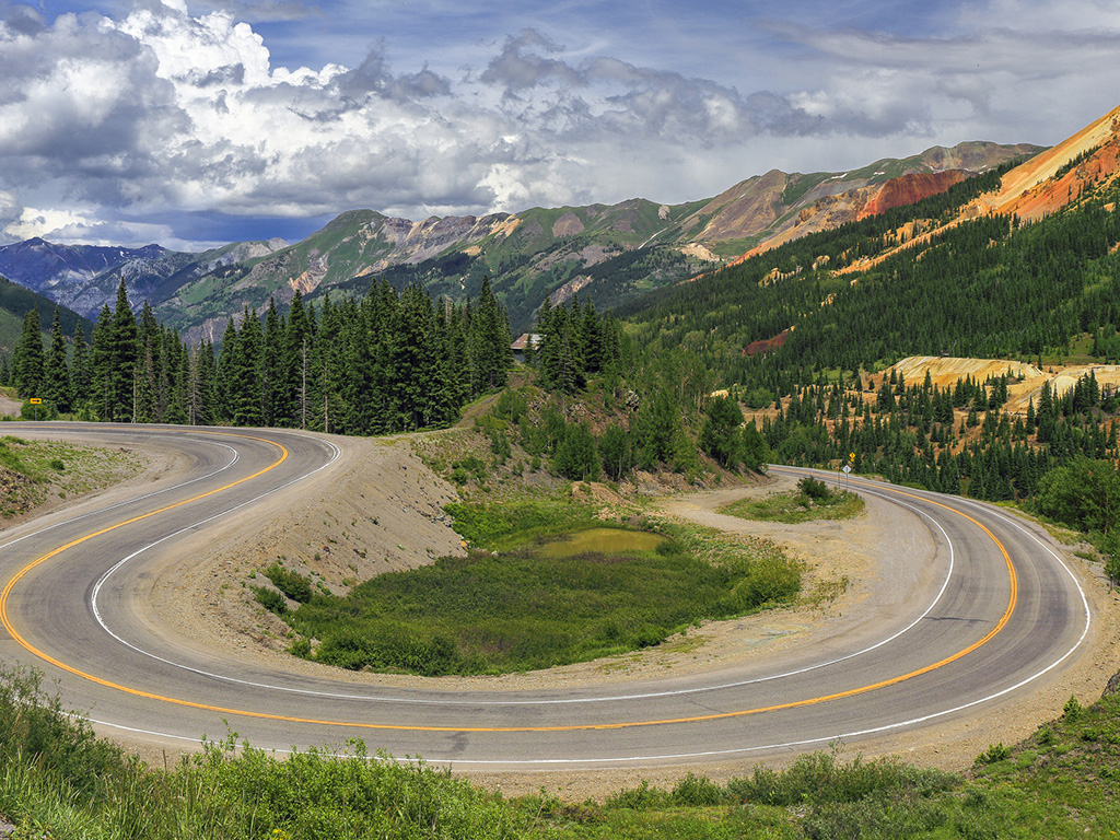
No matter what you want from a scenic drive, the Million Dollar Highway has it in spades. Loaded with sublime natural scenery, historically fascinating and visually appealing small towns, and, most of all, sheer driving pleasure, the road more than lives up to its name. As you might expect of a road born in a Wild West mining country animated by tales of million-dollar fortunes earned, lost, and hoped for, the history of the Million Dollar Highway is rife with legend. The route was first blazed by the so-called “Pathfinder of the San Juans,” a five-foot-tall Russian immigrant named Otto Mears who was working as a U.S. mail carrier between Silverton and Telluride. By 1882 Mears had created a lucrative toll road that he parlayed into a sizable empire of roads and railroads, but his original hand-carved route through the mountains formed the basis of today’s Million Dollar Highway.
Even the origin of the “Million Dollar” name is clouded in myth. Some say it was first used after an early traveler, complaining of the vertigo-inducing steepness of the route, said, “I wouldn’t go that way again if you paid me a million dollars.” Others claim that it derives simply from the actual cost of paving the route in the 1930s. But the favorite explanation is also the most likely: When the highway was first constructed, the builders used gravel discarded by nearby gold and silver mines, only to find out later that this dirt was actually rich in ore and worth an estimated million dollars.
Related Travel Guides
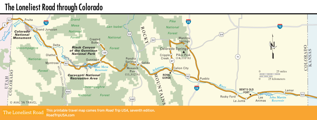
Map of the Loneliest Road through Colorado