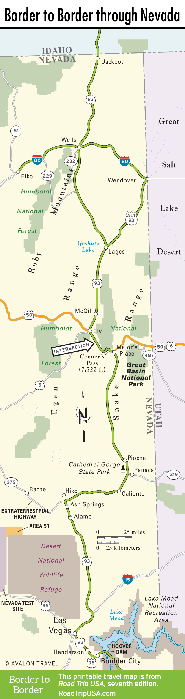
Ash Springs and Alamo
From the Hwy-375 junction, US-93 turns due south again and enters some unexpectedly lush country, in the midst of which three large and faithful springs provide plentiful water for alfalfa farms and cattle ranches, as well as for the only bona fide lake that US-93 encounters in more than 400 miles of its Nevada leg. Ash Springs—consisting of a single gas station and convenience store called R Place—is named after the nearby water source, which is believed to be part of a vast aquifer underlying much of eastern Nevada.
Eight miles south of Ash Springs is Alamo, whose three motels and two truck stops are the only real services between Caliente and Las Vegas. Four miles south of town is Upper Pahranagat Lake, where an old road runs along the eastern shore, with camping, picnic sites, and big cottonwoods—one of the most idyllic spots on the whole Nevada portion of US-93.
Upper Pahranagat Lake is also home to the administration and maintenance facilities for the Desert National Wildlife Refuge, at 1.5 million acres the largest refuge in the Lower 48. Elusive desert bighorn sheep enjoy protection within this huge habitat, alongside which US-93 travels for the length of the aptly named Sheep Range. The road descends gradually into rocky and barren desert until finally, 70 miles from Alamo and 125 miles from Caliente, US-93 merges with the I-15 freeway for the high-speed haul into the Big Glow: Las Vegas.
Related Travel Guides
Travel Map of the Border to Border Route through Nevada