Tybee Island
Less than 20 mi (32 km) southeast of central Savannah, spreading lazily over the easternmost of many islands filling the delta at the mouth of the Savannah River, the town of Tybee Island (pop. 3,110) is a funky old family-oriented resort, with four blocks of burger stands, taverns, and broad clean sands at the eastern end of US-80. Increasingly grown-up and genteel, Tybee still has one last remnant of a rowdier era, in a fun amusement arcade, batting cage, go-kart, and mini-golf combo: Island Miniature Golf and Games (912/898-3833), on US-80 just west of the Bull River Bridge. Locally famous for the annual Beach Bum Parade (912/786-5444 or 800/868-2322) and riotous water fight to kick off summer, Tybee Island’s main attraction is its endless, and usually uncrowded, powdery white-sand beaches, which spread from either side of the pier and pavilion at the east end of 16th Street.
At the north end of Tybee Island, from whence the Union forces bombarded Fort Pulaski during the Civil War, a centuries-old lighthouse stands next to the World War II-era concrete bunkers that house the Tybee Island Light Station and Museum (912/786-5801, Wed.-Mon., $10), which includes the old lighthouse keeper’s cottage among its collections tracing the island’s history.
Other draws here are the wacky, slightly ersatz diner-style Breakfast Club (1500 Butler Ave., Fri.-Mon., 912/786-5984), right at the center of things, open daily for breakfast or an early lunch; if the line is too long, head across the road to the Sunrise Restaurant (1511 Butler Ave., 912/786-7473).
Tybee Island’s stretch of US-80, Butler Avenue, was home to the world’s first Days Inn motel, but these days inexpensive accommodations can be hard to find. There’s an older but comfortable (and pet-friendly!) Dunes Inn & Suites (1409 Butler Ave., 912/786-4591, $100 and up) near the beach and breakfast club. For a more memorable stay, try the Tybee Island Bed and Breakfast Inn (24 Van Horne Ave., 912/786-9255, $200 and up), built in 1902 and set in lovely gardens at the north end of the island, near the grounds of historic Fort Screven.
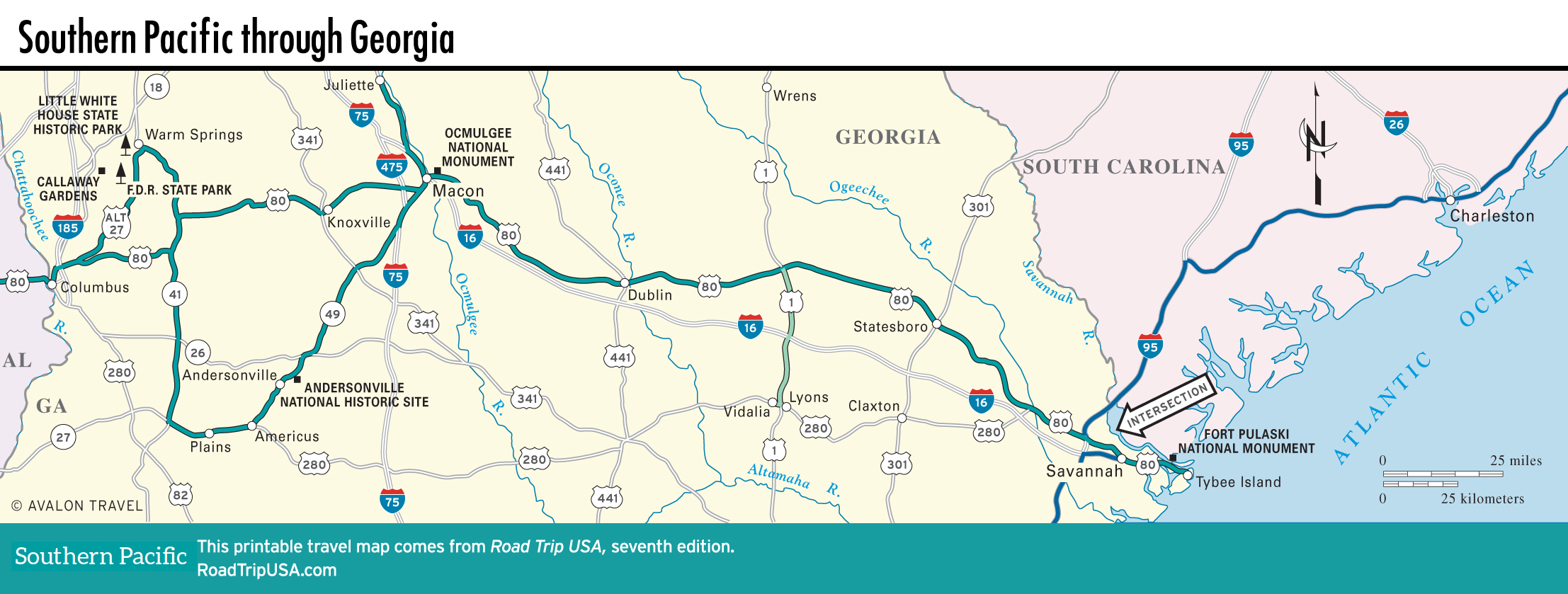
Map of the Southern Pacific Route through Georgia
Related Travel Guides