Cadillac Ranch and Palo Duro Canyon
Cadillac Ranch
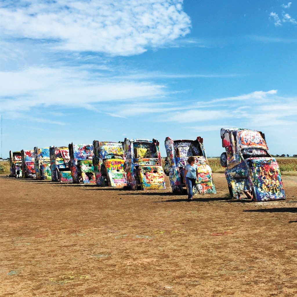
No, you’re not seeing things—there really are nearly a dozen Cadillacs upended in the Texas plain west of Amarillo, roughly midway between Chicago and Los Angeles. Two hundred yards south of I-40 between the Hope Road and Arnot Road exits (exits 62 and 60, respectively), some 10 mi (16.1 km) west of Amarillo where old US-66 rejoins the interstate, the rusting hulks of 10 classic Caddies are buried nose-down in the dirt, their upended tail fins tracing design changes from 1949 to 1964.
A popular shrine to America’s love of the open road, Cadillac Ranch was created by the San Francisco-based Ant Farm artists’ and architects’ collective in May 1974, under the patronage of the eccentric Amarillo helium millionaire Stanley Marsh III. The cars were all bought, some running, some not, from local junkyards and used car lots at an average cost of $200 each. Before the Cadillacs were planted in the ground, all the hubcaps and wheels were welded on, a good idea since most of the time the cars are in a badly vandalized state. Tagging the cars with spray-paint graffiti has become a popular activity, but every once in a while advertising agencies and rock bands tidy them up for use as backdrops during photo shoots. In the late 1990s, Cadillac Ranch got another 15 minutes of fame when Marsh decided to dig them up and move them 2 mi (3.2 km) west from where they’d been—to escape the ever-expanding Amarillo sprawl and preserve the natural horizon. Marsh’s death in 2014 has made the site’s future less secure, so see it while you can.
There’s a well-worn path from the frontage road if you want a closer look. Visitors are allowed any time, day or night.
Palo Duro Canyon State Park
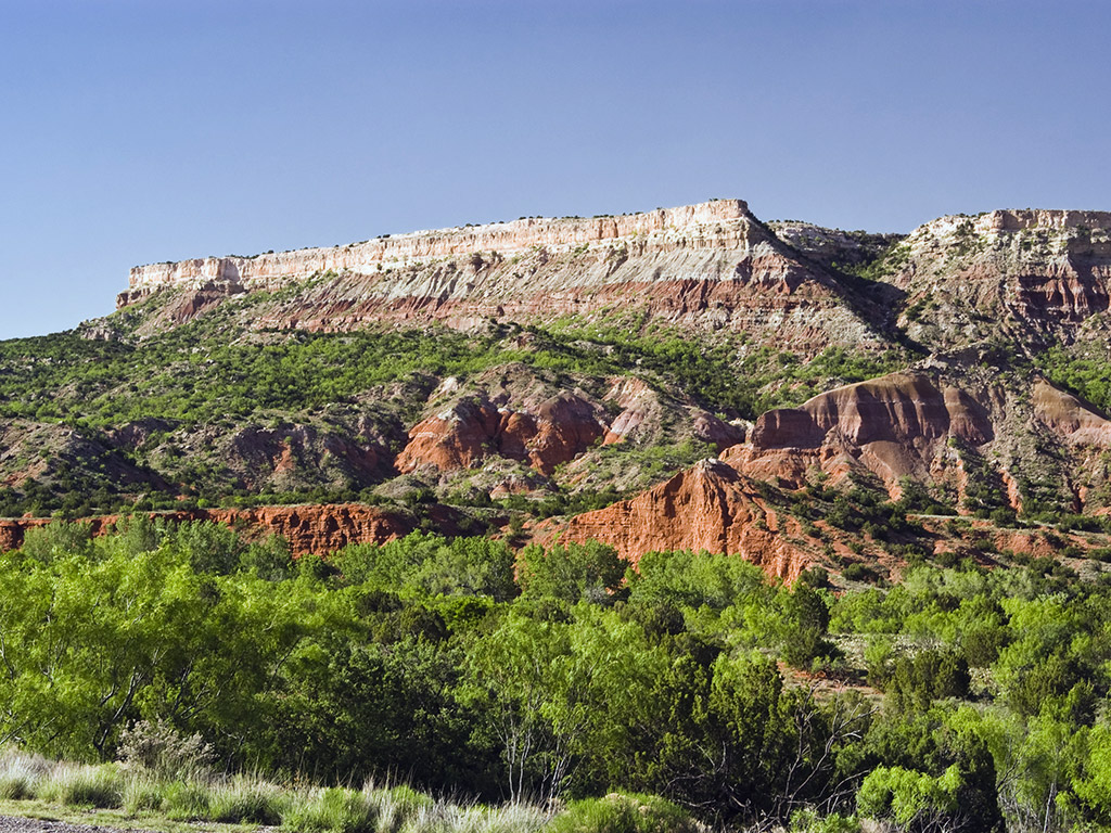
Lovely Palo Duro Canyon State Park (daily, $8), one of the most beautiful places in all of Texas, is just 35 mi (56 km) southeast of Amarillo, east of the town of Canyon off the I-27 freeway. Cut into the Texas plain by the Prairie Dog Town Fork of the Red River, Palo Duro has more than 60 mi (97 km) of ravines, with canyon walls climbing to 800 ft (244 m). Coronado and company were the first Europeans to lay eyes on the area, and numerous Plains people, including Apache, Kiowa, and Comanche, later took refuge here. From the end of Hwy- 217, a well-paved road winds past the Palo Duro park visitors center (806/488-2227, daily), from where a short trail leads to a canyon overlook. Beyond here, more than 30 mi (48 km) of hiking extend through the canyon’s heart. It’s prettiest in spring and fall, and fairly popular year-round.
On your way to or from Palo Duro Canyon, be sure to stop by the excellent Panhandle-Plains Historical Museum (2401 4th Ave., 806/651-2244, Tues.-Sat. Sept.-May, Mon.-Sat. June-Aug., $12.50) in the neighboring town of Canyon. One of the state’s great museums, this has extensive exhibits on the cultural and economic life of the Panhandle region and its relations with Mexico, the Texas Republic, and the United States. The museum, which is housed in a WPA-era building on the campus of West Texas A&M University, has a special section on rancher Charles Goodnight (1836-1929), who once owned a half-million ac (202,300 ha) here, invented the chuck wagon, and was an early advocate of saving the bison from extinction.
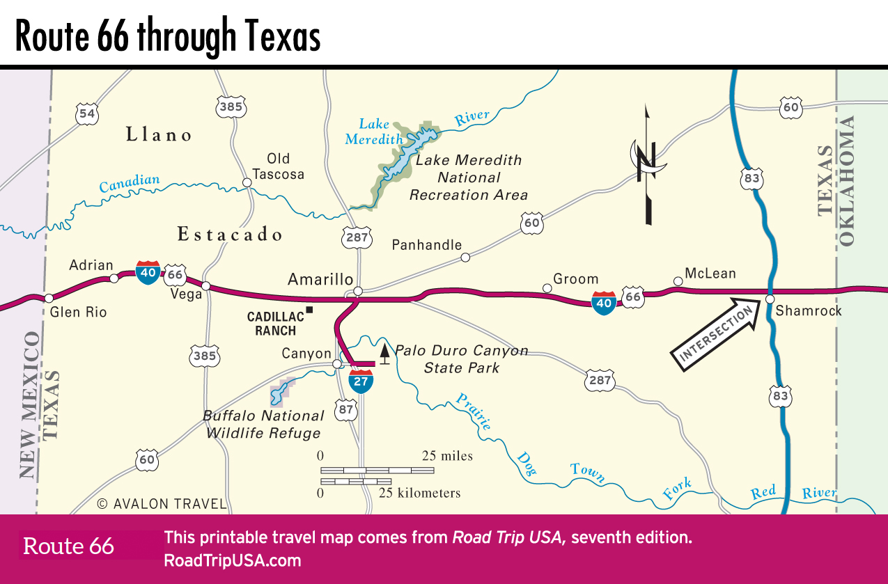
Travel Map of Texas
![[object Object]](https://content.roadtripusa.com/wp-content/uploads/2023/05/9781640497450.webp)
![[object Object]](https://content.roadtripusa.com/wp-content/uploads/2021/06/9781640499812.webp)
![[object Object]](https://content.roadtripusa.com/wp-content/uploads/2020/09/TheOpenRoad2e_Final.jpg)