12 Scenic Drives in Yellowstone National Park
By Moon Yellowstone & Grand Teton author Becky Lomax
Driving through Yellowstone National Park is a treat for every road tripper. Plan an epic driving tour with these twelve options sorted by region: North Yellowstone, Old Faithful and West Yellowstone, and Canyon & Lake Country.
Scenic Drives in North Yellowstone
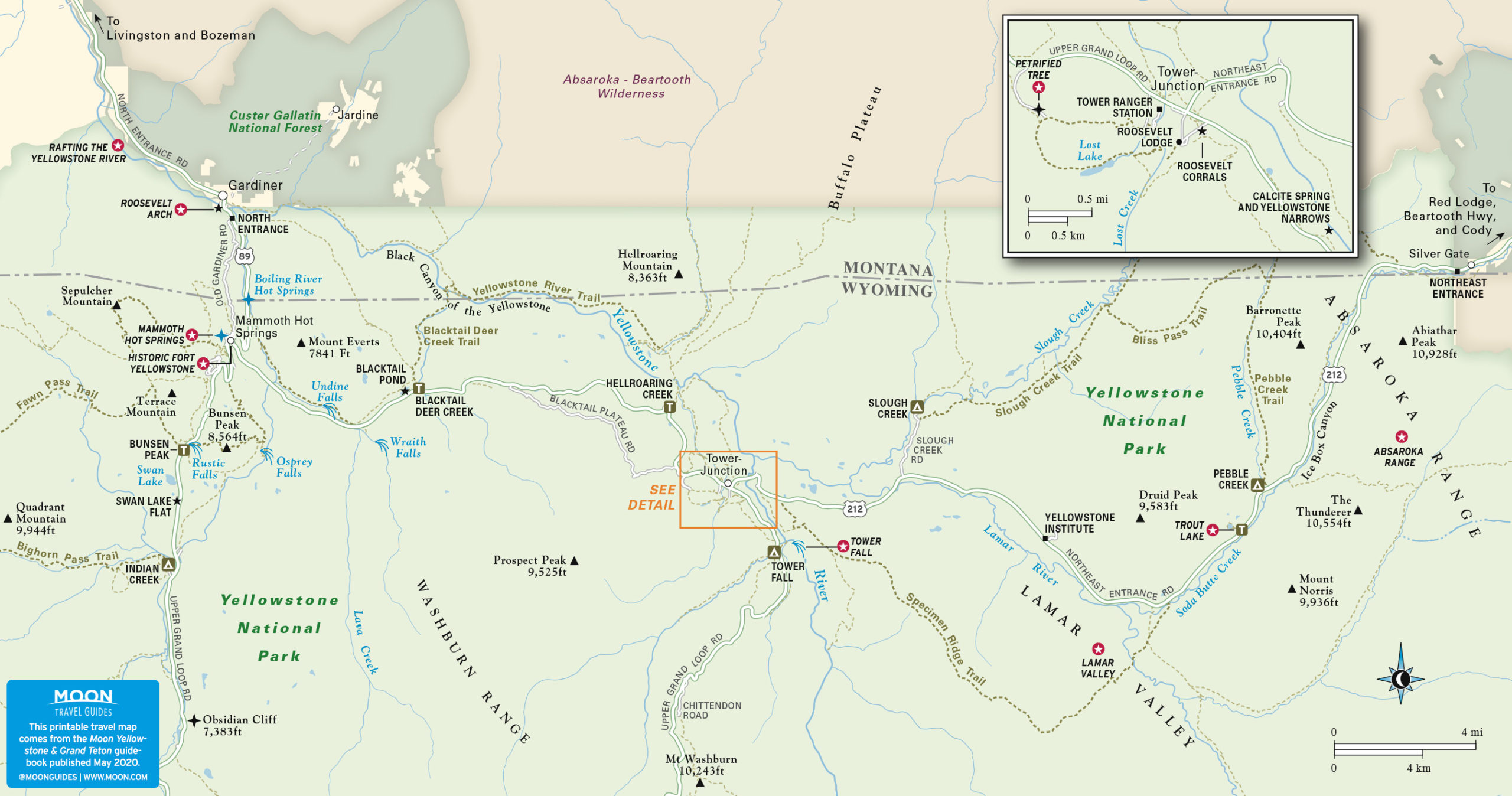
Gardiner to Cooke City – 52 MI (84 KM)
The road between the North Entrance Station at Gardiner and the Northeast Entrance Station at Silver Gate and Cooke City is the only road in Yellowstone open year-round to private cars and RVs. The road is plowed in winter, but snowstorms can cause temporary closures in the fall, winter, and spring. For current road conditions, call 307/344-2117. Plan about two hours one way for this tour. Add on more time for stops.
The two-lane road starts as US-89 in Gardiner, Montana, on Park Street. Drive under the Roosevelt Arch (RVs take the signed shortcut) to reach the entrance station. The road then climbs south through ancient mudflows, crossing the 45th Parallel at the bridge over the Gardner River, then hitting the Montana/Wyoming state line before reaching Mammoth Hot Springs in 5 mi (8 km).
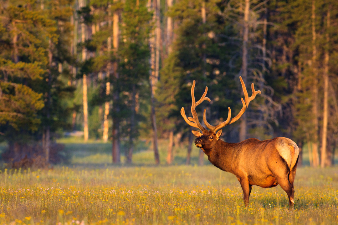
From Mammoth Hot Springs to Tower Junction (18 mi/29 km, 45 min) the route follows Grand Loop Road. Stop to see Undine Falls and the Petrified Tree. Between the two sights, Blacktail Plateau Drive (6 mi/9.5 km, 30 min, open July-early Nov., no RVs or trailers) offers a scenic detour on a curvy, one-way dirt road. The route gains territorial views, goes through fire successions, and is good habitat for elk, bears, and bison.
From Tower Junction to the Northeast Entrance (29 mi/47 km, 60 min), the route crosses the Yellowstone River into Lamar Valley and swings northeast along Soda Butte Creek into the Absaroka Mountains. After Pebble Creek, the road climbs into narrow Ice Box Canyon, flanked by frozen waterfalls in winter and early spring. At the Northeast Entrance, the road exits Yellowstone and enters the tiny blink-and-you-miss-it villages of Silver Gate and Cooke City. In winter (Nov.-May), the route dead-ends at Cooke City due to snowbound roads, but in summer, you can connect with the 68-mi (109-km) Beartooth Highway (open late May-Oct.).
Upper Grand Loop Road – 70 MI (113 KM)
Upper Grand Loop Road links Mammoth Hot Springs with Norris Geyser Basin, Canyon Village, and Tower-Roosevelt. The road east from Mammoth to Tower Junction (18 mi/29 km, 45 min) is open year-round; all other segments of the Upper Grand Loop Road are closed in winter. You can drive the entire loop (open late May-early Nov.) in three hours; stops and side trips add time.
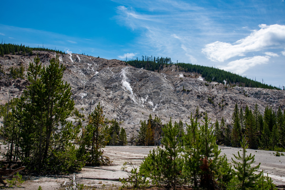
From Mammoth Hot Springs to Norris Junction (21 mi/34 km, 45 min, open late Apr.-early Nov.), the road climbs south through the hoodoos, monster travertine boulders formed by a landslide on Terrace Mountain. It then crawls along the cliffs of Golden Gate before topping out at Swan Lake Flat, where you can often spot wolves and bison. Continuing south, you’ll pass Obsidian Cliff, a site of geological, Native American, and historical significance. Stop again at Roaring Mountain to listen to the thermal activity and look for trumpeter swans in nearby Twin Lakes. Your first leg ends at the Norris Geyser Basin, a hotbed of geothermal activity.
From the Norris Junction, go east toward Canyon Village (12 mi/19.5 km, 30 min, open late Apr.-early Nov.). Continue the loop north from Canyon Village to reach Tower Junction (19 mi/31 km, 45 min, open late May-early Nov.). The road climbs over Dunraven Pass before descending to Tower Fall and the Tower-Roosevelt area. Complete the loop west to Mammoth.
Old Faithful and West Yellowstone Scenic Drives

West Entrance Road – 14 MI (22.5 KM)
For an evening wildlife-watching drive, take the West Entrance Road (14 mi/22.5 km, 30 min, open late Apr.-early Nov.) east from West Yellowstone to Madison Junction. The road parallels the Madison River, with sprawling meadows that fill with bison in summer and elk herds in fall. Pullouts allow places to watch, but don’t become so enamored with the megafauna that you miss eagles in the trees or bobcats hunting along the river.
Lower Grand Loop Road – 96 MI (154 KM)
Lower Grand Loop Road links Madison, Norris, Canyon Village, West Thumb, and Old Faithful to take in loads of wildlife-watching plus Norris Geyser Basin, Grand Canyon of the Yellowstone, Hayden Valley, Yellowstone Lake, West Thumb Geyser Basin, and the Old Faithful complex. Driving the entire loop (open mid-May-early Nov.) will take four hours; add more time for scenic stops and walks along the geyser basins.
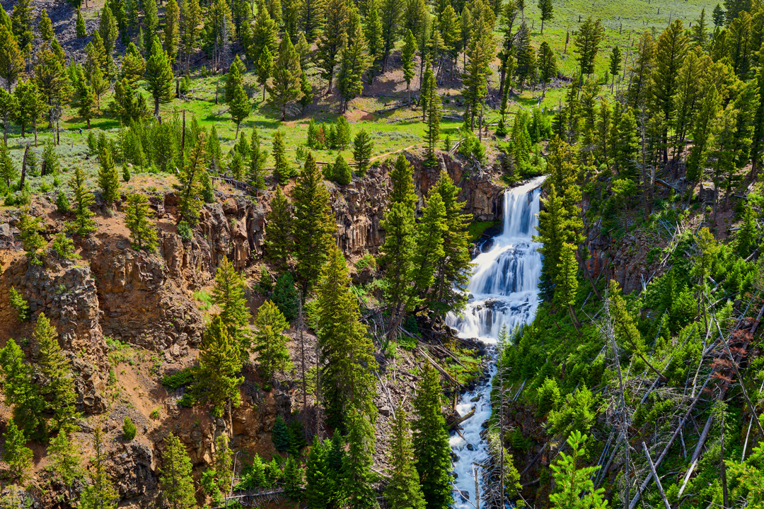
Follow the West Entrance Road from Madison Junction to Norris Junction (14 mi/22.5, 30 min, open mid-Apr.-early Nov.). From Madison, the road loops past Terrace Springs to parallel the Gibbon River. Look for bison and elk in Gibbon Meadows. The road climbs north through a canyon housing Gibbon Falls as it ascends out of the supervolcano caldera. Beryl Spring pops out in the upper meadows near Artists Paintpots before reaching the Norris Geyser Basin.
Zip east over the forested road from Norris to Canyon Village (12 mi/19.5 km, 30 min, open late Apr.-early Nov.). From Canyon Village, the road passes the Grand Canyon of the Yellowstone to head south along the Yellowstone River, curving around the shores of Yellowstone Lake to West Thumb (37 mi/60 km, 90 min, open mid May-early Nov.).
From West Thumb, head west to Old Faithful (17 mi/27 km, 45 min, mid-May-early Nov.). The route bounces twice over the Continental Divide, the highest point at 8,391 ft (2,558 m). Isa Lake, located at Craig Pass, has the unique status of flowing toward both the Pacific Ocean and the Gulf of Mexico. After descending Craig Pass, the road passes Old Faithful and the Upper Geyser Basin before completing the loop north to Madison (16 mi/26 km, 45 min, open late Apr.-early Nov.).
Geyser Basin Tour – 16 MI (26 KM)
The Lower Grand Loop Road climbs south along the Firehole River from Madison Junction to Old Faithful (16 mi/26 km, 45 min, open mid-Apr.-early Nov.), passing through the Lower Geyser Basin, which houses Fountain Paint Pot, Firehole Lake, and Great Fountain Geyser, before passing Midway Geyser Basin. The road then enters Upper Geyser Basin, reaching Biscuit Basin first, then Black Sand Basin, before the Old Faithful Complex. Steam plumes from most of the basins are visible from the road. Bison herds frequent the area; prepare for stopped traffic. Three short spur roads allow scenic side tours.
Firehole Canyon Drive
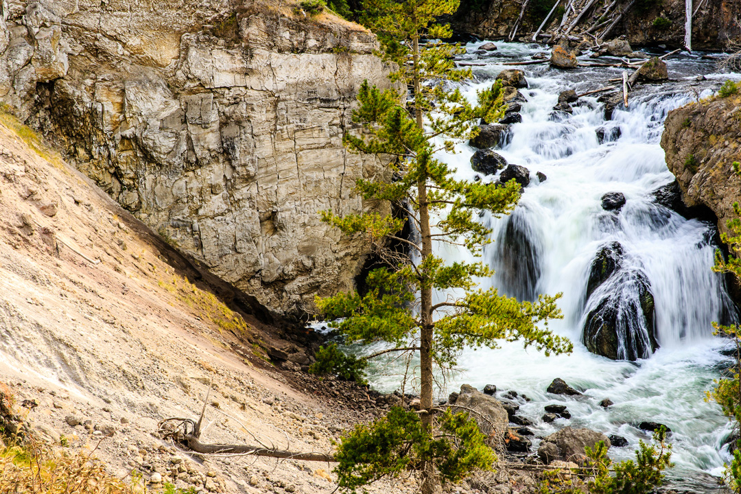
At 0.5 mi (0.8 km) south of Madison Junction, Firehole Canyon Drive (2 mi/3.2 km, 15 min, open mid-Apr.-early Nov., no RVs or trailers) cuts off on the west side of the Grand Loop Road. This one-way, steep and narrow road goes to a scenic overlook of the 40-ft Firehole Falls and 800-ft-thick lava flows; however, there are minimal places to pull over for photos.
Fountain Flat Drive
Find Fountain Flat Drive (1 mi/1.6 km, 15 min, open late May-early Nov.) on the west side of the Grand Loop Road about “bout 5.5 mi (8.9 km) south of Madison Junction or 10.5 mi (16.9 km) north of Old Faithful. The short drive is a good place for wildlife-watching, particularly elk and bison in June; it has the Nez Perce Picnic Area at its start and several pullouts en route. Turn around when the two-way drive dead-ends. Heavy traffic or bison jams can add to driving time. Bear activity keeps the road closed in spring.
Firehole Lake Drive
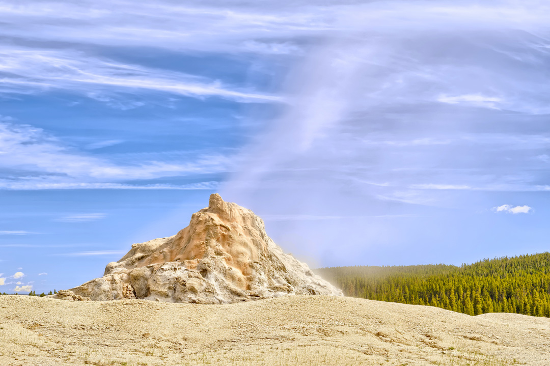
Located about 9.3 mi (15 km) south of Madison Junction and 6.8 mi (10.9 km) north of Old Faithful, the one-way Firehole Lake Drive (3.3 mi/5.3 km, 30 min, open late May-early Nov., no RVs or trailers) is accessed off the east side of the Grand Loop Road. The drive passes eight thermal features, including the brown Firehole Lake, the largest hot springs on the road, and Great Fountain Geyser. The nearby White Dome Geyser erupts at 15- to 30-minute intervals. The Fountain Paint Pot Trail Guide ($1, available at visitors centers) includes interpretive information on Firehole Lake Drive. Bear activity keeps the road closed in spring.
Scenic Drives in Canyon & Lake Country
South Entrance Road – 22 MI (35 KM)
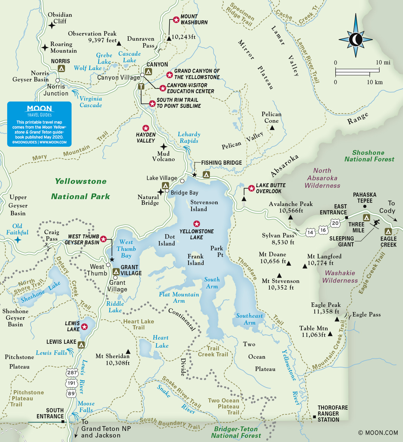
The forested South Entrance Road (45 min, open mid-May-early Nov.) connects the South Entrance of Yellowstone with Grant Village and West Thumb. The road passes the Lewis River, Lewis Falls, and Lewis Lake.
East Entrance Road – 27 MI (43 KM)
From the East Entrance Station, the East Entrance Road (60 min, open late-May-early Nov.) climbs a steep road through cliffs overlooking Middle Creek. Near the head of the valley, a pullout affords views down into the glacier-carved terrain. Amid howling winds, 8,524-ft (2,598-m) Sylvan Pass cuts through a rocky slot in the Absaroka Mountains. A small summit parking lot offers a place to scan the hillsides for bighorn sheep and peruse long, thin waterfalls.
On the descent, use second gear to avoid burning your brakes. At Sylvan and Eleanor Lakes, small pullouts allow photo ops. Thick lupine flanks the road as it plunges through the remains of a 2002 forest fire. For a giant view, take the 1-mi (1.6-km) paved side spur of Lake Butte Road (no RVs or trailers) to Lake Butte Overlook. After reaching the north shore of Yellowstone Lake, the road curves around Steamboat Point, a collection of puffing, noisy fumaroles, and Mary Bay, a volcanic caldera, to reach Fishing Bridge.
Lower Grand Loop Road – 96 MI (155 KM)
The Lower Grand Loop Road (4 hr, open late May-early Nov.) links the Grand Canyon of the Yellowstone, Hayden Valley, Yellowstone Lake, West Thumb Geyser Basin, Old Faithful, and Norris Geyser Basin. Stops for touring geyser basins will add to your time.
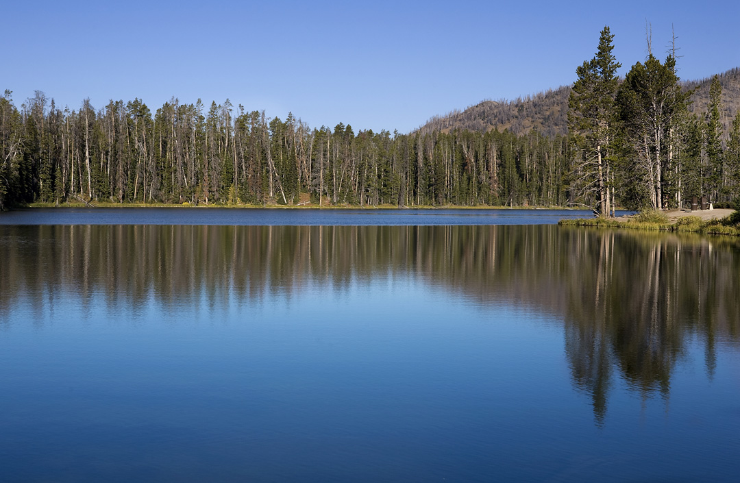
Between Canyon Village and Fishing Bridge (16 mi/26 km, 45 min), the road tours the ultra-scenic Hayden Valley, cut by the meandering Yellowstone River. The valley usually has scads of wildlife: bison, elk, deer, and sometimes bears or wolves. For the best wildlife-watching, drive through Hayden Valley in the early morning or at dusk. Expect slow going where wildlife jams stall traffic. South of Hayden Valley, the smelly volcanic features of Mud Volcano and Sulphur Cauldron shoot steam across the road. LeHardy’s Rapids offers a place to spot harlequin ducks in early summer.
The scenic drive continues south along Yellowstone Lake from Fishing Bridge to West Thumb Junction (21 mi/34 km, 45 min). Stop in Lake Village to view the historic Lake Yellowstone Hotel. Continuing south, the road passes Bridge Bay and the trailhead to Natural Bridge. South of Bridge Bay, the conifer-lined Gull Point Drive (2.1 mi/3.4 km, often closes late May-June due to flooding) leads to Gull Point Picnic Area, where a long sandbar extends out into the lake at Gull Point—a good place for fishing and beachcombing with views across the lake to the Absaroka Mountains. South of Gull Point Drive, multiple picnic areas and pullouts offer places to enjoy the lake; prepare for afternoon wind. West Thumb Geyser Basin is on the left just before West Thumb Junction.
From West Thumb, the Lower Grand Loop Road heads west through lodgepole pine and spruce forests toward Old Faithful (17 mi/27 km, 45 min), reaching a south-side overlook that has trees occluding part of distant Shoshone Lake. The route pops out twice over the Continental Divide, the highest point at 8,391 ft (2,558 m). Isa Lake, located at Craig Pass, has the unique status of flowing toward both the Pacific Ocean and the Gulf of Mexico. After Craig Pass, the road descends into Old Faithful.
Upper Grand Loop Road – 70 MI (113 KM)
Upper Grand Loop Road (3 hr) links Canyon Village with Tower Junction, Mammoth Hot Springs, and Norris. Various segments of the road open at different times in spring; private vehicles can tour the entire loop late May-early November. Stopping at geyser basins and overlooks will add more time to the drive.
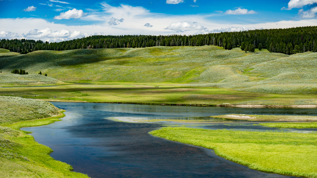
Driving north from Canyon Village to Tower Junction (19 mi/31 km, 45 min), Upper Grand Loop Road climbs to Dunraven Pass, which yields territorial views off either side of the pass. En route, you’ll spot the lookout on the summit of Mt. Washburn. North of the pass, the road descends to Tower Fall, Calcite Springs, and Tower Junction. For the 7 percent grade down from the pass, shift into second gear to avoid burning your brakes.
About the Author
Becky Lomax grew up hiking, camping, and skiing in Olympic National Park, North Cascades National Park, and Mt. Rainier National Park (where her dad used to serve as a ranger).
During college, she worked summers in Glacier National Park. After teaching high school English for many years outside Seattle, she and her husband moved to Montana, where she served as a hiking and backpacking guide in Glacier, worked at a ski resort, and began to write about the outdoors. She relishes visiting national parks to hike, bike, backpack, kayak, and raft.
Through her writing, she advocates for conserving wild places for their unique attributes and the renewal they bring to humans. She has written about hiking trails, historic lodges and roads, camping, paddling, skiing, bicycling, wildlife, wildflowers, birds, and climate change. For magazine stories, she has tagged along with biologists into the field to radio collar bighorn sheep and grizzly bears, even touching the bear’s claws and smelling its fur to discover its earthy scent.
She has published stories in several national travel magazines including Smithsonian and Backpacker. She has also authored Moon USA National Parks, Moon Glacier National Park and Moon Montana, Wyoming, & Idaho Camping.
Recommended Travel Guides
Pin it for Later