Chicago
Sights Along Route 66 in Chicago
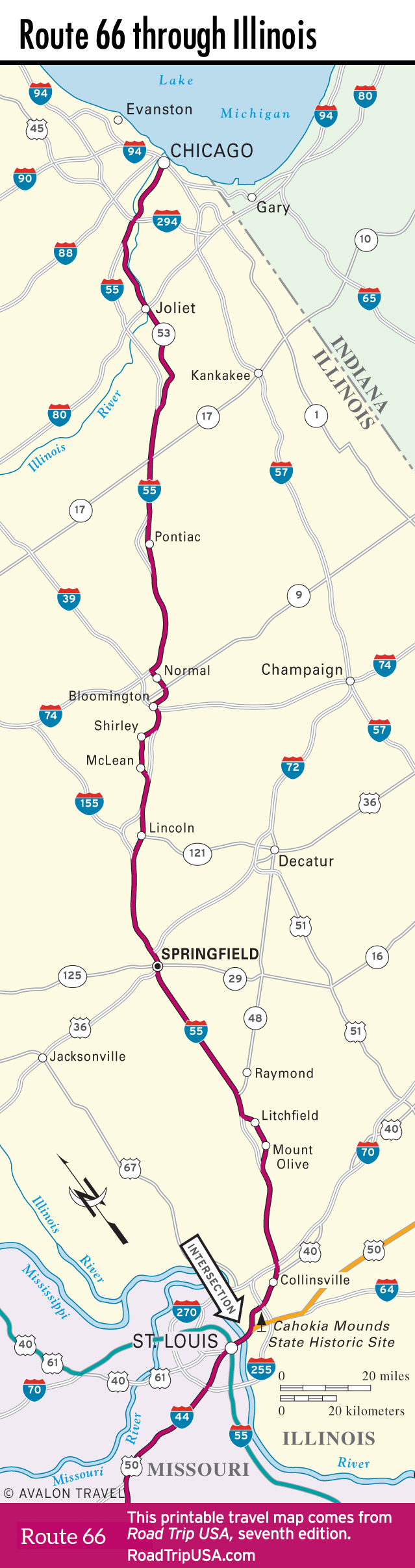
Following the first (or last) leg of Route 66 across Chicago and its hinterlands is not worth the effort for anyone except the most die-hard end-to-ender—even Jack Rittenhouse, in his original 1946 A Guide Book to Highway 66, didn’t bother to describe the route until it reached Plainfield, 35 mi (56 km) southwest of the Loop, and these days the Chicagoland suburbs don’t fade away until you get beyond Joliet.
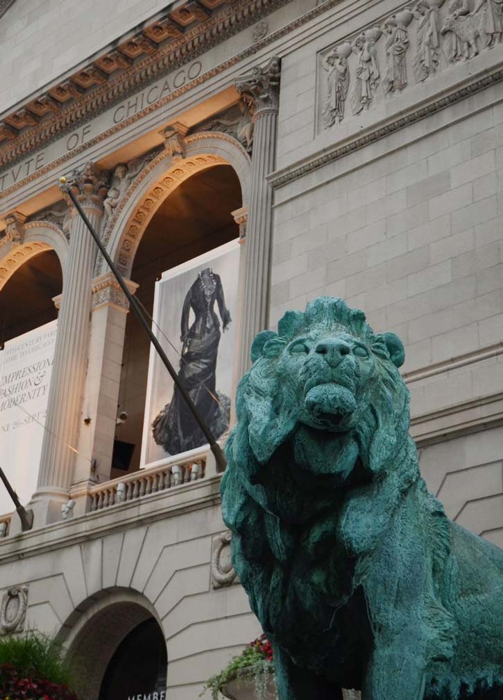
For a symbolic starting point, you can use the grand old Art Institute of Chicago in Grant Park along the lakeshore, since the last US-66 shield used to hang from a streetlight just south of the gallery (and a commemorative marker hangs there now). If Chicago is your “end of the road,” you’ll probably prefer to avoid the final few miles of surface streets and make your way to town as quickly as possible via I-55, celebrating your arrival with a cup of coffee at Lou Mitchell’s restaurant and bakery.
From Lake Michigan, the old road ran westbound through the Loop via Adams Street (take Jackson Boulevard eastbound; both are one-way) before angling southwest along Ogden Avenue—a long, diagonal exception to the city’s main grid of streets.
Ogden Avenue, which carries Route 66 in and out of Chicago, is not one of the world’s scenic wonders, but it can reveal a lot about the places it passes through. Located just south of Frank Lloyd Wright’s hometown of Oak Park, Cicero is notorious for its connections to another local legend: mobster Al Capone, who took refuge here outside the jurisdiction of the Chicago police. Cicero’s main Route 66 connection is the fine sign—“It’s a Meal in Itself”—marking Henry’s Drive-In (6031 W. Ogden Ave., 708/656-9344), where you can snack on excellent Polish hot dogs smothered with a pile of french fries. And crisp pickles, if you want them.
Bounded by the I-55 freeway, Berwyn effectively marks one end of this first or last stretch of Route 66 with the unusual Chicago Portage National Historic Site. This nearly 100-ac (40.5-ha) semi-wilderness, surrounded by decrepit and abandoned industrial lands, preserves the place where early explorers learned to carry their canoes and boats between the Chicago and Des Plaines watersheds, linking the Atlantic Ocean and Gulf of Mexico via the Great Lakes and Mississippi River. (Today, the euphemistically named Chicago Sanitary and Ship Canal serves a similar role, running via Lockport and Joliet.)
One longstanding Route 66 landmark stands about 20 mi (32 km) outside Chicago in Willowbrook, off Hwy-83 on the north side of I-55: Dell Rhea’s Chicken Basket (645 Joliet Rd., 630/325-0780) is a welcoming old roadside tavern, with famously fabulous chicken dinners and frequent live music.
Related Travel Guides


Map of Route 66 in Illinois