Illinois
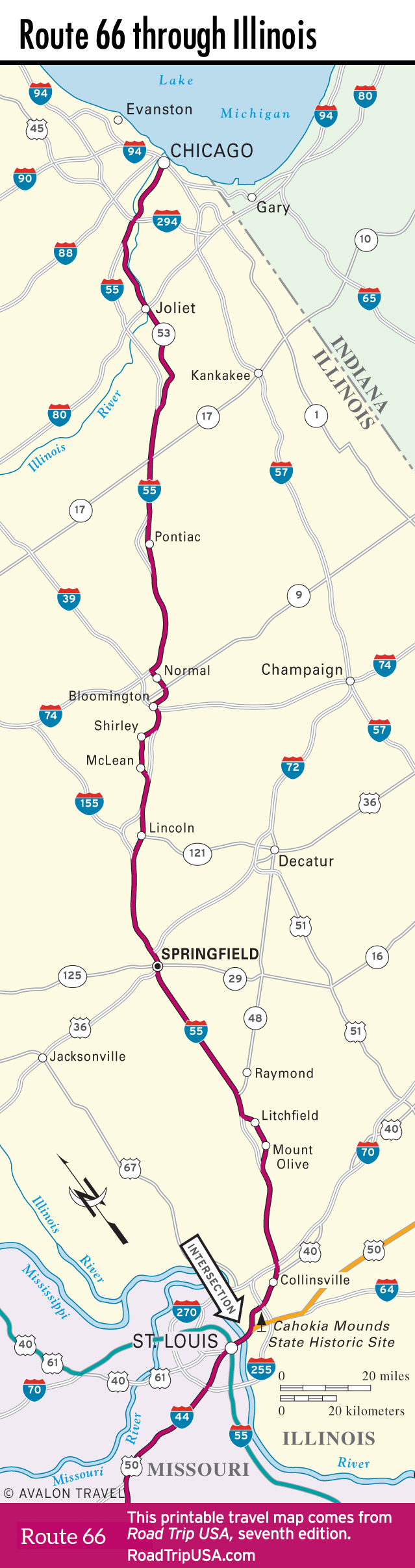
Heading diagonally across the state from Chicago to St. Louis, what remains of Route 66 is a surprisingly rural cruise through endless fields of corn. Despite the urban conglomerations at both ends, for most of its nearly 300-mi (485-km) trek here, Route 66 and its modern usurper, I-55, pass along flat prairies with nary a smokestack or skyscraper as far as the eye can see.
The heavy industrial and poverty-stricken hinterlands of Chicago and East St. Louis aren’t terribly rewarding for travelers in search of the Mother Road, but a couple of intriguing attractions—one a prehistoric city, the other a water tower shaped like a catsup bottle—are worth searching out. The only real city along Route 66 is the Illinois state capital, Springfield, which has preserved its sections of Route 66 alongside a wealth of places connected to the namesake president here in the “Land of Lincoln.” Dozens of small towns across the state play up their Route 66 connections, and most boast at least one true old-road landmark.
Related Travel Guides


Map of Route 66 Through Illinois