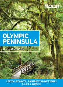
Hurricane Ridge
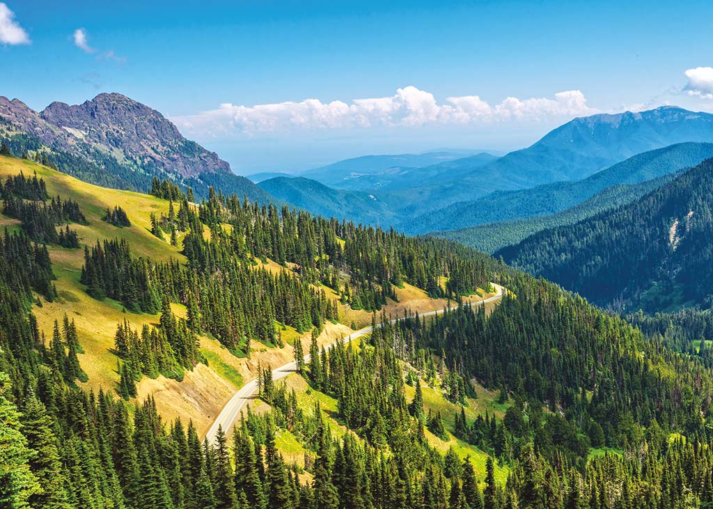
High above Port Angeles, Hurricane Ridge provides the most popular access to Olympic National Park. A paved road twists and turns 17 mi (27 km) up a steep 7-percent grade to the mile-high summit, where, on a clear day, you can gape at the breathtaking 360-degree views of mountain, valley, and sea. A lodge at the crest provides food and drink, and a concession offers ski and snowshoe rentals on winter weekends. Trails lead down into the backcountry, where you’re likely to spot marmots, deer, and bald eagles—and if you’re lucky, maybe an elk or a mountain lion. From Hurricane Ridge, thrill-seeking drivers and mountain bikers may get a kick out of Obstruction Point Road, a twisting gravel road that continues (without guardrails!) for another 8 mi (13 km) along the crest from the parking lot. In winter, the snowed-in road becomes a popular cross-country skiing trail.
Apart from the area right around Hurricane Ridge, most of the Olympic National Park backcountry is fairly wet and rugged. If you plan to camp overnight, be prepared, and be sure to get a permit from the Olympic National Park Visitor Center (360/565-3130) in Port Angeles, just south of US-101 on the road up to Hurricane Ridge. This is also the best place to pick up general information on the rest of the park, which extends all the way west to the rainforest areas along the coastal valleys.
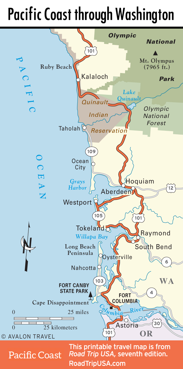
Travel Map of the Pacific Coast through Washington
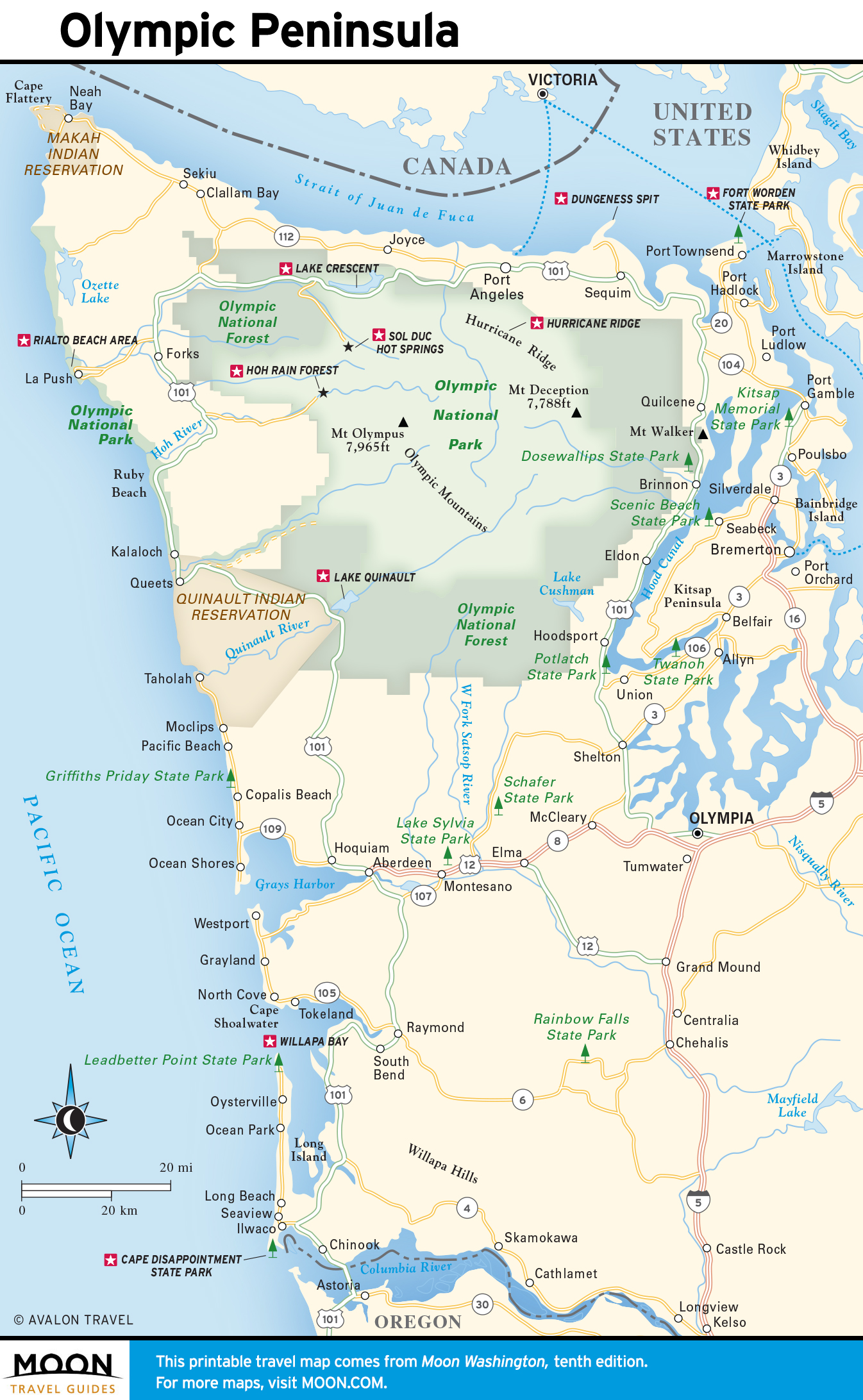
Travel Map of the Olympic Peninsula
Related Travel Guides