Farmlands or San Juan Bautista
Watsonville, Castroville, and Moss Landing
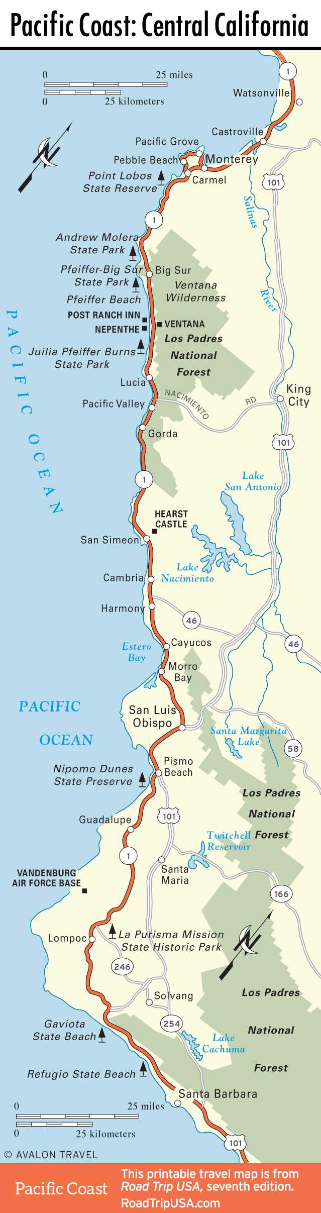
Between Santa Cruz and Monterey, Hwy-1 loops inland through the farmlands fronting Monterey Bay. Part freeway, part winding two-lane road, Hwy-1 races through, and to be honest there’s not a lot worth stopping for: The beaches can be dreary, and the two main towns, Watsonville and Castroville, are little more than service centers for the local fruit and vegetable packers, though Castroville does have one odd sight: the “World’s Largest Artichoke,” a concrete statue outside a large fruit stand at the center of town.
Back on the coast, midway along Monterey Bay, the port community of Moss Landing is a busy commercial fishery, with lots of trawlers and packing plants—not to mention pelicans aplenty. Moss Landing sits alongside Elkhorn Slough, the largest and most wildlife-rich wetlands area in Monterey Bay (a busy nursery for baby seals, baby otters, and baby leopard sharks), which you can see in greatest comfort via pontoon boat tour (831/633-5555). Moss Landing is also home to the research arm of the Monterey Bay Aquarium, a nice KOA campground, an obtrusively huge electricity generating plant, and The Whole Enchilada (831/633-3038), which has spicy seafood right on Hwy-1, near the power plant. Alternatively, try the sustainable and organic Haute Enchilada Café (7902 Moss Landing Rd., 831/633-5843), west of the highway.
Much of the bay front north of Monterey formerly belonged to the U.S. Marine Corps base at Fort Ord. Almost the entire parcel was turned over to the State of California to house the California State University at Monterey Bay, which opened its doors in 1994.
Inland to San Juan Bautista
Away from the coast, 15 miles inland from Monterey Bay via Hwy-129 or Hwy-156, stands one of California’s most idyllic small towns, San Juan Bautista (pop. 1,862). It centers on a grassy town square bordered by a well-preserved mission complex, complete with a large church and monastery, standing since 1812. Two other sides of the square are lined by hotels, stables, and houses dating from the 1840s through 1860s, preserved in their entirety within a state historic park (831/623-4881, daily).
Completing the living history lesson, the east edge of the square is formed by one of the state’s few preserved stretches of El Camino Real, the 200-year-old Spanish colonial trail that linked all the California missions with Mexico. Adding to the interest, the trail runs right along the rift zone of the San Andreas Fault, and a small seismograph registers tectonic activity. (Incidentally, San Juan Bautista was where the climactic final scenes of Hitchcock’s Vertigo were filmed—though in the movie, they added a much more prominent bell tower with a seemingly endless staircase.)
The town’s main street is a block from the mission and is lined by a handful of antiques shops, Mexican restaurants, and cafés like the Mission Café (300 3rd St., 831/623-2220).
California’s Central Coast Travel Map
Related Travel Guides