Ohio
The many routes across Ohio along the Lake Erie shore have long been major thoroughfares. Traders and war parties of Iroquois and other Native Americans regularly passed this way hundreds of years before European and American pioneers started coming through in Conestoga wagons.
Nowadays, historical survivors, including colonial-era taverns and other early roadside Americana, and a rapidly decreasing number of vegetable farms and greenhouses fill the flatlands, threatened by ever-expanding suburbia. All over northern Ohio you’ll also see Rust Belt remnants of massive industrial activity that took place here from the 1880s to the 1950s, when the Great Lakes were the “Anvil of America,” producing the bulk of the nation’s—and the world’s—iron, steel, and petroleum products.
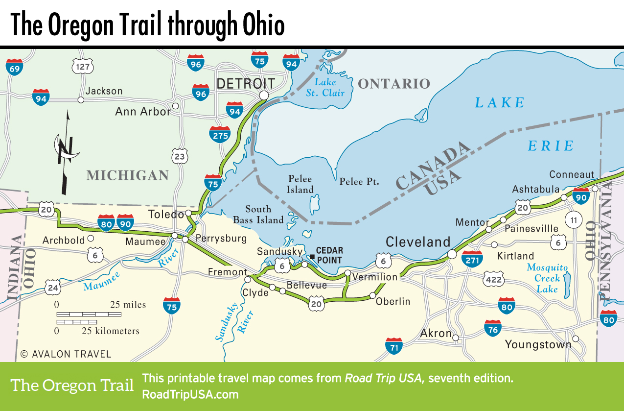
Rather than try to follow one or another of the many old roads that crisscross the state, it’s best to alternate between a variety of routes to either side of the part-tollway, part-freeway known as I-90. In the western half of the state, we follow US-20 from Toledo through a rural landscape of gambrel-roofed, red-painted barns, daubed with Chew Mail Pouch signs and made immortal by Sherwood Anderson’s classic portrayal in his book Winesburg, Ohio. In the middle, we detour north to the lakeshore along US-6, which passes through idyllic summer home communities, gritty old ports, and one of the country’s great old amusement parks, Cedar Point. East of the metropolitan Cleveland area, US-20 veers north along the Lake Erie shore, while US-6 zigzags south through the fertile farming country of northeastern Ohio—a region accurately described by the 1939 WPA Guide to Ohio as an “enchanting country of tumbling hills, valleys, and forests.”
Related Travel Guides