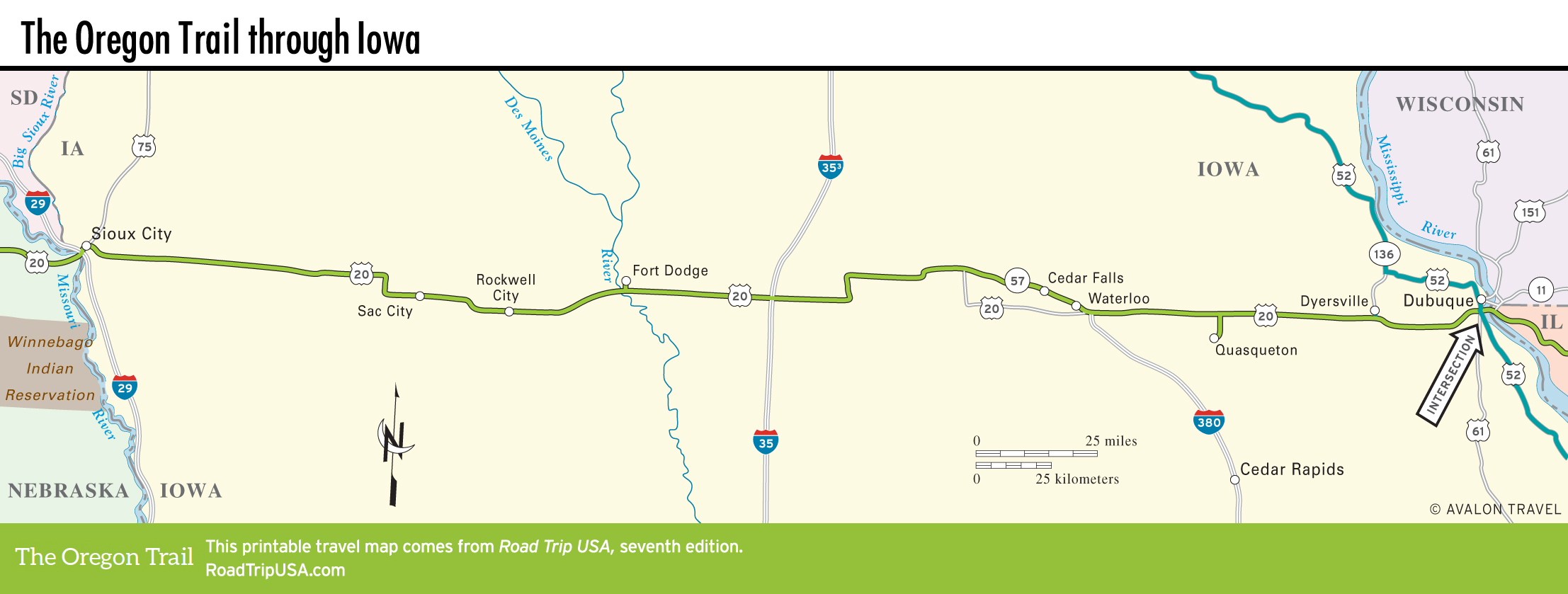
Iowa
US-20 cuts straight across the midsection of Iowa between the Missouri and the Mississippi Rivers, running along the invisible border that divides the flat agricultural tableland that distinguishes the northern half of the state from the more heavily industrialized south.
The first industry here was lead mining in the 1840s, but the predominant activity these days is livestock raising. Cows and pigs feed on the abundant corn that grows in fields all along the highway. Popcorn is also a major crop.
More than on any other section of its cross-country trek, US-20 across Iowa has been “upgraded” into a fast four-lane freeway, so you may well want to consider alternative routes like old US-30, which preserves some fine stretches of the historic Lincoln Highway, the country’s first transcontinental road.
Related Travel Guides