Tillamook and the Three Capes Loop
Tillamook
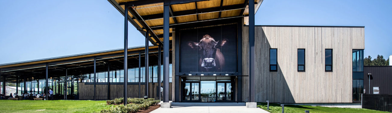
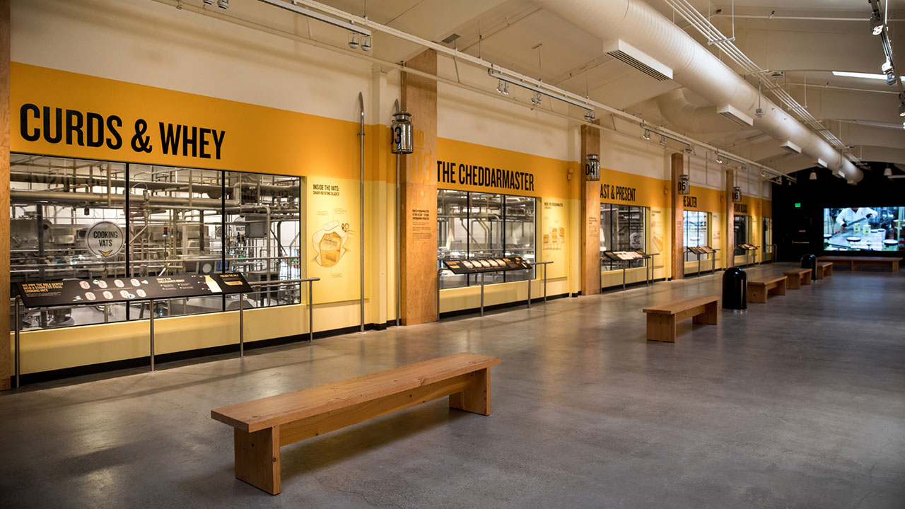
Tillamook (pop. 5,311), where cows outnumber people, sprawls over lush grasslands at the southern end of Tillamook Bay. Its motto, “Land of cheese, trees, and ocean breeze,” conjures a clear sense of a place where the high school football team is cheered on by shouts of “Go Cheesemakers!” Tillamook (some say the name is a Salish word meaning “land of many waters”) is dominated by the Tillamook Cheese Factory at the north end of town, one of the busiest tourist draws in the state. In June 2018, the factory upgraded their visitor experience with an in-depth farm exhibit and informational videos, as well as plenty of samples and products to stock up on. A self-guided tour with informational placards traces Tillamook cheese-making from the last century to the present, while an observation area lets you watch the goods being made and packaged.
Tillamook’s other attraction is east of US-101 and south of town. One of the world’s largest wooden structures has been preserved as the Tillamook Air Museum (503/842-1130, Tues.-Sun., $9.50 adults). Built in 1942, it’s 296 feet wide, 1,072 feet long, and nearly 200 feet tall, enclosing more than 7 acres of open-span floor space. It’s now a museum telling the story of the World War II surveillance blimps kept here by the U.S. Navy. There are also displays about other dirigible craft (like the ill-fated Hindenburg) as well as a world-class collection of vintage airplanes (from MiG fighters to an elegant, twin-tailed P-38 Lightning), plus a theater and a restaurant, all making for a fascinating and unusual stop. The building used to be one of a pair of hangars, but the other one burned down in 1992.
Three Capes Scenic Route
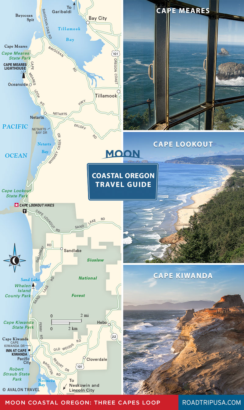
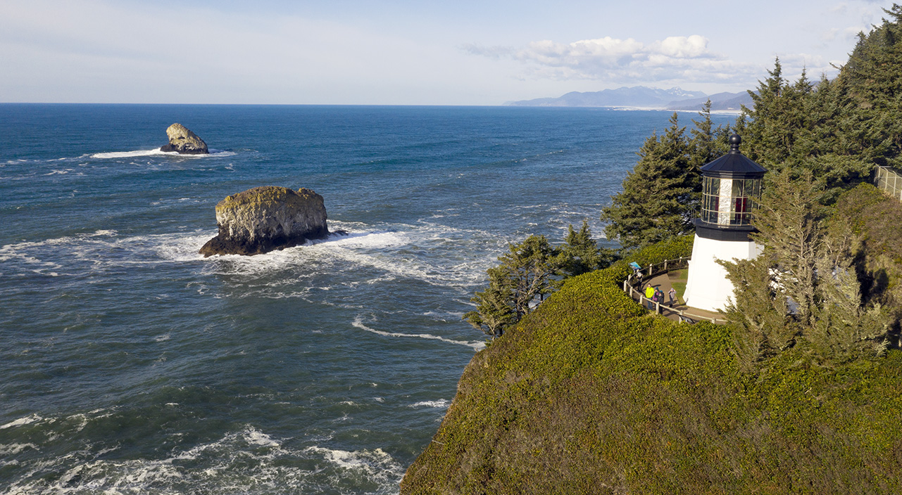
US-101 veers inland for 50 miles between Tillamook and Lincoln City, the next sizable town south. If time and weather are on your side, head west along the coast via the well-signed, 40-mile-long Three Capes Scenic Route. Running northwest from Tillamook, the loop reaches the mouth of Tillamook Bay at Cape Meares, which has a restored 1890 lighthouse and an oddly contorted Sitka spruce known as the Octopus Tree.
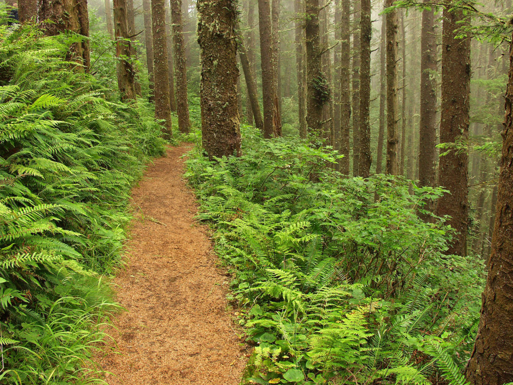
Heading south through the coastal villages of Oceanside and Netarts, the loop proceeds through dairy country until it climbs onto the shoulder of Cape Lookout, where a small sign proclaiming “Wildlife Viewing Area” marks the beginning of a 2.5-mile trail that leads through an ancient forest to the tip of the cape. Besides the coastal panorama, in winter and spring this is a prime place to view passing gray whales. From the trailhead, the middle path leads to the cape, while others to the left and right lead down to the water. Cape Lookout State Park (503/842-4981) has the area’s most popular campground, where tent sites, yurts, and cabins come with hot showers and other creature comforts.
The Oregon coast’s most famous promontory, Cape Kiwanda, sees some of the state’s wildest surf battering the sandstone headland. Across from the cape is yet another Haystack Rock, this one being a 327-foot-tall sea stack, a half mile offshore. Along the beach south of the cape, surfers ride waves while fisherfolk skid their small dories along the sands most afternoons—a sight worth hanging around to see.
The southernmost settlement on this scenic alternative to US-101 is neighboring Pacific City.
Three Capes Loop Driving Directions
Moon’s Road Trip travel guide series covers the top road trips in North America. Here are mile by mile directions excerpted from Moon Pacific Northwest Road Trip by Allison Williams, and her take on how to drive the Three Capes Loop.
Start: Tillamook, inland on U.S. 101
CAPE MEARES: 14 MILES (23 KILOMETERS)
In Tillamook, drive west on Highway 131 (this is called 3rd Street in town) and follow it northwest for 13.5 miles (22 kilometers) to Cape Meares Lighthouse (503/842-2244). The short, squat lighthouse was built in 1889 and features a Fresnel lens. A short trail passes by interpretive signs, viewpoints, and the Octopus Tree, a 250-year-old Sitka spruce with limbs that bend at right angles.
Leaving the park, follow Bayshore Drive south for 2.5 miles (4 kilometers) to Oceanside, where the road becomes Cape Meares Loop. Turn right on Pacific Avenue and stop for a snack at Roseanna’s Café (1490 Pacific Ave. NW, 503/842-7351), located in a century-old wooden building, with plenty of seafood to match the waterfront location. After lunch, continue walking north along Pacific Avenue to explore Oceanside Beach State Recreation Site (1790-1798 Rosenberg Loop, 503/842 3182, year-round). Walk up the beach and look for a tunnel in the rocks that leads to the next beach, the aptly named Tunnel Beach (only accessible at low tide).
CAPE LOOKOUT: 8 MILES (13 KILOMETERS)
CAPE KIWANDA: 12 MILES (19 KILOMETERS)
Leaving Netarts, follow Cape Lookout Road south for a little more than 3 miles (4.8 kilometers). Turn right onto Sandlake Road and drive 8 miles (13 kilometers) to Cape Kiwanda State Natural Area (Hungry Harbor Rd. and McPhillips Dr., 503/842-3182), where Pelican Pub & Brewery (33180 Cape Kiwanda Dr., 503/965-7007) marks your final stop on this detour. Grab a cream ale or an IPA and enjoy it on one of the patio tables outside. The microbrewery also serves yummy burgers, seafood, and pizza (in case your lunch has worn off).
End: Tillamook (25 miles/40 kilometers) or Lincoln City (20 miles/32 kilometers)
To complete the loop, return to U.S. 101 by taking Cape Kiwanda Drive south for 1 mile. Turn left onto Pacific Avenue, and then make an immediate right onto Brooten Road, just after the bridge. Follow Brooten Road for 2.5 miles (4 kilometers) to U.S. 101. Take U.S. 101 north for 25 miles (40 kilometers) back to Tillamook, or drive south for 20 miles (32 kilometers) to Lincoln City to continue exploring the coast.
Related Travel Guides


Pin For Later