Montana
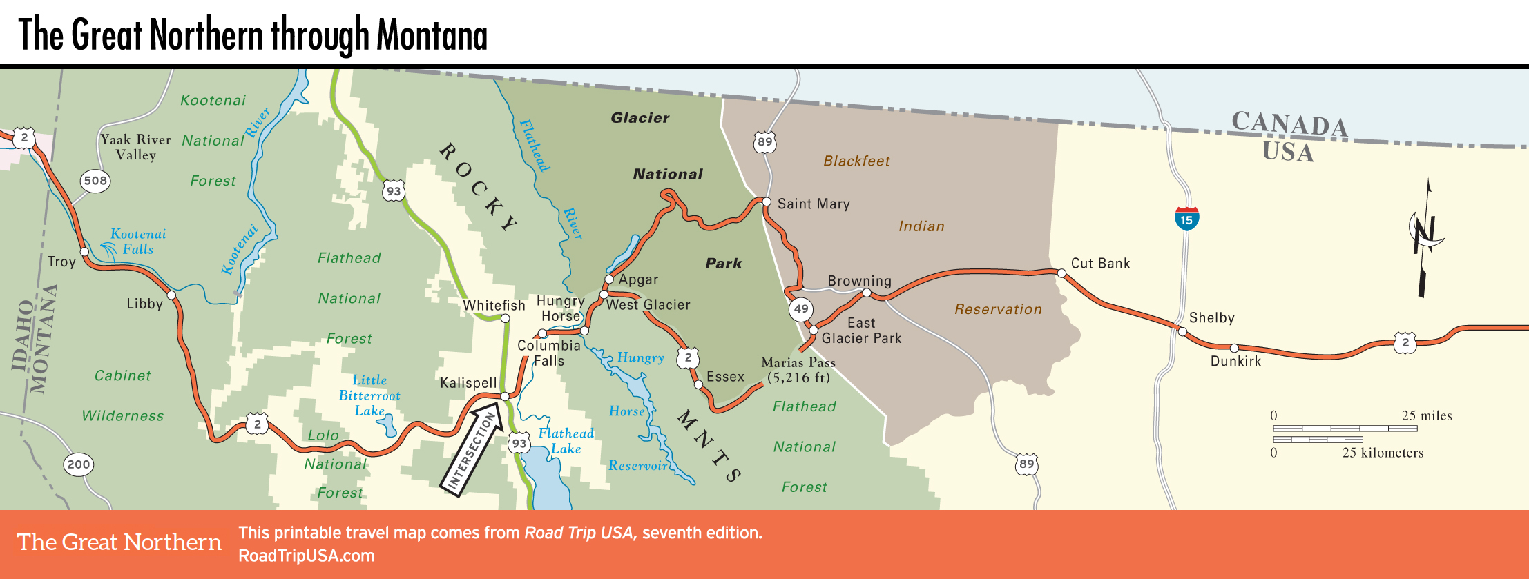
Crossing northern Montana roughly 30 mi (48 km) south of the Canadian border, US-2 gives an up-close look at two very different parts of this huge state. The western quarter, on the slopes of the Rocky Mountains, offers incredible scenic beauty and innumerable options for outdoor recreation, culminating in magnificent Glacier National Park.
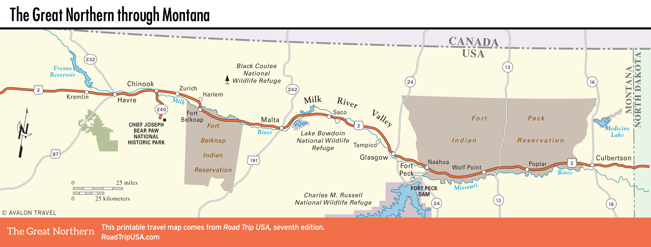
East of Glacier, it’s like a completely different world as two-lane US-2 (popularly known as the “Hi-Line”) races across glaciated Great Plains rangelands along the many tributaries of the broad Missouri River. A few low buttes and cylindrical grain silos rise up in sharp silhouettes, but the horizon is the dominant aspect, stretching for what feels like hundreds of miles in all directions. Apart from dozens of one-side-of-the-road blink-stops, the towns along US-2 in the eastern stretches of Montana—Culbertson, Wolf Point, Glasgow, Malta, and Havre—are few and far between. It’s here you realize what the “Big Sky Country” is all about: cruising along at 70 mph (113 km/h), pacing a freight train and waving at the engineer, and never passing a gas station when the tank is less than half full.
Related Travel Guides