California
From deserts to bayou swamps and Tex-Mex to barbecue, this route offers a full-flavored taste of America.
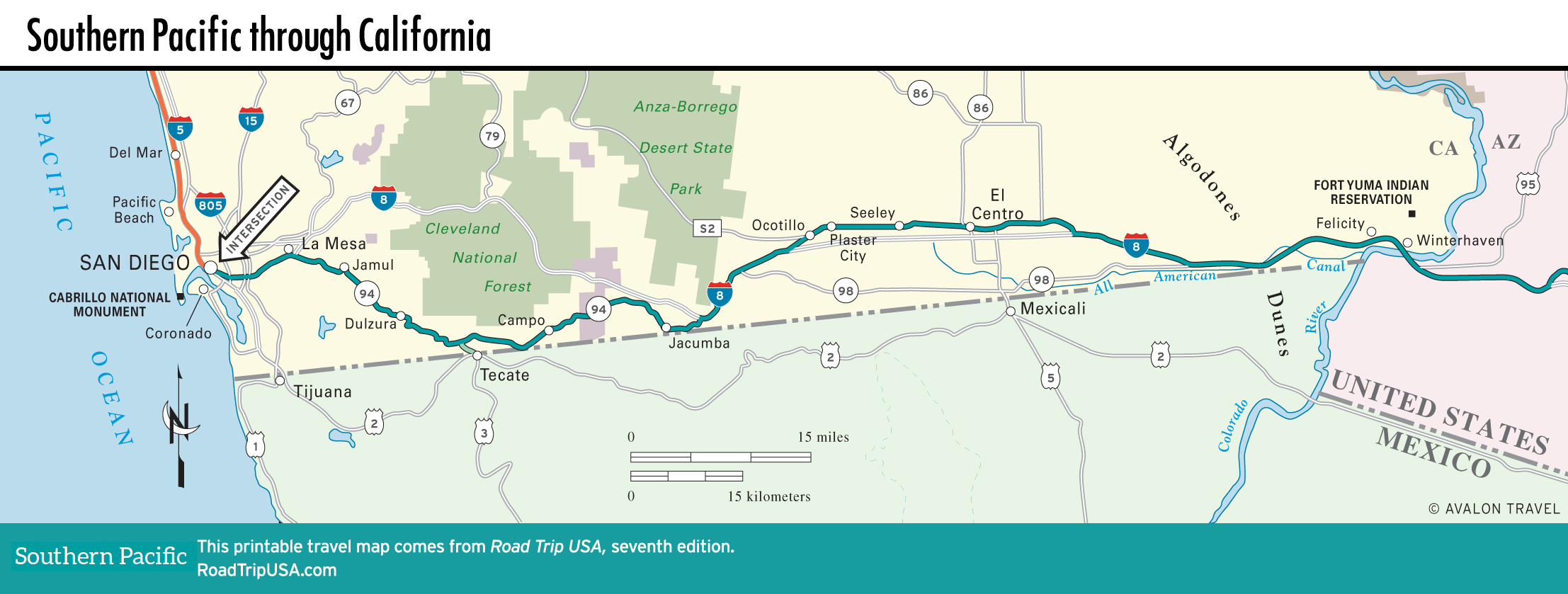
From the Pacific bays and golden beaches of San Diego, you can choose between two routes as you head east across Southern California: the high-speed I-8 freeway up and over pine-forested mountains, or a winding drive along the Mexican border.
We’ve covered the slower, more southerly route that follows the remnants of old US-80 through sleepy border towns and past a pair of unique roadside attractions—the funky old Desert View Tower and the oddly endearing “Official Center of the World” at tiny Felicity. Also included is a quick side trip south of the border to beer-making Tecate. But no matter which way you choose, eventually you’ll have to cross many monotonous miles of the Mojave Desert, a barren, dry, and inhospitable land.
Map of the Southern Pacific Route though California
Related Travel Guides