Texas
Driving Route 66 through Texas
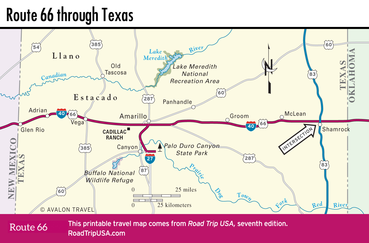
Known as the Panhandle because of the way it juts north from the rest of Texas, this part of our Route 66 drive is a nearly 200-mi (320-km) stretch of pancake-flat plains. Almost devoid of trees or other features, the western half, stretching into New Mexico, is also known as the Llano Estacado or “Staked Plains,” possibly because early travelers marked their route by driving stakes into the earth. The Texas Panhandle was the southern extent of the buffalo-rich grasslands of the Great Plains, populated by roving bands of Kiowa and Comanche people as recently as 100 years ago. Now oil and gas production, as well as trucking and Route 66 tourism, have joined ranching as the region’s economic basis.
Even more than in New Mexico or Oklahoma, old Route 66 has been replaced by I-40 most of the way across Texas, though in many of the ghostly towns, like Shamrock, McLean, or Vega, and the sole city, Amarillo, old US-66 survives as the main business strip, lined by the empty remains of roadside businesses. A select few are still open for a cup of coffee and a sharp taste of the living past. Originally spanning 178 miles (290 km) through Texas, today’s Route 66 is about 150 miles (24 km) that are actually drivable.
Top Route 66 Attractions in Texas
- Tower Station and U-Drop Inn Café in Shamrock: This former Conoco station is a must-see landmark, both architecturally and historically.
- Devil’s Rope Museum and Old Route 66 Museum in McLean: This museum entirely dedicated to barbed wire has more than 450 types on display.
- Palo Duro Canyon State Park in Canyon: This second-largest canyon in the United States is known as the “Grand Canyon of Texas”.
- Cadillac Ranch in Amarillo: This surreal public art installation consists of 10 vintage Cadillacs buried upright in a wheat field.
Related Travel Guides


Travel Map of Texas