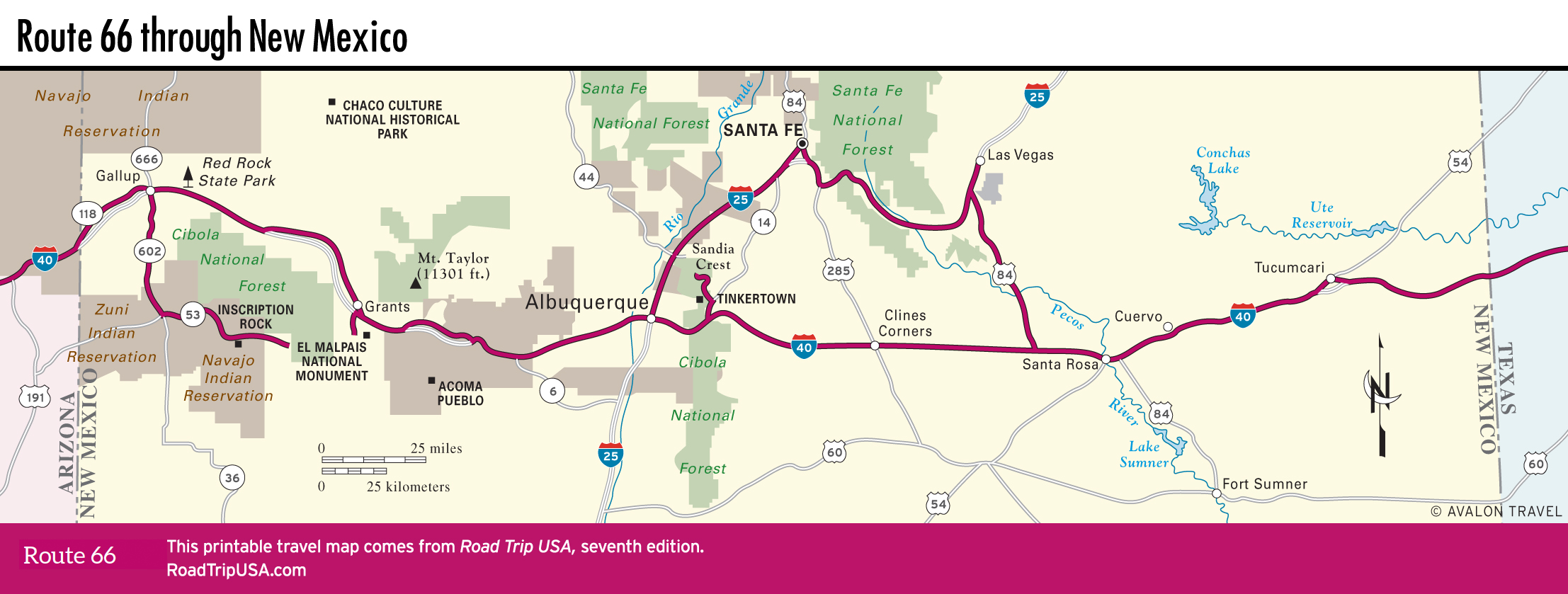
Clovis and Santa Rosa
Clovis
South of Tucumcari, at the edge of the desolate Llano Estacado that stretches south and east across the Texas Panhandle, the city of Clovis is a large railroad and ranching town that has two unique claims to fame. It is the site where some of the oldest archaeological remains ever found in North America were unearthed: In the 1930s, archaeologists dug up bones and arrowheads that proved human habitation dating back as early as 11,000 BC. Some of these artifacts, belonging to what archaeologists have dubbed “Clovis Man,” are on display at the Blackwater Draw Museum (575/562-2202, Tues.-Sun., $3), on US-70 about 20 mi (32 km) south of Clovis.
Clovis also played a part in early rock ’n’ roll: Buddy Holly came here from Lubbock, across the Texas border, in the late 1950s to record “Peggy Sue,” “That’ll Be The Day,” and other early classics. You can tour the restored Norman Petty Recording Studios (1313 W. 7th St., 575/356-6422), open only by appointment). Buddy’s contributions to Western culture are also well documented in his hometown of Lubbock, which is described on p. 815.
Santa Rosa
The I-40 freeway has bisected the town of Santa Rosa (pop. 2,680) and cut its old Route 66 frontage in two, but for more than 65 years, travelers crossing New Mexico along made a point of stopping here for a meal at Club Café, “The Original Route 66 Restaurant Since 1935,” thanks to signs lining the road, emblazoned with the smiling face of the “Fat Man.” The Club Café closed in 1992; the signs are now gone.
Just off the freeway, east of downtown on Route Just off the freeway, east of downtown on Route 66 and marked by a hard-to miss bright-yellow hot rod perched atop a 30-ft (9-m) pole, the Route 66 Auto Museum (2836 Historic Route 66, 575/472-1966, $5) has a wide-ranging exhibit on “anything to do with wheels,” highlighted by some tricked-out old Fords and Chevys.
Santa Rosa’s other main attraction is unique: the Blue Hole, an 80-ft-wide (24-m), 80-ft-deep (24-m) artesian well filled with water so crystal-clear that it draws scuba divers from all over the Western states to practice their underwater techniques here. The water of the Blue Hole, at around 62°F (17°C), is too cold for casual swimming, but in the summer heat it’s a great place to cool your heels. The Blue Hole is well signed at the end of Blue Hole Road, a half-mile (0.8 km) south of old Route 66; for purists, Blue Hole Road is old, old Route 66, since it formed the early (pre-1937) alignment of the Mother Road across Santa Rosa, the rest of which is used as a runway at the city’s airport (no cars allowed!). East of here, running along the south side of I-40, one of the oldest stretches of Route 66 is only partly paved and best done in a 4WD or on a mountain bike. Here you get an indelible sense of what travel was like in the early days, when less than half of the route’s 2,400 miles (4,023 km) were paved.
Travel Map of New Mexico
Related Travel Guides