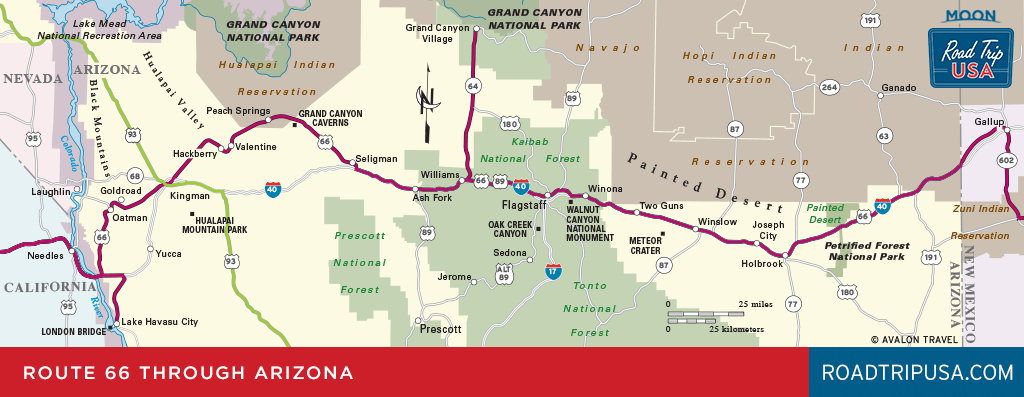
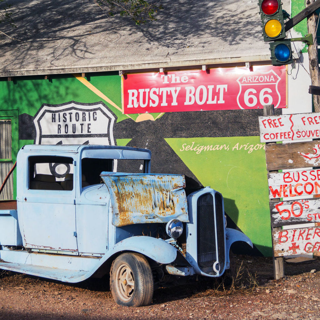
Seligman
From I-40 exit 139, just west of Ash Fork, a nice section of the old Route 66 two-lane runs along the railroad tracks just north of, and parallel to, the I-40 freeway all the way to the sleepy little town of Seligman. One of best places to stop and get a feel for the spirit of old Route 66, Seligman (pop. 445; pronounced “suh-LIGmuhn”) is a perfect place to take a break before or after rejoining the interstate hordes. The town retains a lot of its historic character—old sidewalk awnings and even a few hitching rails—and offers lots of reasons to stop. Coming into Seligman on this stretch of Route 66, you’ll be greeted by The Rusty Bolt (22345 Old Route 66, 928/422-0106), a fantastic junk shop and oddball emporium that’s impossible to miss along the north side of the old highway.
Another good place to eat is the kitschy Roadkill Café (502 W. Route 66, 928/422-3554) near the OK Saloon and Rusty Bolt junk shop. Find German-American barbecue at Westside Lilo’s (22855 W. Route 66, 928/422-5456); good coffee served behind the bright-green façade of Seligman Sundries, a half-mile (0.8 km) farther west; and the cold beer typically downed by cowboys and truckers across the road at the Black Cat Bar.
For an overnight, choose from a half-dozen motels like the nice, clean, and friendly Historic Route 66 Motel (22750 W. Route 66, 928/422-3204, $80 and up).
The longest and probably the most evocative stretch of old Route 66 runs between Seligman and Kingman through the high-desert Hualapai Indian Reservation (pronounced “WALL-ah-pie”), along the Santa Fe Railroad tracks through all-but-abandoned towns bypassed by the “modern” interstate world. Save the stretch between here and Needles for daytime, as it’s one of the most memorable of the Mother Road’s whole cross-country haul.
Related Travel Guides


Travel Maps of Arizona