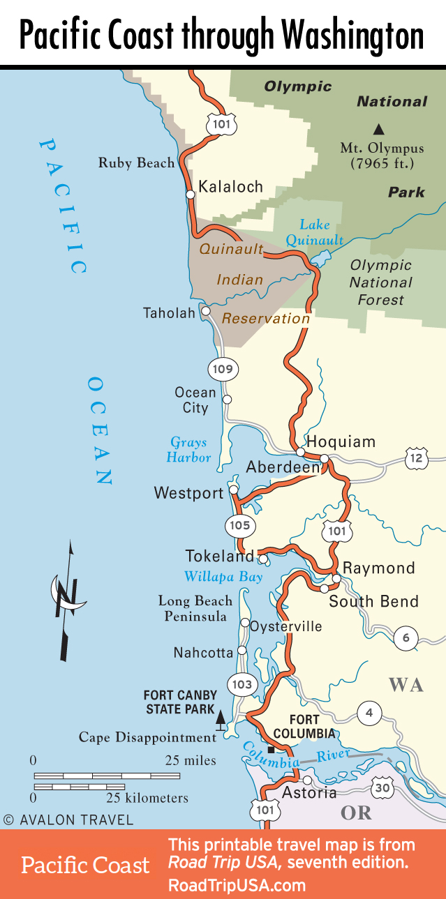
Cape Disappointment
The high headland marking the place where the Columbia River finally merges into the Pacific Ocean, Cape Disappointment was named by the early explorer Captain John Meares, who in 1788 incorrectly interpreted the treacherous sandbars offshore to mean that, despite reports to the contrary, there was neither a major river nor any mythical Northwest Passage here.
Besides the grand view of the raging ocean, the best reason to visit the cape is to tour the small but worthwhile Lewis and Clark Interpretive Center (360/642-3029, daily Apr.-Oct., Wed.-Sun. Nov.-Mar., $5), incongruously built atop a World War II-era artillery emplacement a short walk from the end of the road. On November 7, 1805, after five months and more than 4,000 miles, the explorers finally laid eyes on the Pacific from this point, and then they sat through nine days of continuous rain before fleeing south to Oregon. Displays inside the museum give the overall context for their journey of discovery, walking you through the different stages of their two-year round-trip. A half-mile walk from the interpretive center, the small “Cape D” lighthouse stands atop a cliff high above the Pacific Ocean. The more photogenic 1898 North Head Lighthouse is on the ocean side of the peninsula a mile north of the museum.
The entire 1,882-acre area around the cape, including miles of beaches backed by rugged cliffs, is protected from development within Cape Disappointment State Park (360/642-3078), which has hiking, camping, and overnight lodgings in historic quarters next to North Head Lighthouse.
The seven-mile Lewis and Clark Discovery Trail heads north to the town of Long Beach and a series of thought-provoking installations by architect Maya Lin (creator of the Washington, DC, Vietnam Veterans Memorial). Called the Confluence Project, and located along the riverfront east as far as Columbia Gorge, these works all deal with the coming together of the natural and artificial worlds, as well as the interaction of explorers and Native Americans. The installations range from driftwood columns, boardwalks, and interpretive trails (lined in places by quotations from Lewis and Clark’s diaries) to a sculptural basalt fish-cleaning table.
The nearest services to Cape Disappointment are two miles away, back on US-101 in the rough-and-tumble fishing port of Ilwaco. Southeast of Ilwaco, toward the Oregon border, US-101 winds along the north bank of the Columbia River, giving good views of the mighty river’s five-mile-wide mouth.
Maps of the Pacific Coast through Washington
Related Travel Guides