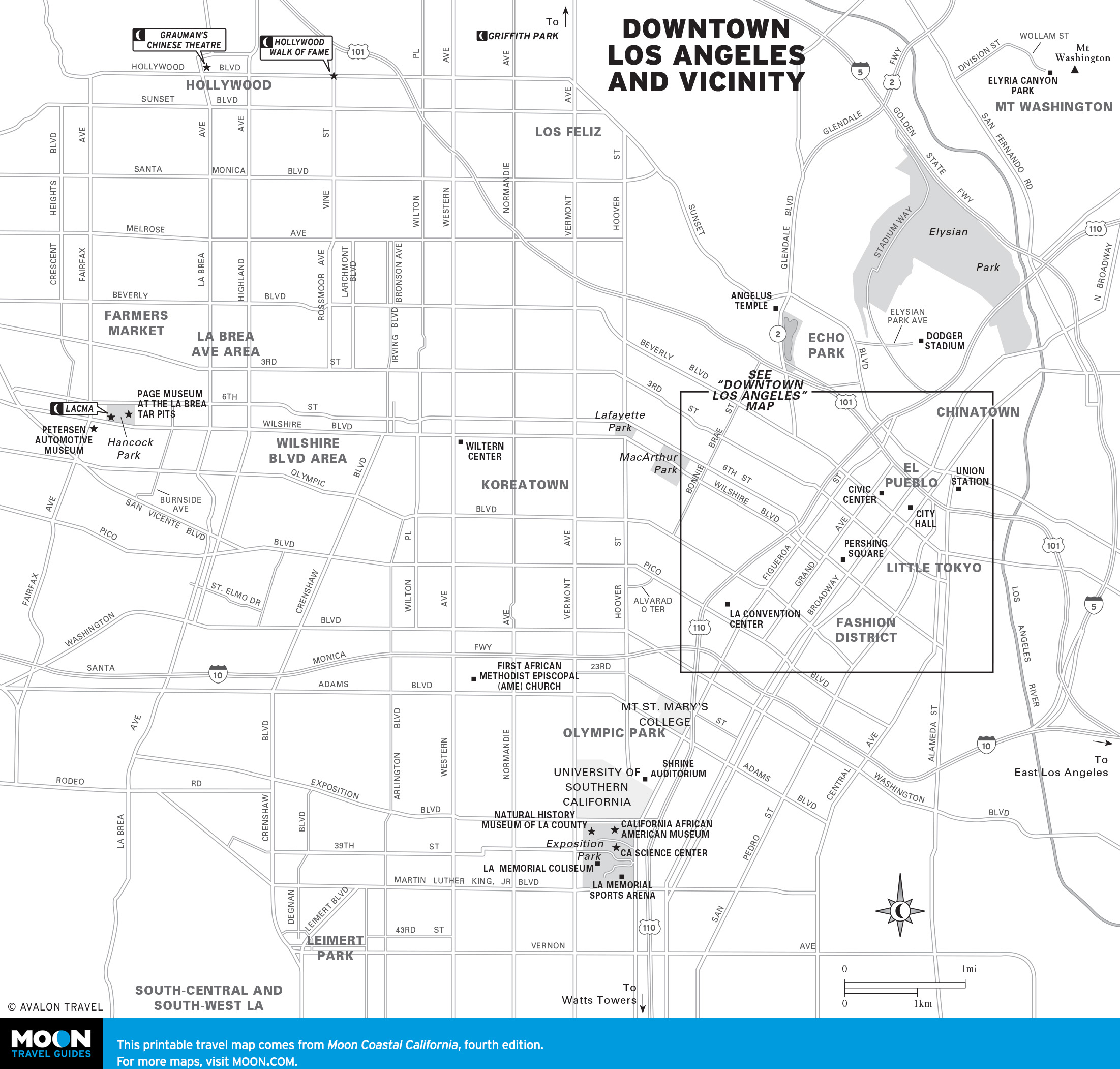
Los Angeles
Crossing Los Angeles
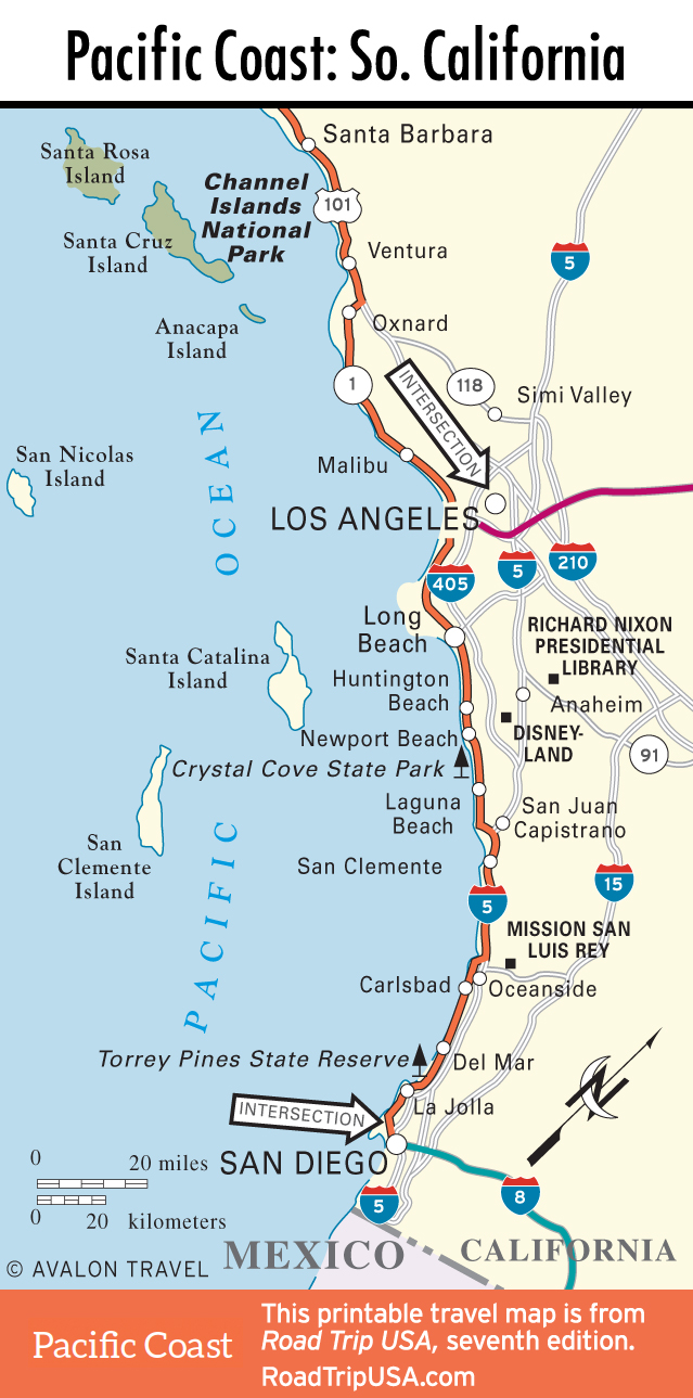
From Malibu and Topanga Canyon, Hwy-1 swoops along the shore, running along the beach as far as the landmark Santa Monica Pier before bending inland through a tunnel and metamorphosing quite unexpectedly into the I-10, the Santa Monica Freeway. The second exit off this freeway (which has been officially dubbed the Christopher Columbus Transcontinental Highway, running all the way east to Jacksonville, Florida) takes you to Lincoln Boulevard, which carries the Hwy-1 moniker south through Venice and Marina del Rey to Los Angeles International Airport (LAX), where it runs into Sepulveda Boulevard.
After passing through a tunnel under the airport runways—worth the drive just for the experience of seeing 747s taxiing over your head—Sepulveda emerges in the Tarantino-esque communities of LA’s South Bay, which utterly lack the glamour of chichi Santa Monica and Malibu. At Hermosa Beach, one of a trio of pleasant if surprisingly blue-collar beach towns, Sepulveda Boulevard changes its name to Pacific Coast Highway, then bends inland to bypass the ritzy communities of the Palos Verdes Peninsula, passing instead through the industrial precincts of San Pedro that border the Los Angeles-Long Beach harbor, one of the busiest on the West Coast.
Exploring Los Angeles
Love it or hate it, one thing you can’t do about LA is ignore it. Thanks to Hollywood in all its many guises (movies, television, the music industry), the city is always in the headlines. Without falling too deeply under the spell of its hyperbole-fueled image-making machinery, it’s safe to say that LA definitely has something for everyone. In keeping with its car-centered culture, however, our suggested tour ignores the many individual attractions and focuses instead on a pair of quintessential LA drives.
Winding along the crest of the Hollywood Hills, Mulholland Drive is the classic LA cruise. Starting in the east within sight of the Hollywood sign and the Hollywood Bowl, this ribbon of two-lane blacktop passes by the city’s most valuable real estate, giving great views on both sides, both by day and after dark.
Another classic LA cruise, running from the scruffy fringes of downtown all the way west to the coast, Sunset Boulevard gives glimpses into almost every conceivable aspect of Los Angeles life. Starting downtown, the historic core of colonial Los Angeles and now a showcase of contemporary architecture thanks to a stunning new cathedral and concert hall, Sunset Boulevard’s 27-mile course then winds west past Echo Park and Hollywood to West Hollywood, where it becomes the Sunset Strip, still the liveliest nightclub district in town. Continuing west, Sunset winds through Beverly Hills, Brentwood, and Bel Air, lined by the largest mansions you’re likely to see, before ending up at the edge of the Pacific Ocean.
The Los Angeles Dodgers (866/363-4377) play at beautiful Dodger Stadium, on a hill above downtown.
Practicalities
Most flights into Los Angeles arrive at Los Angeles International Airport (LAX), on the coast southwest of downtown, where you’ll find all the usual shuttles and rental car agencies. Other useful LA-area airports include Hollywood Burbank (BUR) in Burbank and John Wayne (SNA) in Orange County.
Before choosing a place to stay, think about where you want to spend your time and settle near there. High-end places abound, but character can be hard to come by. Along the coast, recommended accommodations range from the handy HI-Santa Monica (1436 2nd St., 310/393-9913, starts at $35 per person), a block from the beach, to the unique Queen Mary (877/342-0738, $139 and up) in Long Beach, a hotel offering authentic art deco-era staterooms in the fabulous old luxury liner. Midrange, with a great mid-city location, try the Farmer’s Daughter Hotel (115 S. Fairfax Ave., 323/937-3930, $239 and up), next to the historic Farmers Market, a friendly 1950s-style motel with tons of charm and the city’s hottest new shopping mall and entertainment complex, The Grove, across the street. Downtown, the most fabulous place to stay is the retro-1960s The Standard Downtown LA (550 S. Flower St., 213/892-8080, $225 and up), with the world’s coolest rooftop poolside bar.
For food, one place I always try to stop is The Apple Pan (10801 W. Pico Blvd., 310/475-3585, Tues.-Sun.), an ancient (circa-1947) landmark on the West LA landscape, serving the best hamburgers on the planet—though I’ll admit to being biased, since I grew up eating them. Take a seat at the counter, and be sure to save room for a slice of the wonderful fruit pies. Late at night, the huge sandwiches and heart-warming soups at Canter’s Deli (419 N. Fairfax Ave., 323/651-2030, daily 24 hours) draw all kinds of night owls to a lively New York-style deli in the heart of the predominantly Jewish Fairfax District. Downtown, between Chinatown, historic Olvera Street, and the landmark Union Station, Philippe The Original (1001 N. Alameda St., 213/628-3781) serves famous French dip sandwiches in a classic workers’ cafeteria, offering good food at impossibly low prices, with character to spare.
The usual array of information about hotels, restaurants, tickets to TV show tapings, and all other LA-area attractions is available through the Los Angeles Tourism and Convention Board (6801 Hollywood Blvd., 323/467-6412 or 800/228-2452).
Los Angeles Travel Map
Southern California Travel Map
Related Travel Guides