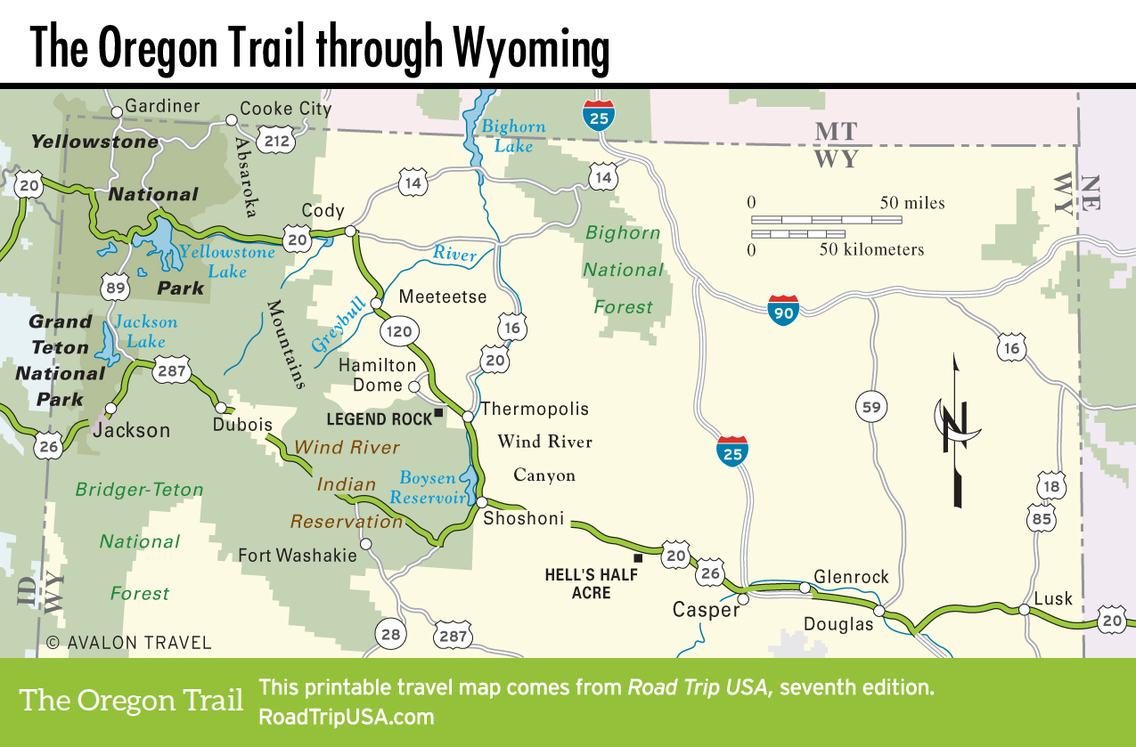
Wind River Canyon
South of Thermopolis, US-20 winds through Wind River Canyon, one of the most memorable drives in a state of memorable drives. The 2,500-ft-deep (762-m) canyon, with the highway on one side of the broad river and the railroad on the other, reveals millions of years of sedimentary rock. As you drive along heading south, you reach deeper and deeper into the earth; each layer is labeled with signs explaining its geological age and significance, with the oldest layers dating back some 3 billion years ago, during the Precambrian era.
Due in part to the visual effect of the uplifted sedimentary layers, the river at times gives the illusion of flowing uphill; this may explain why the local indigenous people and early explorers thought there were two distinct rivers and called the canyon itself the “Wedding of the Waters.” The river still has two distinct names: Upstream from Wind River Canyon, it is called the Wind River; downstream from the canyon, it’s called the Bighorn River.
At the south end of the Wind River, Boysen State Park, a popular place for fishing and waterskiing, backs up behind Boysen Dam, which was built from 1947 to 1952. The land west of the reservoir forms the 2.2-million-ac (890,300-ha) Wind River Indian Reservation, home to descendants of the Eastern Shoshone and Northern Arapahoe peoples. A woman thought by some to be Sacagawea (the Shoshone guide of Lewis and Clark fame) is buried on the reservation, along the Wind River near Fort Washakie.
Related Travel Guides