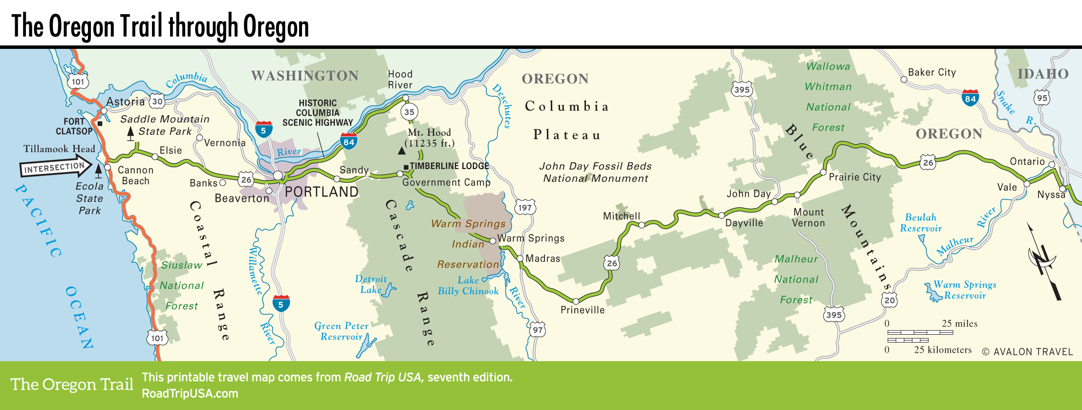
Timberline Lodge and Warm Springs
Timberline Lodge
East of Government Camp, near the junction of US-26 and Hwy-35, which comes from Hood River and the Columbia Gorge, be sure to turn off north toward Mt. Hood to visit Timberline Lodge (503/272-3311 or 800/547-1406, $175 and up), an elegantly rustic national landmark dedicated in 1937 by the Depression-era artisans of the Works Progress Administration. The actual hotel seen (from the outside, not the inside) in Stanley Kubrick’s creepy 1980 film, The Shining, Timberline Lodge is an unforgettable place, with a humongous fireplace in the three-story main lobby, a cool pool, plus grand dining rooms and cozy guest rooms decorated in characterful Pacific Northwest motifs, not to mention an unbeatable setting high atop the Cascade Mountains. Even if you don’t stay, check out the Cascade Dining Room’s award-winning cuisine, the more-casual pizza and sandwiches at the Blue Ox Bar, and the Ram’s Head Bar & Restaurant, which has locally brewed beers and ales.
Warm Springs Indian Reservation
East of the Cascades crest, US-26 becomes the Warm Springs Highway as it angles down out of the mountains across the sage and juniper country of eastern Oregon. Most of the land between here and Madras is part of the more than 640,000-acre (259,000 hectares) Warm Springs Indian Reservation, home to the Confederated Tribes of Warm Springs.
Back on US-26, the real attraction of the reservation is the modern 25,000-sq-ft (2,323-sq-m) Museum at Warm Springs (541/553-3331, Tues.-Sat., $7). Check out exhibits of more than 20,000 artifacts, replicas of a Paiute mat lodge and a Wasco plank house, recordings of Native American languages, and a push-button-activated Wasco wedding scene. A mile (1.6 km) east, at the edge of the reservation, US-26 bridges the deep canyon of the Deschutes River.
Related Travel Guides

Map of the Oregon Trail through Oregon