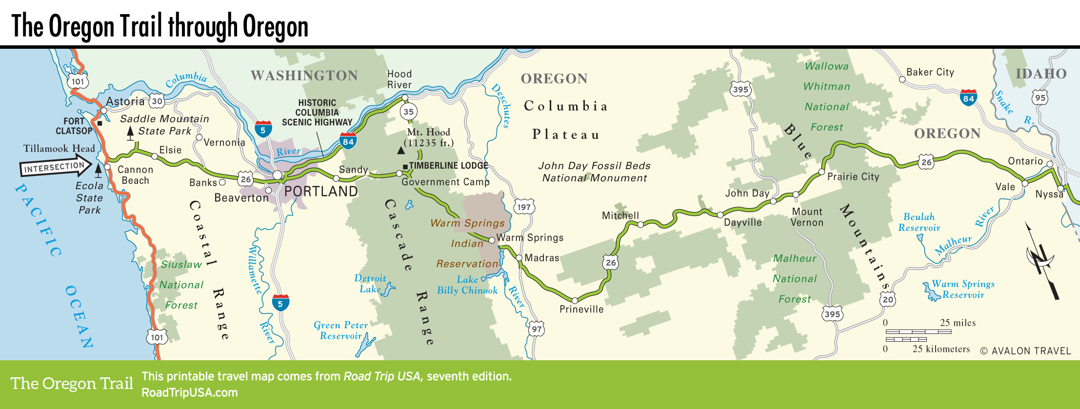
Vale to Nyssa
Vale
The seat of Malheur (“Bad Smell” or “Bad Luck,” depending upon who tells it) County, Vale (pop. 1,825) sits on the banks of the Malheur River at the junction of US-20 and US-26. The comparatively easy river crossing and the presence of a natural hot spring made it a prime stopping place on the Oregon Trail. Murals and markers around town explain something of the history and point out sights like the Malheur Crossing, next to the bridge on the eastern edge of the town, where pioneers dunked their aching bods in the still-hot Malheur River Springs; and Capt. Keeney Pass, just south of downtown Vale on Enterprise Avenue, where 150-year-old wagon ruts can still be seen along the roadside. There’s more to see inside the Rinehart Stone House Museum (255 Main St. S., 541/473-2070, 12:30pm-4pm Tues.-Sat. Mar.-Oct.), housed inside a frontier-era stagecoach stop and hotel.
Taking a breather at Vale is an honored tradition—it was here that pioneers rested before climbing out of the Snake River Valley into the Blue Mountains.
Ontario and Nyssa
Approaching the Idaho border, you have two choices: to follow I-84, heading east via Ontario (pop. 11,080), the largest of many midsize farming and ranching communities in the surrounding area; or to continue along the more atmospheric older roads. The official Oregon Trail Auto Route (US-20/26) bends to the south along the Snake River, passing one last Oregon town, Nyssa, before crossing into the Land of Famous Potatoes. Nyssa calls itself the “Thunderegg Capital of the World” because of the many geodes found there, but it’s primarily a shipping point for the tons of spuds, onions, and sugar beets grown nearby—the different crops are even labeled along the highway for your edification.
Related Travel Guides

Map of the Oregon Trail through Oregon