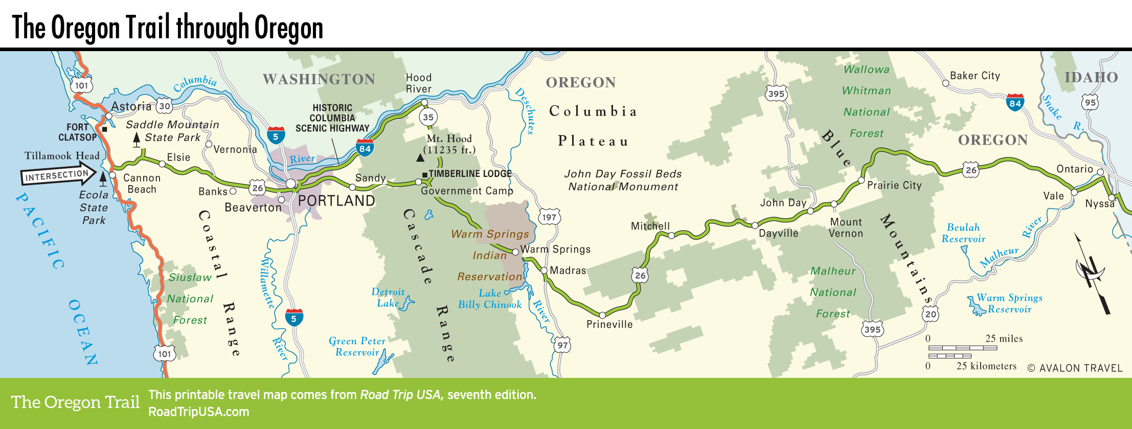
Prairie City
The first town east of John Day is tidy little Prairie City (pop. 878), an old-fashioned ranching community that is fast becoming a western false-front photo opportunity. For a taste of local life, stay at the 100-year-old Riverside School House Bed and Breakfast (28077 N. River Rd., 541/820-4731, $150), a white-clapboard two-room schoolhouse, in use until the 1960s and now rented out as a one-of-a-kind B&B, located on a working cattle ranch with delightful views over the headwaters of the John Day River.
Leaving the John Day River watershed, US-26 heads east, climbing over mile-high Dixie Pass (which is just one yard shy of being one mile high—5,277 ft/1,608 m above sea level) while rambling through the Malheur National Forest (541/575-3000) and the Wallowa-Whitman National Forest (541/523-6391), where campgrounds, cool mountain lakes, natural hot springs, and dense forests abound.
East of the crest, dropping down from the mountains across the Snake River plain, US-26 crosses another 75 mi (121 km) of rolling sagebrush, with little more than an occasional cattle ranch, or a golden eagle sitting atop a telephone pole, to attract your attention. Tiny little tavern-and-post-office towns like Unity, Ironside, Brogan, and Willow Creek will make you slow to 45 mph (72 km/h, or risk a ticket), while on a hot summer’s day the smell of juniper and sage is so potent it perfumes the dry desert air, unmistakable even if you cruise through at 70 mph (113 km/h) with the air-conditioning blasting.
Related Travel Guides

Map of the Oregon Trail through Oregon