Idaho Falls
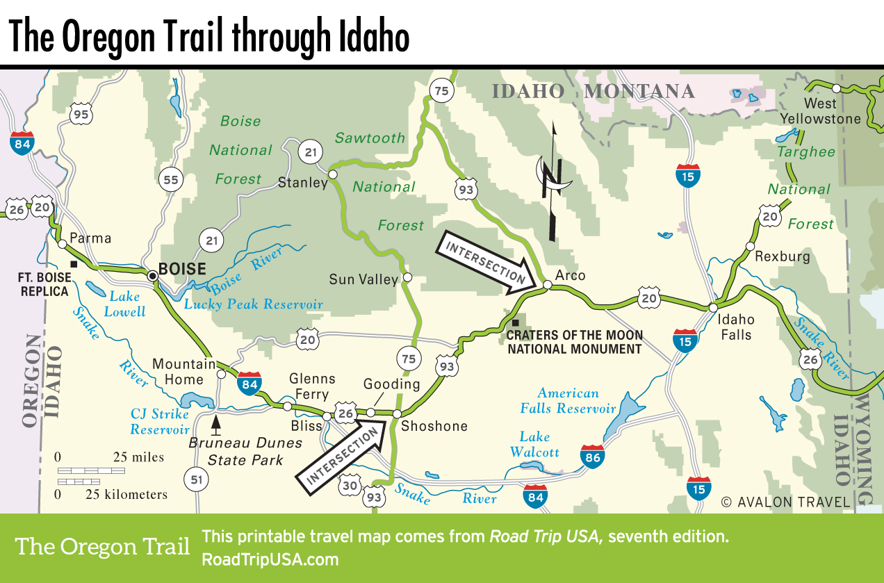
Taking its name from the wide but short waterfall completely tamed to form a pleasant green lake at the center of town, Idaho Falls (pop. 61,535), at the junction of US-20 and I-15, is a busy big city with an attractive Middle American downtown set along the banks of the Snake River. Grain elevators and stockyards stand along the railroad tracks, train whistles blow throughout the night, and all manner of neon signs line the highways, offering a concentrated dose of rural Americana. The town’s hotels, supermarkets, and restaurants make Idaho Falls a handy last stop before heading on to the diverse wilderness areas that rise to the north, east, and west. Apart from the chance to wander around a business district that’s hardly changed since 1956, you can stroll along the waterfront park, feeding the geese or just watching the waters tumble over the weirs.
Though it’s rich in small-town Americana, Idaho Falls also has a few pockets of big-city sophistication, no doubt thanks to the well-paid engineers employed at INEL west of town and the skiers bound for Grand Targhee in the mountains to the east. Cafés and bakeries crowd together around Park Avenue and A Street downtown, serving a wide enough range of pastries, coffees, and sandwiches to suit any palate. If you time it so you miss the crowds, the tiny but tasty The SnakeBite Restaurant (401 Park Ave., 208/525-2522, cash only) is excellent for everything from juicy steaks to chocolate cakes. West of downtown across the river, Smitty’s Pancake and Steak House (645 W. Broadway, 208/523-6450) has been serving “IDF’s Best Breakfast” for years, east of downtown along old US-20. For a place to stay, try Residence Inn (635 W. Broadway St., 208/542-0000, $100 and up), overlooking the falls.
Related Travel Guides