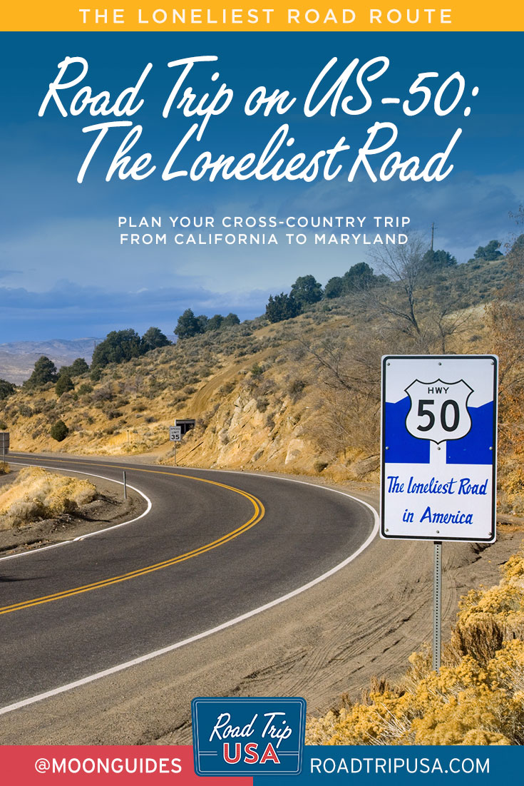
The Loneliest Road
Running coast-to-coast through the heart of America on an odyssey of more than 3,000 miles from sea to shining sea, US-50 passes through a dozen different states and four state capitals, as well as the nation’s capital, Washington DC. Along the route are some of the country’s most magnificent landscapes: the Sierra Nevada and the Appalachian and Rocky Mountains, the endless farmlands of the Great Plains, and the desiccated deserts of Utah and Nevada. It follows the footsteps of pioneers and gives a reverse timeline of national development. Heading west to east, you can travel back in history from the cutting-edge high tech of contemporary Silicon Valley, across the Wild West frontier of the mid-1800s, and through lands the likes of Daniel Boone and countless others pioneered in the 1700s, before arriving at the Atlantic Ocean near some of the oldest and best-preserved colonial-era landscapes in the United States.
All the way across the country, US-50 passes through literally hundreds of timeworn small towns, the great majority of which have survived despite the modern onslaught of Walmarts and fast-food franchises. Blue Highways author William Least Heat-Moon writes about US-50, “for the unhurried, this little-known highway is the best national road across the middle of the United States.” The route offers such a compelling cross-section of the nation that Time magazine once devoted an entire issue to telling the story of the road it called the “Backbone of America.”

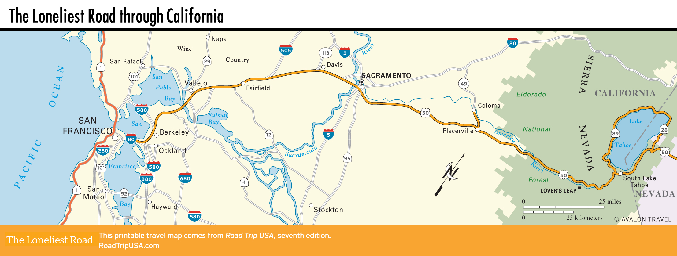
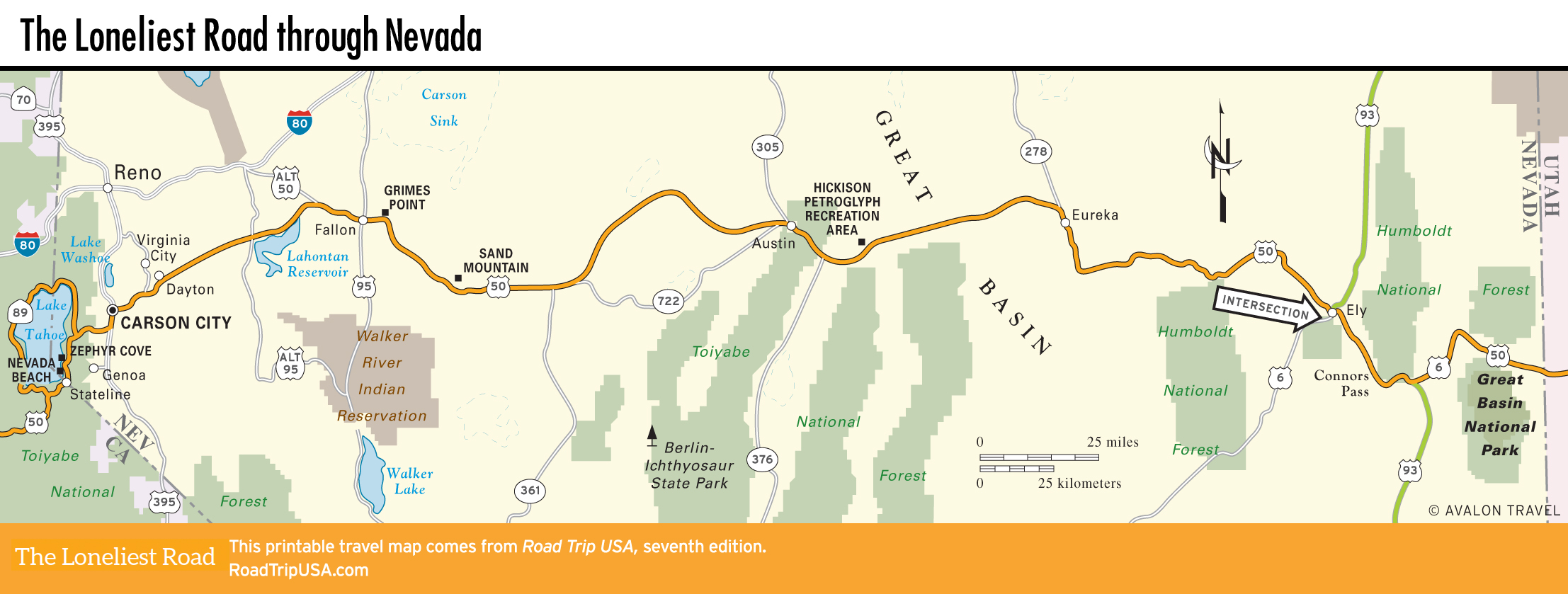
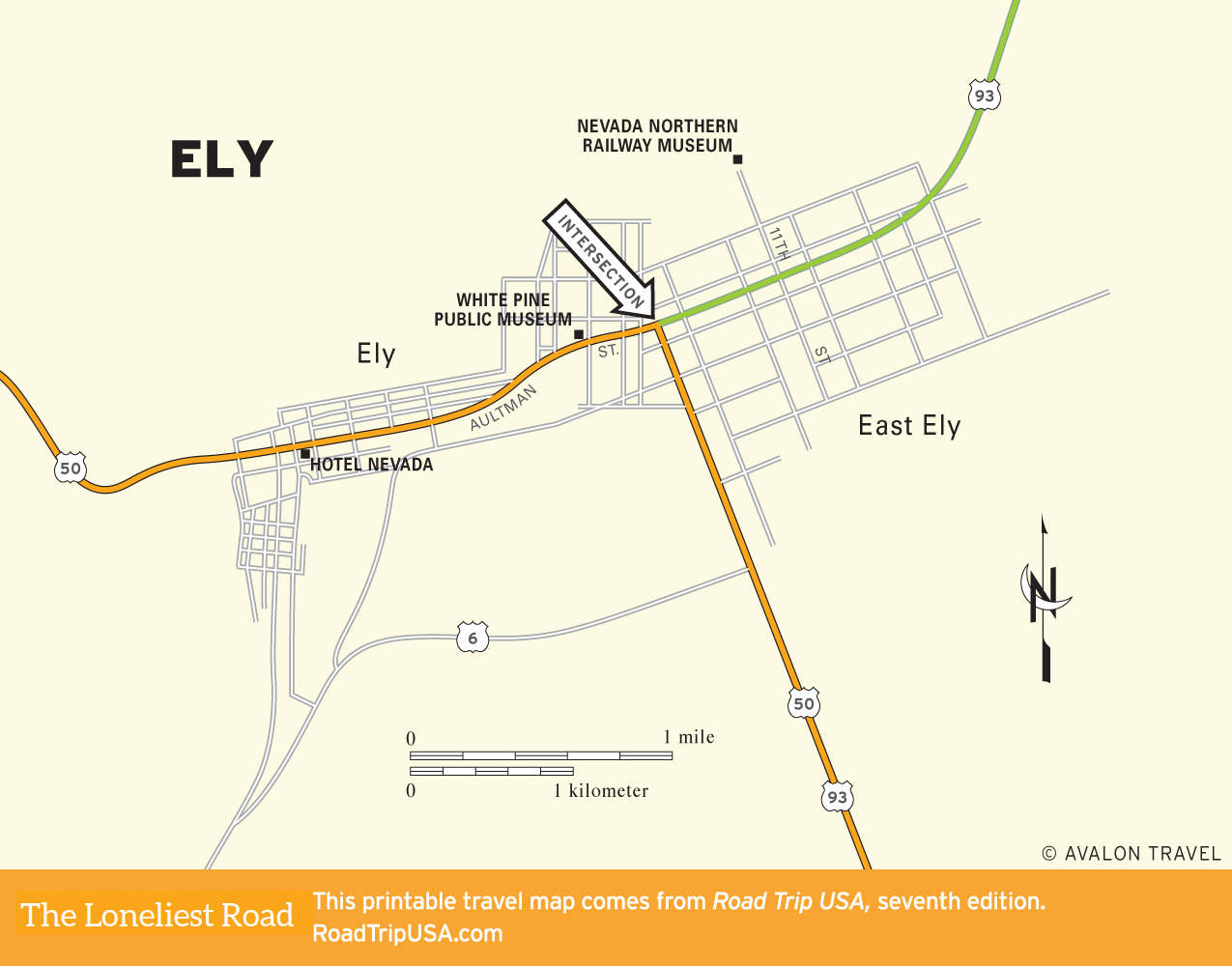
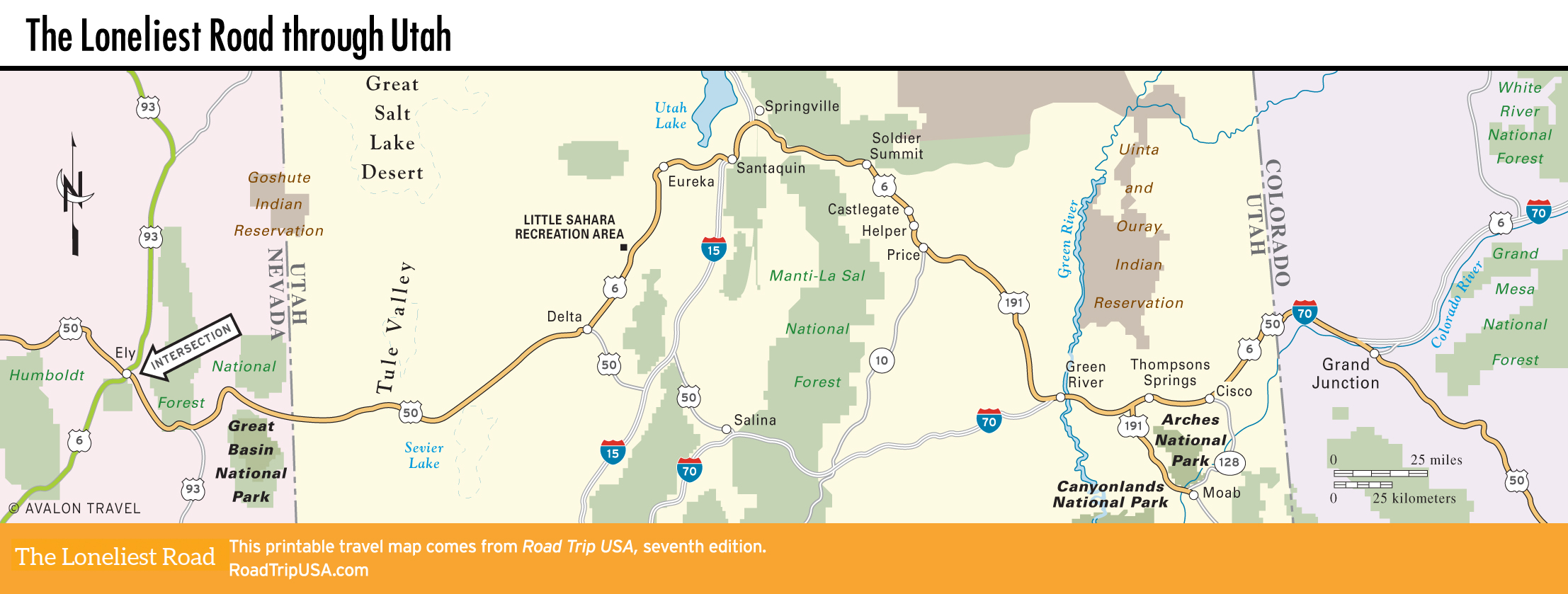
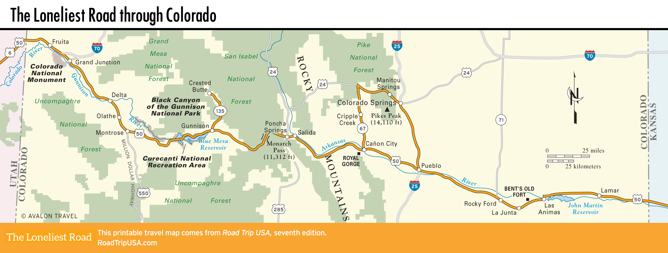
From its start at San Francisco, the route cuts across California’s midsection, passing the state capital of Sacramento before following the route of the old Pony Express up into the Sierra Nevada to the shores of Lake Tahoe and into Nevada. The Nevada portion of the route, dubbed “The Loneliest Road in America” by travel writers and tourist boards, is one of the most compelling long-distance drives in the country—provided you find miles and miles of little more than mountains, sagebrush, and blue sky compelling. The Great Basin desert continues across half of Utah, but then the route climbs over the Wasatch Front and onto the national park-packed red-rock country of the Colorado Plateau.
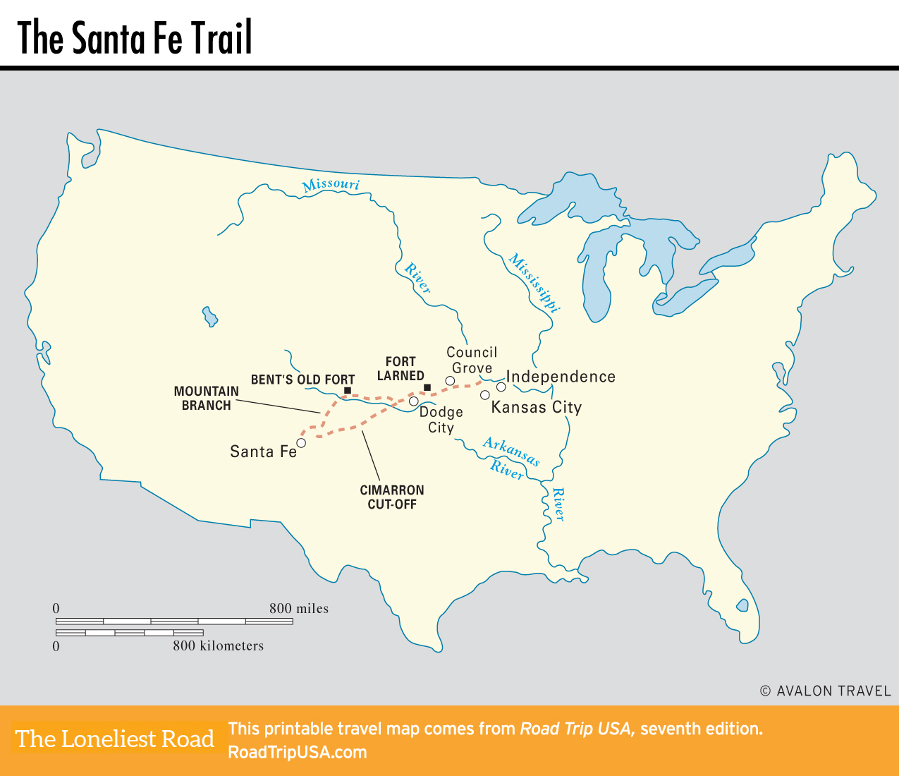
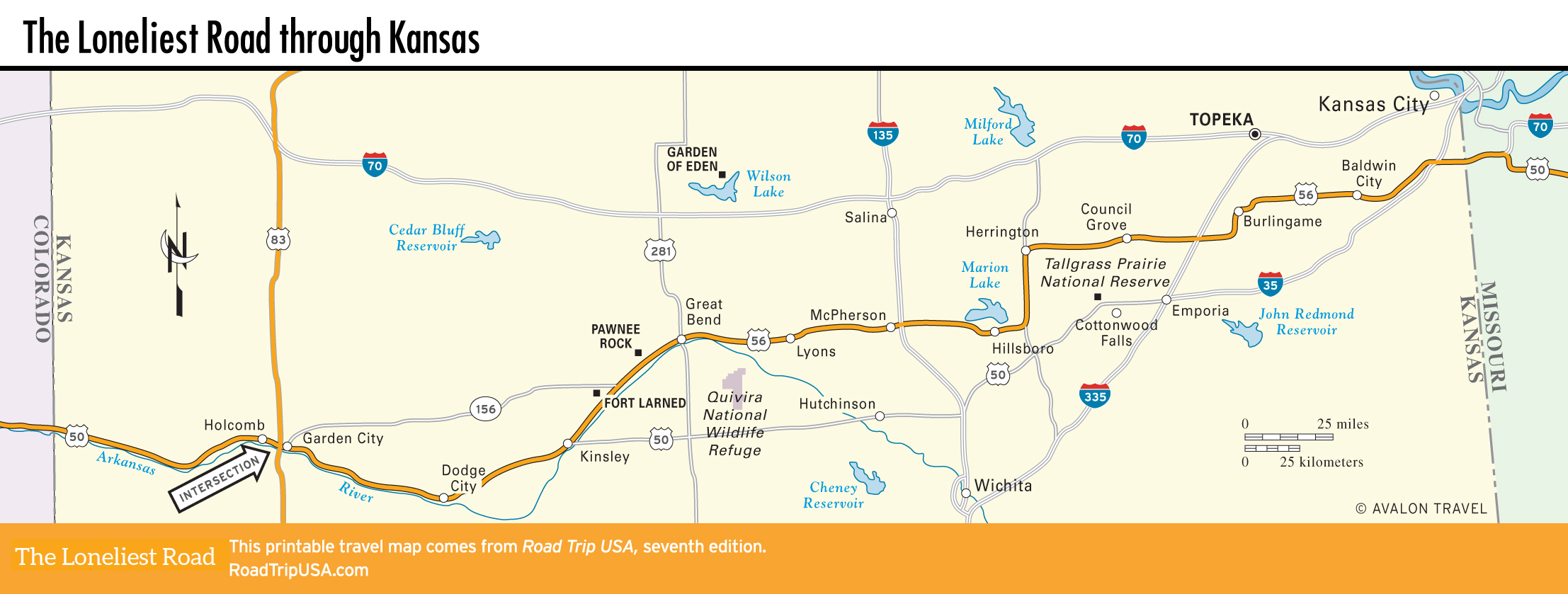
Continuing east, you cross the Continental Divide atop the Rockies, then follow the Arkansas River along the historic Santa Fe Trail. For fans of vanishing Americana, the route comes into its own here across the Great Plains, with its hypnotically repetitive landscape of water towers, windmills, railroad tracks, and one small town after another.
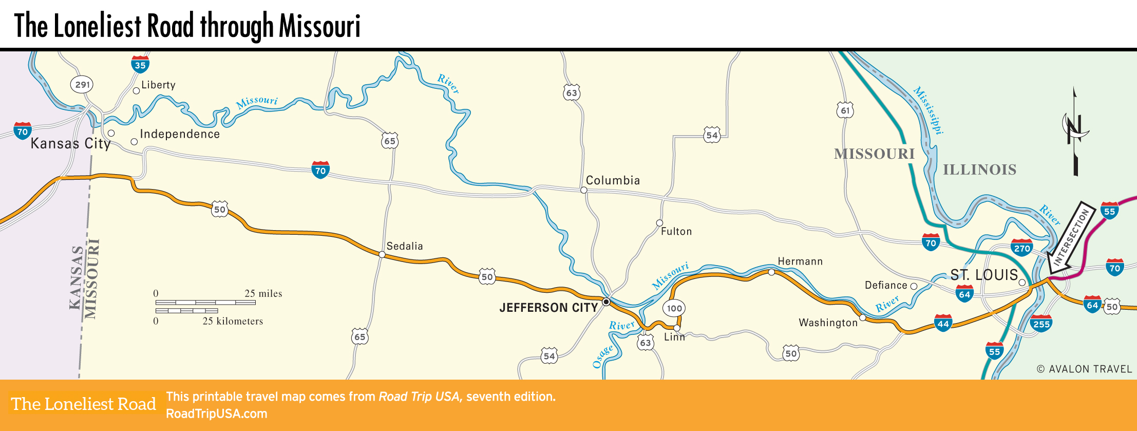
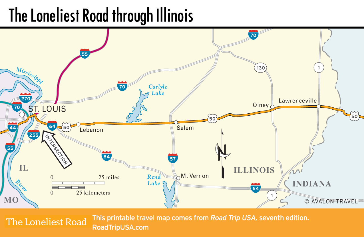
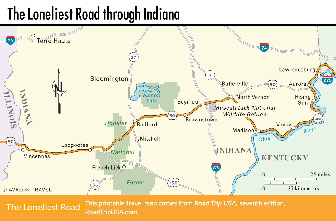
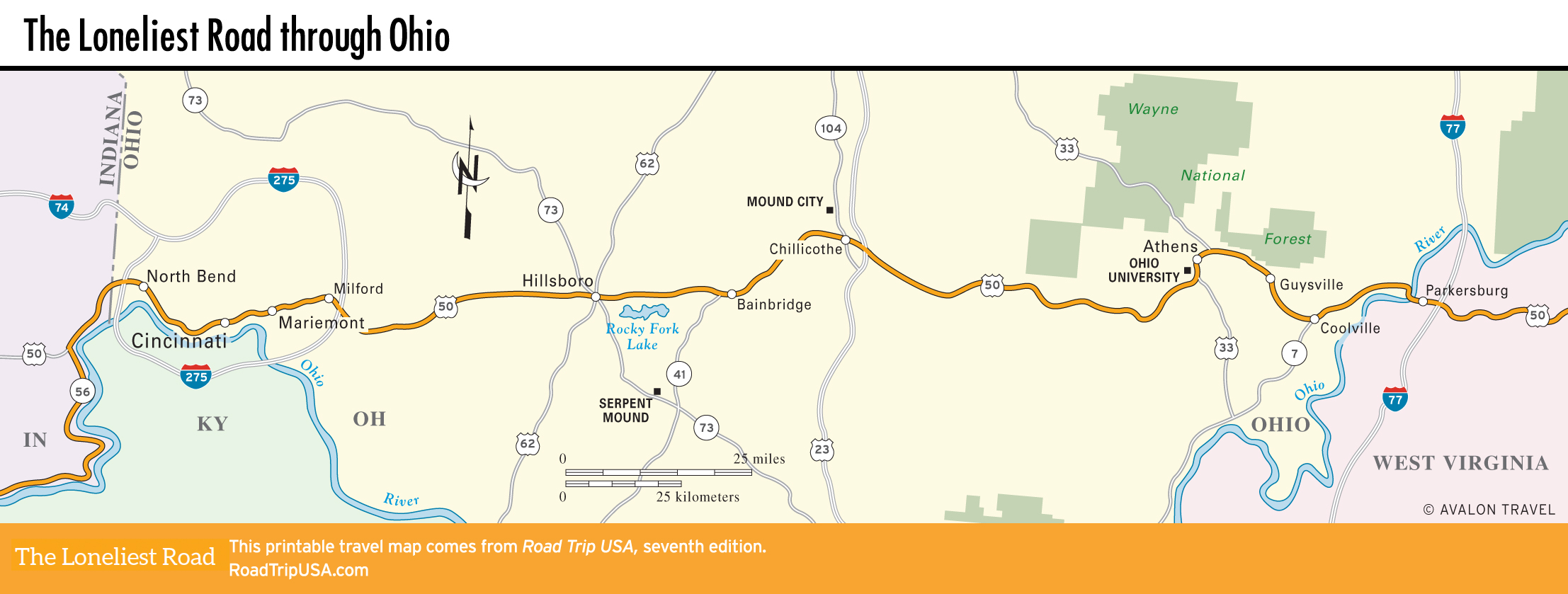
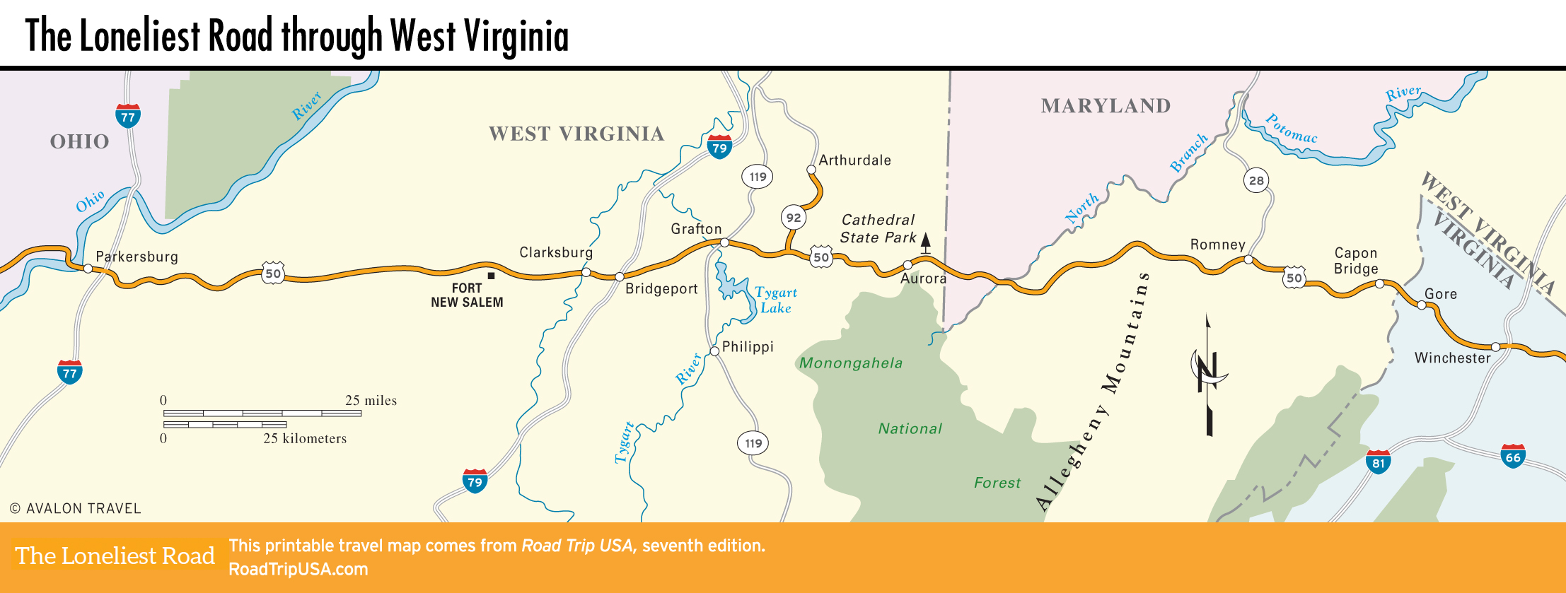
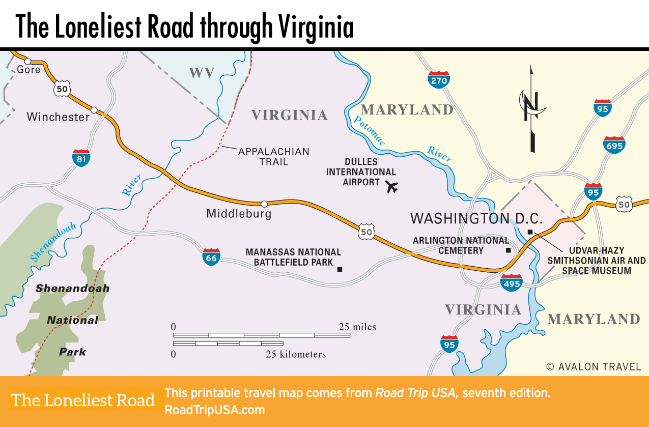
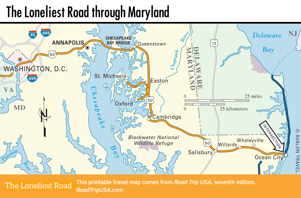
After bisecting Missouri from Kansas City to St. Louis, US-50 crosses the Mississippi River into a much older and more settled landscape, through the agricultural heartlands of Illinois, Indiana, and Ohio. After climbing into the Appalachian backwoods of West Virginia, US-50 emerges suddenly into the wealth and power of downtown Washington DC before passing through the still perfectly picturesque fishing and farming communities of Maryland’s Eastern Shore.
Notable Sights Along the Loneliest Road
- South Lake Tahoe, CA – Visit one of the biggest and deepest lakes in the country
- Carson City, NV – Named in honor of explorer Kit Carson, Nevada’s capital city is rich with Wild West history.
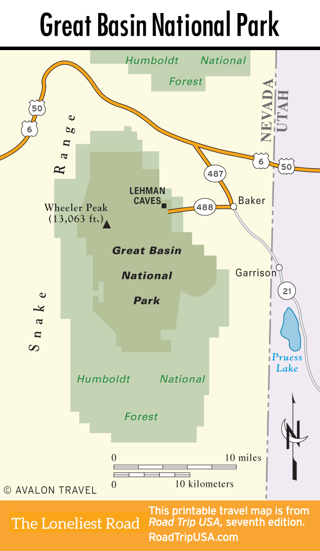
- Great Basin National Park, NV – Find solitude amid alpine forests, ancient bristlecone pines, wildflowers, and glacial lakes.
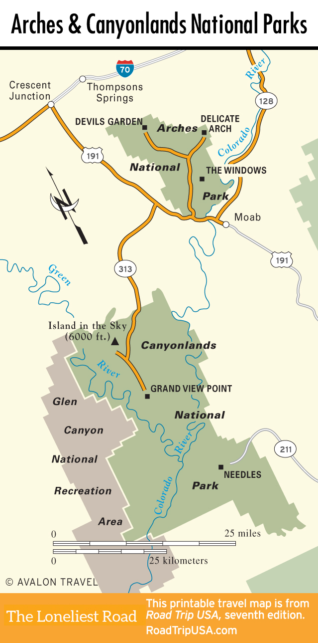
- Canyonlands & Arches National Parks, UT – Explore arid wilderness, high plateaus, deep canyons, and sandstone arches in these two must-visit parks.
- Million Dollar Highway, CO – Take a scenic drive along a classic stretch of two-lane blacktop that forms a swirling ribbon through the San Juan Mountains, the wildest and ruggedest peaks in the Colorado Rockies.
- Garden of Eden in Lucas, KS – Experience one of the country’s oldest and oddest folk-art environments, the sort of place that puts the Gothic back in American Gothic.
- Kansas City, MO – Museum lovers will have plenty of options to choose from in this history-infused city.
- Serpent Mound, OH – See two fascinating remnants of the Mound Builder people who once lived in this part of what is now Ohio.
- Manassas and Arlington, VA – Visit the site of the first major land battle of the Civil War and the final resting place of over 400,000 U.S. soldiers, sailors, and public servants.
- Washington D.C. – Walk through the monuments that embody nearly two centuries of American political history, then take your pick of museums showing off everything from ancient art to the first flying machines.
- Ocean City, MD – Enjoy a fun-filled day or long weekend with the best array of old-time funfair attractions in the Mid-Atlantic.
Related Travel Guides

The Loneliest Road Travel Maps
Pin it for Later