Michigan
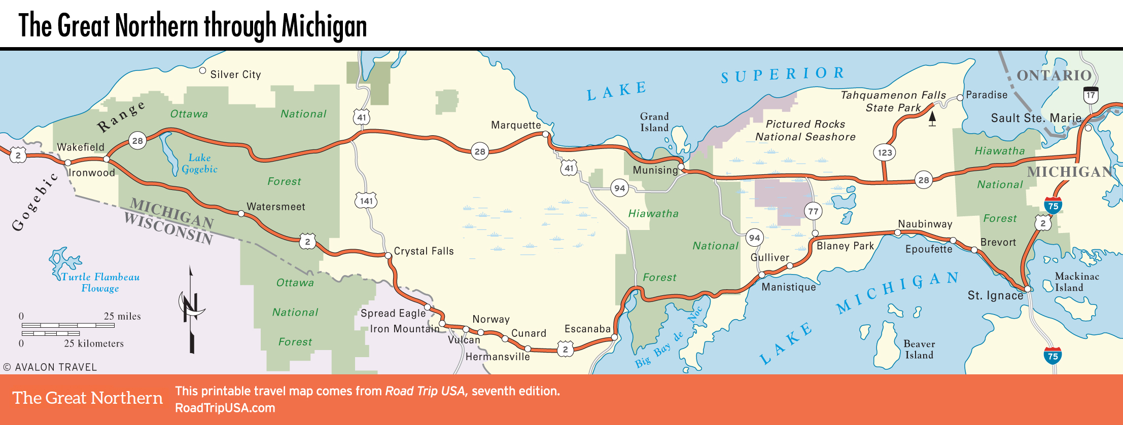
There are two main routes across Michigan’s Upper Peninsula (the “UP”), which stretches for nearly 350 mi (565 km) between Canada and Wisconsin, wedged between Lake Superior and Lake Michigan. Between Ironwood in the west and Sault Ste. Marie on the Canadian border in the east, you can choose US-2 along the north shore of Lake Michigan or the slightly more direct option, Hwy-28, which runs near the south shore of Lake Superior near Pictured Rocks National Lakeshore. Either way takes most of a day, and this is not a place to try to make up time.
In either case, you’re privy to one of the greater finds of the Midwest, the sparsely populated and thoroughly underappreciated (especially by the “trolls” of southern Michigan) land of the “Yoopers,” as the proud residents have christened themselves, many still ensconced in the logging and mining enclaves their forebears founded. The UP is a surprisingly mountainous and larger-than-it-looks place, dotted with boom-to-bust towns relying on summer tourism and one or more of the industrial triumvirate up here: timber, mining, and fishing. More than three quarters of the land here is protected to varying degrees within national and state parks and forests, and it’s no surprise that the best places tend to be farthest away from the main roads; though the roadside scenery is plenty pretty, the more remote areas are as wild and ruggedly beautiful as anywhere in North America.
Related Travel Guides