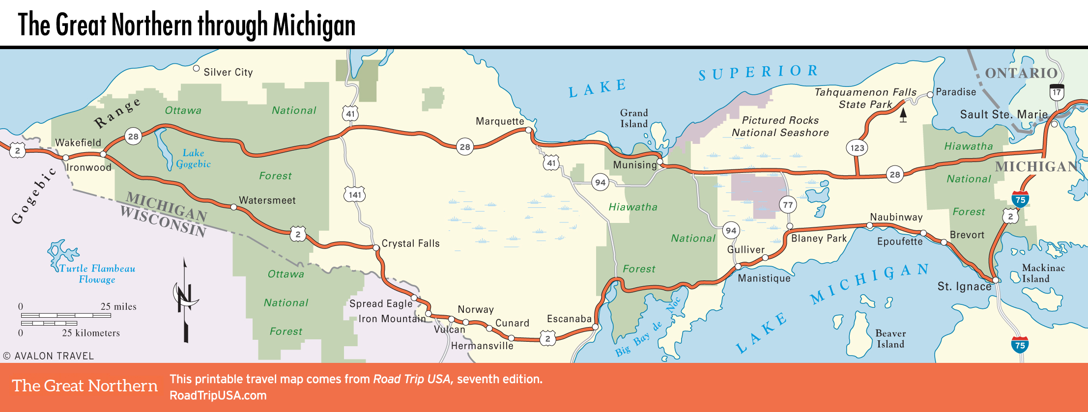
St. Ignace
Coming into St. Ignace (pop. 2,322; pronounced “IG-nus,” and sometimes “St. Iggy”) from the west along US-2, travelers are tempted by a number of “scenic overlooks,” each proffering a chance to stretch and view the often fog-shrouded Mackinac Bridge over blue Lake Michigan. Coming from the east, the approach is slightly diminished by the busy I-75 freeway, and from the south the buildup is truly unforgettable, riding high on the elegant Mackinac Bridge. No matter how you get here, picturesque St. Ignace is more important than its obviously tourism-contrived loveliness would indicate, situated as it is at the crossroads of the upper and lower regions of Michigan, with Mackinac Island just across the bay. The town is busy and cheerful, in places gentrified and meticulously maintained; downtown, you can stroll along a bright lake promenade lined with gift shops, motels, and restaurants.
Downtown, the city-run Museum of Ojibwa Culture (500 N. State St., 906/643-9161, daily May-Oct., donation) traces over three centuries of life along the Straits of Mackinac, detailing the lifeways of the indigenous Ojibwa and Huron peoples. The museum, on the site of Father Marquette’s original mission, also hosts a summer powwow and a heritage day. Attending one is an unforgettable way to experience the community’s heritage.
Sample yet more local culture by heading north from downtown along the lakeshore to Bessie’s Original Homemade Pasties (1106 N. State St., 906/643-8487), where you can sample the UP’s local delicacy, the Cornish pasty, brought over by immigrant miners from England over a century ago. Bessie’s closest rival is Famous Lehto’s Pasties (1983 W. US-2, 906/643-8542), west of the I-75 freeway, and between the two pasty stands is the blue mansard roof of an All-American classic: Clyde’s Drive In (3 W. US-2, 906/643-8303), serving up good burgers, onion rings, and milkshakes since 1949.
Related Travel Guides