Long Key State Park to the Lower Keys
Long Key State Park
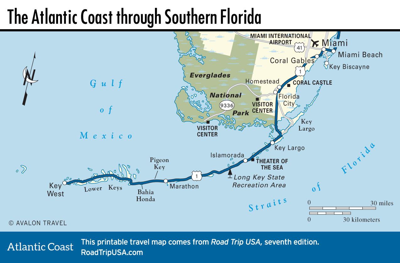
South of Islamorada, up and over the high “Channel 5” bridge, the roadside scene gets pretty again fast, especially at the Long Key State Park (MM 67.5), where boardwalks wind through coastal hammocks (dense stands of mahogany and dogwood trees that bunch together on the small humps of land that lie above the tide line). There’s a campground (305/664-4815, $43) in the park, with showers, and some nice but narrow beaches. Access may be affected by ongoing beach restoration.
Marathon and Pigeon Key
The second-longest of the many bridges that make up US-1, the elegant multiarched Long Key Bridge supports a long flat causeway where the road finally earns its other name, the Overseas Highway. Unobstructed views of the distant horizon are yours in all directions, with the narrow ribbon of highway seemingly suspended between the sky and the sea. Fortunately, turnouts at both ends of the causeway let you take in the vista without worrying about oncoming traffic.
The Long Key Bridge marks the northern end of Marathon, a sprawling community that’s the second largest in the keys, stretching between mile markers 60 and 47 over a series of islands. One of the visitor highlights of Marathon is on Grassy Key, where the Dolphin Research Center (MM 59, 305/289-0002, daily, $28 adults), a rescue and education facility for the study and care of marine mammals, is marked by a 30-ft-tall (9-m) statue of a dolphin mother and baby. You can swim with a dolphin for around $199.
Accessible by ferry from a visitors center in Marathon, Pigeon Key (MM 47, 305/743-5999, daily, $12 adults) is one of the least famous but perhaps most fascinating spots along the Overseas Highway. A national historic district, preserving substantial remnants of the clapboard construction camp that housed some 400 workers employed on the original Seven Mile Bridge from 1912 to 1935, Pigeon Key offers a glimpse of blue-collar keys history the likes of which you’ll find nowhere else.
Lower Keys: Bahia Honda
The old Seven Mile Bridge, which carried first the railroad and later US-1 over Pigeon Key between Marathon and Big Pine Key, was replaced in the early 1980s by a soaring new bridge that gives another batch of breathtaking ocean-to-gulf views. The old bridge, which was seen in the Arnold Schwarzenegger-Jamie Lee Curtis movie True Lies, still stands below the new one.
The west end of the Seven Mile Bridge, near mile marker 40, marks the start of the Lower Keys, which are considerably less commercial than the others. The best of the Lower Keys is yours to enjoy at mile marker 37, where the entrance to Bahia Honda State Park (305/872-2353) leaves the highway behind and brings you back to the way the keys used to be: covered in palms and coastal hardwood hammocks, with white-sand beaches stretching for miles along blue-water seas. Facilities include a few cabins (around $160), a general store, snorkel equipment and kayak rental, interpretive exhibits, hiking trails—and it’s a great place to spend some time fishing, beachcombing, sunbathing, or swimming in the deep warm waters of the Atlantic Ocean or Gulf of Mexico. Camping (around $36) is the best way to enjoy the sunset, sunrise, and everything in between.
From Bahia Honda, US-1 bends along to Big Pine Key, second largest of the keys and suffering from a bout of suburban mini-mall sprawl. Though it looks about as far from natural as can be, Big Pine Key happens to be part of the National Key Deer Refuge, set up to protect the increasingly rare key deer, the “world’s smallest deer” at around 3 ft (0.9 m) tall. Some 800-1000 key deer now live on the island.
The last big key before Key West is Sugarloaf Key, home to the wild Mangrove Mama’s (MM 20, 305/745-3030), a roadhouse tucked away west of the bridge. The seafood and key lime pie are as good as it gets, and there’s often live music in the evenings.
Related Travel Map
Recommended Florida Travel Guides