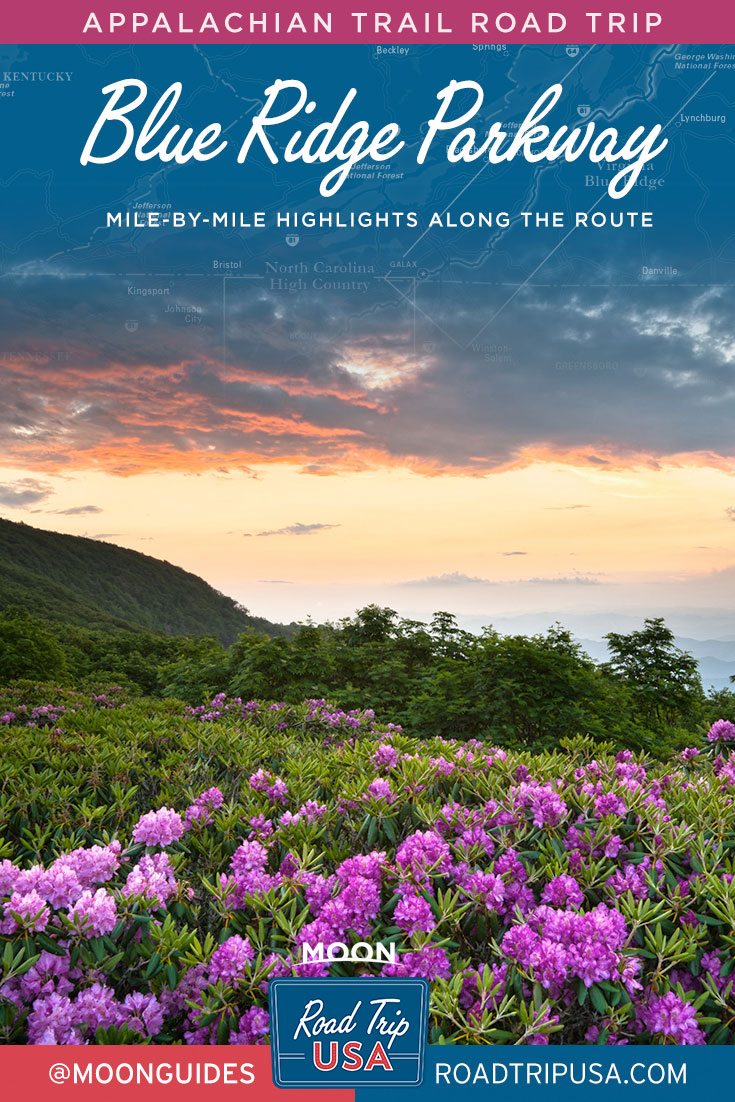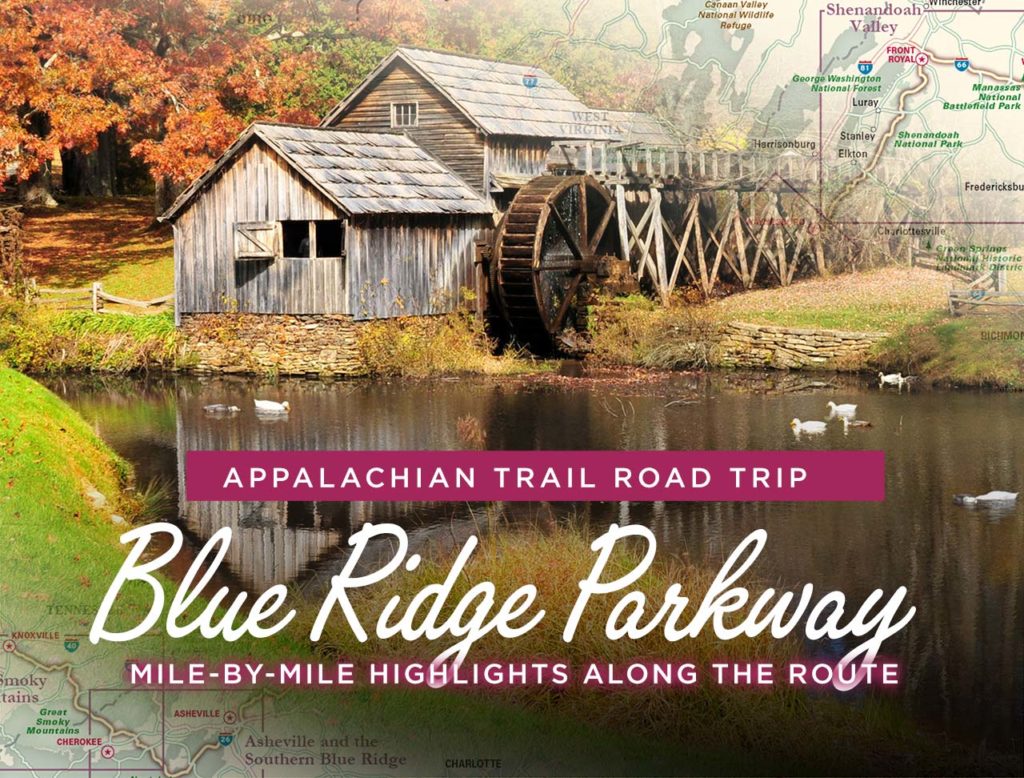
The Blue Ridge Parkway Road Trip
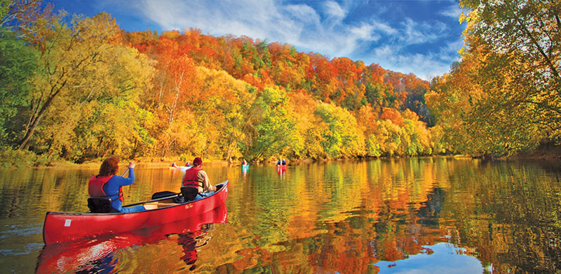
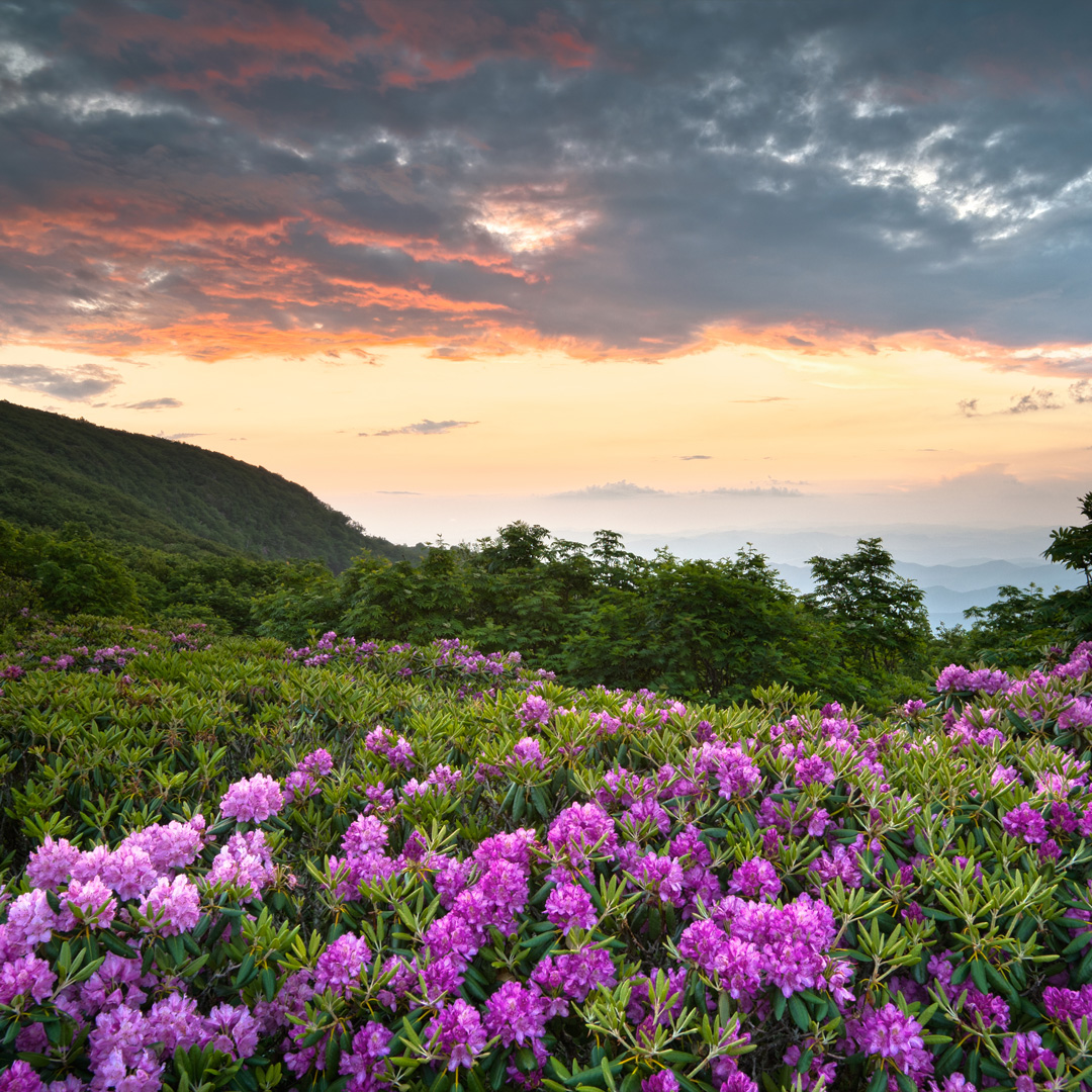
Starting at the southern end of Shenandoah National Park and winding along the crest of the Blue Ridge Mountains all the way to Great Smoky Mountains National Park some 469 miles away, the Blue Ridge Parkway is one of the country’s great scenic drives. This is especially true during autumn, when the dogwoods and gum trees turn deep red, and the hickories yellow, against an evergreen backdrop of pines, hemlocks, and firs. Spring is wildflower time, with abundant azaleas and rhododendrons blooming orange, white, pink, and red throughout May and June, especially at the higher elevations.
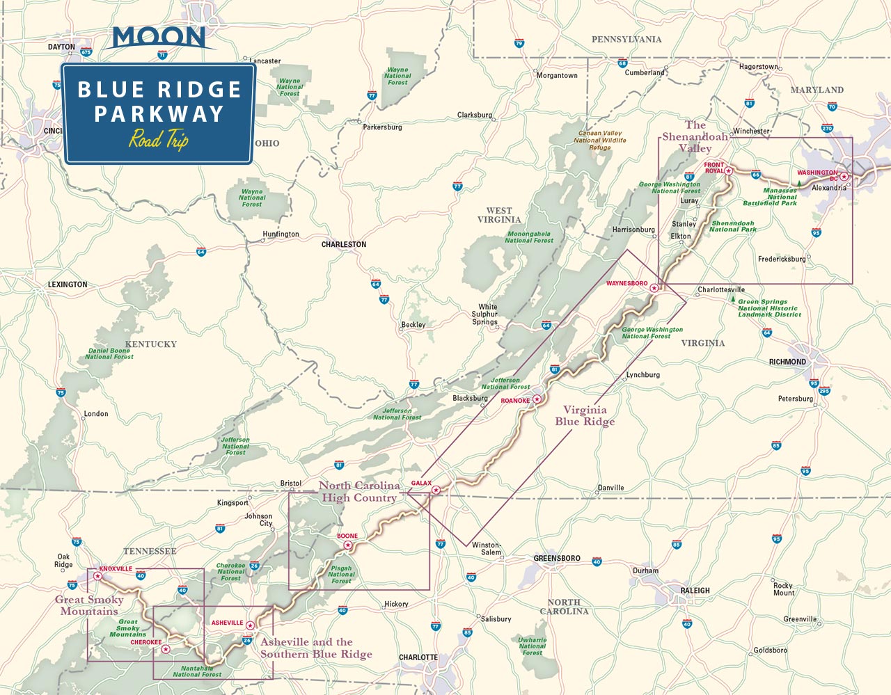
First proposed in the 1920s, the bulk of the Blue Ridge Parkway was constructed in many stages between 1935 and 1967, during which time it grew from a network of local roads to the current route, along which billboards and commercial traffic are both banned. The last section near Linn Cove Viaduct in North Carolina was completed in the mid-1980s. While the parkway avoids towns and commercial areas to concentrate on the scenery, many interesting towns and other places along the way are well worth a detour. For ease of use, we’ve divided the Blue Ridge Parkway into three main sections, starting with the drive between Shenandoah National Park and Roanoke.
The Blue Ridge Parkway: From Shenandoah National Park to Roanoke
-
Mile 0
Rockfish Gap at the southern end of Shenandoah National Park’s Skyline Drive, marks the northern start of the Blue Ridge Parkway.
-
Milepost 6.1
Humpback Rocks has a short but strenuous trail (45 minutes each way), leading through a reconstructed farmstead and a visitors center (visitors center at Milepost 5.9), ending with a 270-degree view over the mountains.
-
Milepost 34.4:
The Yankee Horse parking area has an exhibit on an old logging railroad, part of which has been restored, and a short trail to Wigwam Falls.
-
Milepost 63.6:
The James River Visitor Center (434/299-5496) offers exhibits and trails along the James River and Kanawha Canal. This is the lowest point on the parkway, at 649 feet, and also the junction with US-501, which runs west along the James River for 15 miles to Natural Bridge.
-
Milepost 76.5:
Great views can be had over both valleys from the highest point on the parkway in Virginia, at 3,950 feet.
-
Mileposts 84-87:
The most popular—and most developed—stretch of the parkway, the Peaks of Otter section includes a visitors center (540/586-4496), gas station, restaurant, and pleasant lodge (540/586-1081, year-round, $129 and up) Three peaks rise above a small lake and give great sunrise and sunset views; many good trails, including a two-mile loop to Fallingwater Cascades, let you escape the sometimes-sizable crowds.
-
Milepost 105:
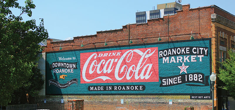
This section ends at the city of Roanoke.
The Blue Ridge Parkway: Roanoke to North Carolina
South from Roanoke, the Blue Ridge Parkway winds another 100 miles before crossing the North Carolina border. This midsection of the parkway, especially the first 25 miles south of Roanoke, runs at a lower elevation across a more settled and cultivated landscape than the rugged ridge tops followed elsewhere. In place of the spectacular vistas, you’ll see many more houses and small farms, a few pioneer cabins (preserved and not), miles of split-rail fences, and some picturesque cemeteries. The southern reaches, approaching the North Carolina border, get better and better.
-
Milepost 122
This section begins at the city of Roanoke.
-
Milepost 154.5
A 2.6-mile loop trail leads to a pioneer cabin overlooking the Smart View for which it’s named. Blooming dogwoods abound in May.
-
Milepost 165.2
At Tuggles Gap, the junction with Hwy-8 has a motel, restaurant, gas station, and also a small cemetery right along the parkway.
-
Mileposts 167-174
The 4,800-acre Rocky Knob area contains a campground (540/745-9664), a visitors center, and a strenuous but rewarding 10-mile round-trip trail (starting at milepost 167.1) leading down through Rock Castle Gorge and over 3,572-foot Rocky Knob.
-
Milepost 176.1
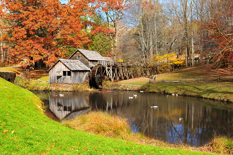
A short trail leads to Mabry Mill, in use from 1905 to 1935. In summer and fall, interpreters demonstrate blacksmithing and milling skills. A restaurant, open spring through fall, sells old-fashioned pancakes made from stone-ground flour, plus country ham and hamburgers.
-
Mileposts 199-200
This is the junction with US-52, which runs south to Mount Airy, North Carolina, home of Mayberry, RFD.
-
Milepost 216.9
You’ve reached the Virginia/North Carolina border!
The Blue Ridge Parkway: North Carolina to the Smokies
The highest and most memorable parts of the 469-mile Blue Ridge Parkway are the 250 mountainous miles leading along the backbone of North Carolina. Following the southern Blue Ridge Mountains as they fade into the taller and more massive Black Mountains, the parkway skirts three other mountain ranges before ending up at Great Smoky Mountains National Park on the Tennessee border. Spring flowers (including massive rhododendrons), fall colors, songbirds, wild turkeys, numerous waterfalls, and occasional eerie fogs that fill the valleys below all make this an unforgettable trip no matter what the time of year. Take your time and drive carefully, however hard it is to keep your eyes on the road.
A couple of worthwhile detours—to the mountain hamlets of Blowing Rock and Little Switzerland, and to the city of Asheville—are covered in greater detail in the main text of Road Trip USA. From north to south, here are the mile-by-mile highlights along the North Carolina portion of the Blue Ridge Parkway:
-
Milepost 216.9
This section starts at the Virginia-North Carolina border.
-
Milepost 217.5
An easy half-mile trail leads to the top of 2,885-foot Cumberland Knob.
-
Milepost 260.6
An easy mile-long trail leads to the top of Jumpinoff Rocks for a sweeping view.
-
Mileposts 292-295
Moses H. Cone Memorial Park is a 3,500-acre former private estate, with many miles of mountaintop hiking trails. At Mile 294, Southern Highlands Crafts Guild members demonstrate various Appalachian crafts throughout the summer at the Parkway Craft Center on the front porch of the former Cone mansion, which is now part of the Southern Highlands Craft Guild nonprofit.
-
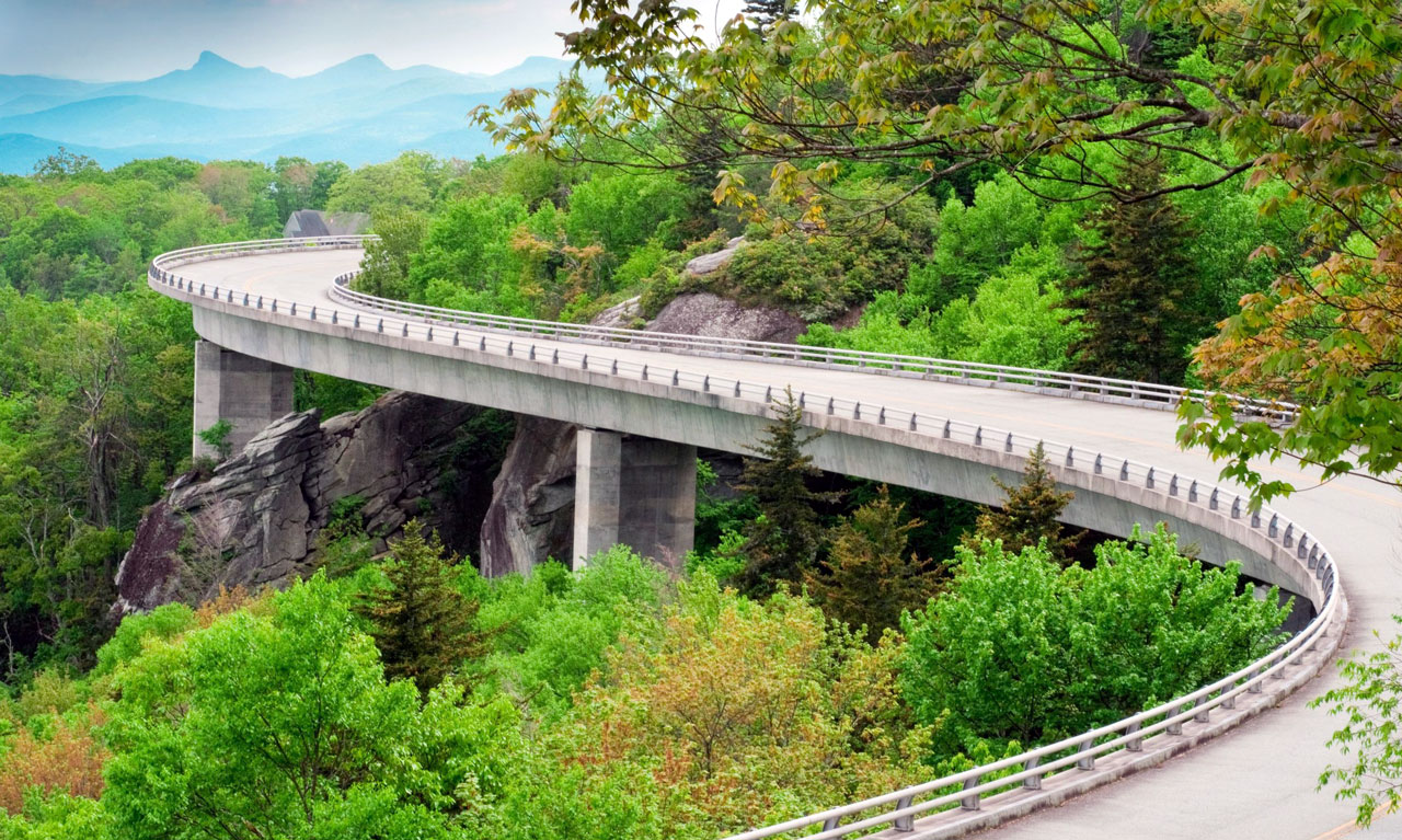
Milepost 304
The marvelous engineering feat of the Linn Cove Viaduct carries the parkway around rugged Grandfather Mountain. Completed in 1987, this was the last part of the parkway to be built. Dense walls of rhododendrons border the parkway south of the viaduct.
-
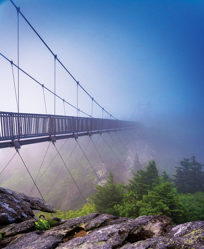
Milepost 305.1
US-221, which used to carry the parkway before the viaduct was built, leads a mile south to 5,946-foot Grandfather Mountain (828/733-4337 or 800/468-7325, daily, $20 adults), the highest peak in Blue Ridge, now a private park with nature trails, a zoo, and the famous Mile-High Swinging Bridge.
-
Milepost 308.2
A half-mile nature trail leads to 3,995-foot Flat Rock for a view of Grandfather Mountain.
-
Milepost 316.3
Linville Falls crashes through a rugged gorge; short trails lead to scenic overlooks.
-
Milepost 331
At the junction of Hwy-226, the Museum of North Carolina Minerals (828/765-2761, daily 9am-5pm, free) displays all kinds and sizes of local gemstones, which you can watch being polished.
-
Milepost 355.4
West of the parkway, the 1,650 acres of Mount Mitchell State Park include a mountaintop observation tower. Drive to within 200 yards of the weather-beaten 6,684-foot summit, the highest point east of the Mississippi River.
-
Milepost 364.6
Best seen in late spring when the rhododendrons are in full bloom, the lush greenery of Craggy Gardens feels like an Appalachian Shangri-La.
-
Milepost 382
You can check out exhibits and demonstrations of Appalachian arts and crafts in the Folk Art Center (828/298-7928, daily).
-
Milepost 431
At the highest point on the parkway (6,047 feet in elevation), a self-guided nature trail leads through a first-growth spruce and fir forest.
-
Milepost 469.1
The southern end of the Blue Ridge Parkway is at the junction with US-441 and the entrance to Great Smoky Mountains National Park.
Recommended Travel Guides