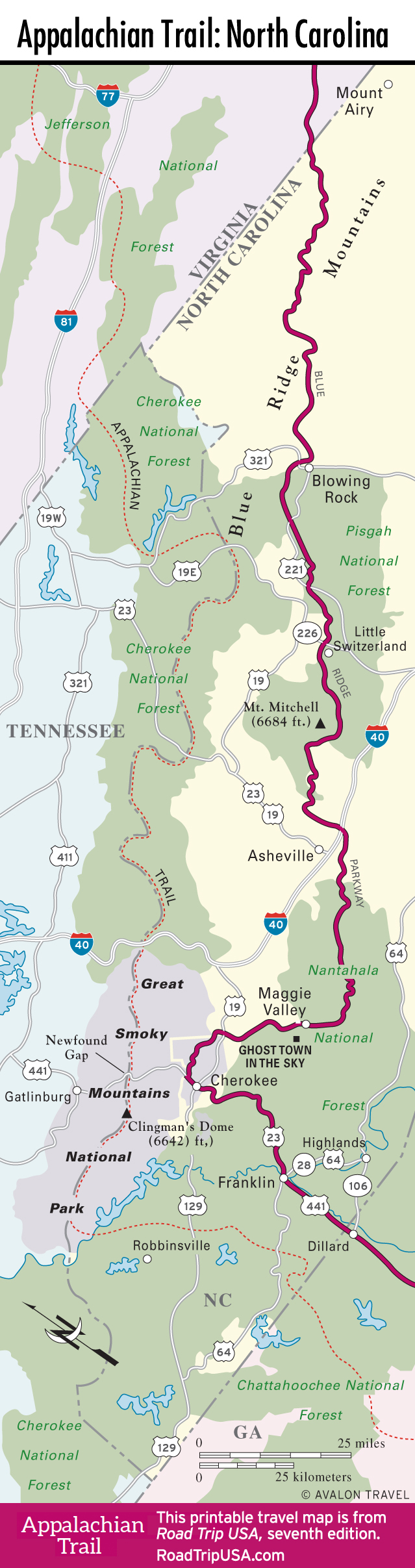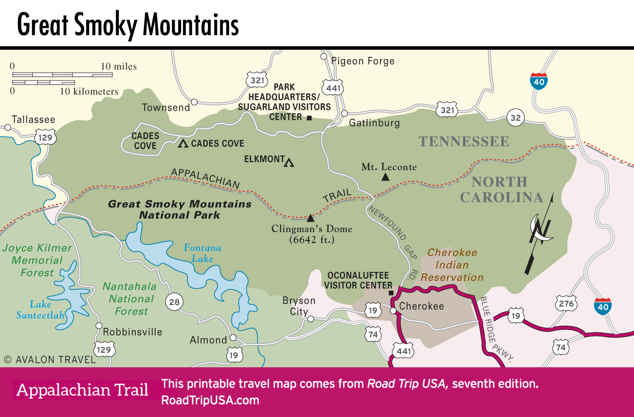
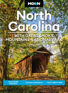
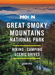
Great Smoky Mountains National Park
The most popular park in the United States, Great Smoky Mountains National Park offers a taste of wilderness to more than twelve million visitors annually. Knoxville, Nashville, and Atlanta are all within a two-hour drive. Day-trippers visit mostly during late October for the annual display of fall color. Crisscrossed by more than 800 miles (1,290 km) of hiking trails, including the Appalachian Trail, the park covers 522,427 ac (212,000 ha) along the 6,643-ft-high (2,024-m) crest of the Great Smoky Mountains, so named for the fogs that fill the deep valleys. Before the park was established, its lands were extensively logged—70 percent of the trees had been clear-cut by 1934, when the lands were protected as a national park. Fortunately, the forests have grown back to obscure any sign of past degradations, and the uncut portions form the most extensive stands of primeval forest in the eastern United States. The region has recently suffered years of drought, culminating in a wind-swept 2016 forest fire that burned from the park’s northern border into the neighboring tourist town of Gatlinburg, killing 14 people.
Driving Newfound Gap Road
The main route through the park is Newfound Gap Road (US-441), which runs northwest from Cherokee to the even more tourist-traveled Gatlinburg and Pigeon Forge in Tennessee. The road winds steeply through dense forests packed with magnificent giant hardwoods, flowering poplars, dogwoods, azaleas, and rhododendrons, and evergreen pines and firs at the highest elevations. Where the highway reaches the crest, a spur road runs parallel to the Appalachian Trail 5 mi (8 km) west to 6,643-ft (2,024-m) Clingmans Dome, the highest point in the park, where you can take a short but steep trail up to a lookout tower.
One of the most extensive natural areas—unlogged, old-growth forest, full of the park’s oldest and tallest trees—lies at the center of the park, off Newfound Gap Road on the north side of the crest. Starting at the popular Chimney Tops picnic area, the well-marked three-quarter-mile (1.2-km) Cove Hardwood Nature Trail winds through a sampling of the park’s most stately maples and other broad-leafed trees—the ones responsible for the best of the fall colors.
Along Little River Road, west of the Sugarlands Visitor Center off US-441 at the park’s northern entrance, stands another group of ancient trees. Midway along, trails lead to two marvelous waterfalls, Laurel Falls and Meigs Falls. Little River Road ends up at Cades Cove, where the preserved remnants of a mountain community that existed here from the early 1800s until the 1930s give a strong sense of Appalachian folkways. A church and a number of mills still stand. Self-guiding tour books are available to explain the history and culture of these “hillbilly” people, some 6,000 of whom used to live within the park boundaries. Bike rentals (865/448-9034) are available at the Cades Cove Trading Company near the Cades Cove campground, and you’ll find plenty of opportunities for rides along the old country lanes.
Another popular park destination is Grotto Falls, southeast of Gatlinburg via the Roaring Fork Road, where a short, flat trail to the tumbling cascade leads through lush hemlock forest—an ideal environment for mushrooms, and for the 27 to 30 different species of salamanders that slither around underfoot.
Cabins and Camping in Great Smoky Mountains National Park
The only beds available in the park are at the historic LeConte Lodge (865/429-5704, $155 and up), built in the 1920s atop 6,593-ft (2,009-m) Mt. LeConte, and located a 6.5-mile hike from the nearest road. There are no phones, no TVs, little privacy, and no showers, but the nightly rates do come with “family-style” breakfast and dinner. Ten fairly basic campgrounds (877/444-6777, no showers or hookups) operate in the park, with reservations taken only for the largest and most popular ones at Cades Cove, Cataloochee (reservations required), Cosby, Elkmont, and Smokemont. Cades Cove, Elkmont, and Smokemont are accessible to RVs up to 35 ft (10.7 m) long; for hikers, there are also bear-proofed backcountry shelters along the Appalachian Trail.
For more information, or to pick up the handy brochures describing the park’s array of flora, fauna, trails, and other features, stop by either of the two main visitors centers. North of Cherokee at the south entrance, the Oconaluftee Visitor Center (828/497-1904) stands alongside the Mountain Farm Museum, a collection of historic buildings preserved as one pioneer farmstead, where gardening and agricultural demonstrations are given in summer. From the Sugarlands Visitor Center (865/436-1200), 4 mi (6.4 km) south of Gatlinburg, Tennessee, you can take a short hike to Cataract Falls.
Related Travel Guides
North Carolina Travel Map