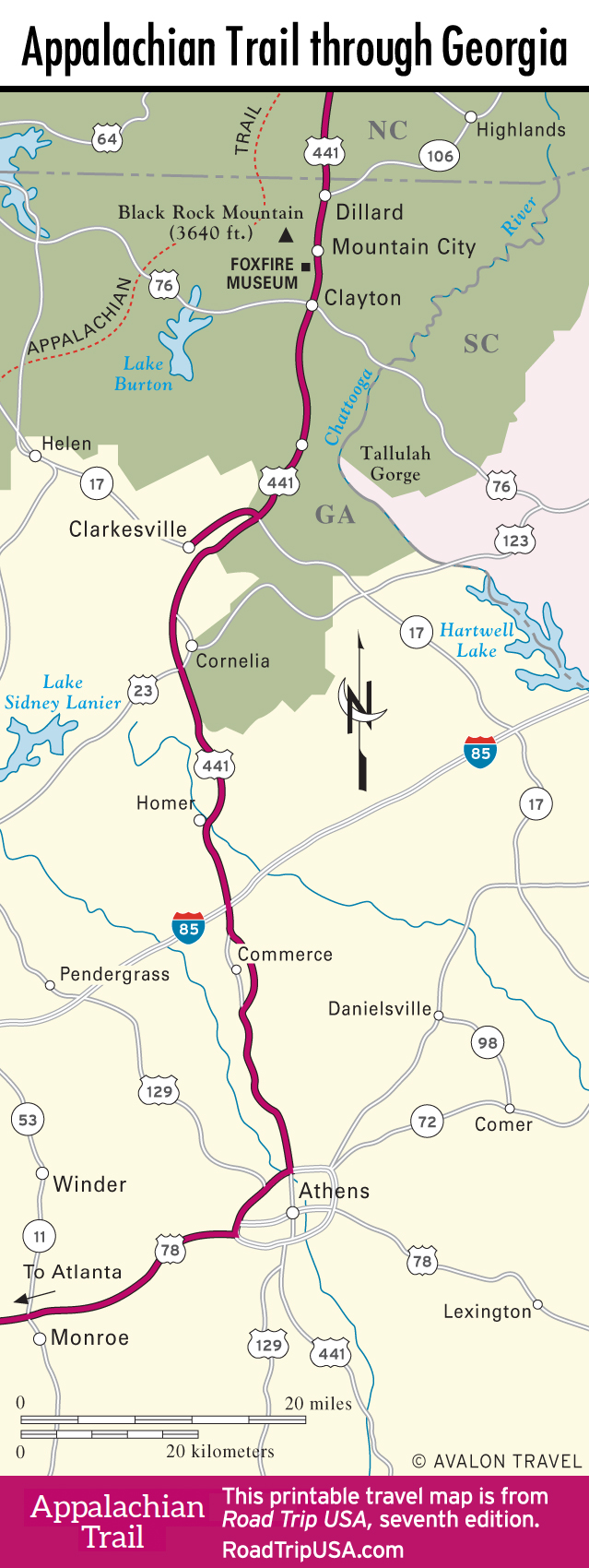
Georgia
If Georgia brings to mind endless flat cotton or peanut plantations, you’ll be pleasantly surprised by the mountainous wilds of the state’s northern tier. The great Appalachian ridge that runs along the East Coast has its southern foot here, high up in the forests of Rabun County, which packs natural wonders, outdoor adventures, and down-home Appalachian spirit into the state’s small isolated corner.
Chattooga River white water—made famous by the movie Deliverance and rated among the top 10 river runs in the United States—is the biggest draw, and sightseers can take in the spectacular waterfalls of Tallulah Gorge. Christmas-tree farms, dairies, and car graveyards dot the old-time mountain towns, but the ongoing “improvement” of US-441 into a four-lane freeway has resulted in a development boom of golf courses and mountain-view estates, increasing exponentially as the route approaches Atlanta’s endless suburbs.
Georgia Travel Map
Related Travel Guides