New Mexico
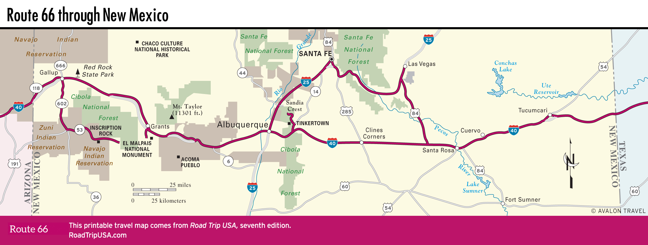
Following old Route 66 across New Mexico gives you a great taste of the Land of Enchantment, as the state calls itself on its license plates. There is less of the actual “old road” here than in other places, but the many towns and ghost towns along I-40, built more or less on top of Route 66, still stand. Route 66 runs around the historic heart of the state’s cultural and political capital, Santa Fe, and right through the heart of its sprawling Sun Belt commercial center, Albuquerque. In other places finding the old road and bypassed towns can take some time, though the effort is usually well rewarded.
Western New Mexico has the most to see and the most interesting topography, with sandstone mesas looming in the foreground and high pine-forested peaks rising in the distance. Paralleling the Burlington Northern Santa Fe Railway, the route passes through the heart of this region. Numerous detours—to El Morro National Monument and Chaco Culture National Historical Park, among others—make unforgettable stops along the way. In the east, the land is flatter and the landscape drier as the road transitions from the Great Plains.
Related Travel Guides